Enable Location

We need your location to show you interesting places around you

Discover nearby places

Find interesting locations and hidden gems around you

Precise directions

Get accurate directions and distances to places

Your location is never shared with other users. It's only used when you tap the location button.

Chevron Richmond Refinery

Log in to your account

Start exploring — it's free

Trusted by travelers worldwide

Continue with Google
Continue with Apple
or

We will send you a code to connect

By continuing, you accept our Terms and Conditions and our Privacy Policy

Check your inbox

We've sent a pincode in your inbox. Please enter the code below.

Chevron Richmond Refinery

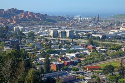
Chevron Richmond Refinery, Oil refinery in Richmond, California.

Description

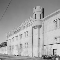
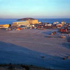
The Chevron Richmond Refinery sprawls along the bay shoreline east of San Francisco, transforming crude oil into fuels and chemical feedstocks through towers, reactors, and separation units. The industrial site covers several square miles of waterfront and inland hillside, with rows of cylindrical tanks reflecting sunlight and metal piping networks connecting dozens of processing structures.

History

Standard Oil opened the refinery in the early 1900s to process California crude near the growing port. Over more than a century, the facility expanded through multiple phases and ownership changes, eventually becoming part of the Chevron network after corporate mergers and reorganizations.

Culture

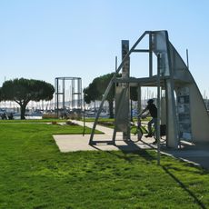
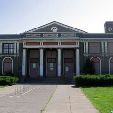
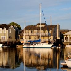
The facility maintains a private recreational center from 1921 for employees, featuring a yacht harbor, shooting ranges, baseball fields, and tennis courts.

Practical

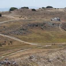
The refinery sits north of downtown Richmond and remains closed to the public, though its structures are visible from nearby highways and waterfront paths. Viewing areas along adjacent trails and hillsides offer a sense of the complex scale from a safe distance outside the perimeter fencing.

Did you know?

Flare towers burn excess gas around the clock, producing tall flames and plumes that glow orange against the night sky and reflect across the water. The site operates its own fire department and wastewater treatment systems independent of the city, maintaining emergency response teams and environmental monitoring stations throughout the grounds.

Location
GPS coordinates
37.94220,-122.39500
Latest update
December 20, 2025 15:15

AroundUs brings together thousands of curated places, local tips, and hidden gems, enriched daily by 60,000 contributors worldwide. Discover all places nearby (California).

Around this place
Angel Island Immigration Station
United States of America

Angel Island Immigration Station

8.5 km
Richmond–San Rafael Bridge
United States of America

Richmond–San Rafael Bridge

4.7 km
SS Red Oak Victory
United States of America

SS Red Oak Victory

5 km
Point Isabel Regional Shoreline
United States of America

Point Isabel Regional Shoreline

7.9 km
Ford Motor Company Assembly Plant
United States of America

Ford Motor Company Assembly Plant

4.7 km
East Brother Island Light
United States of America

East Brother Island Light

4.1 km
United States of America

Richmond Inner Harbor

6.5 km
Rosie the Riveter World War II Home Front National Historical Park
United States of America

Rosie the Riveter World War II Home Front National Historical Park

4.9 km
Winehaven
United States of America

Winehaven

2.2 km
The Plunge
United States of America

The Plunge

2.2 km
Ring Mountain
United States of America

Ring Mountain

8.7 km
Wapama
United States of America

Wapama

4.7 km
Sikh Center of San Francisco Bay Area El Sobrante
United States of America

Sikh Center of San Francisco Bay Area El Sobrante

7.1 km
Kaiser Richmond Field Hospital
United States of America

Kaiser Richmond Field Hospital

3.7 km
Point Richmond Historic District
United States of America

Point Richmond Historic District

2 km
Golden State Model Railroad Museum
United States of America

Golden State Model Railroad Museum

3.2 km
Hotel Mac
United States of America

Hotel Mac

2.2 km
Albany Beach
United States of America

Albany Beach

9.1 km
Southampton Shoal Light
United States of America

Southampton Shoal Light

6.8 km
Triangle Marsh
United States of America

Triangle Marsh

9.2 km
Belvedere-Tiburon Library
United States of America

Belvedere-Tiburon Library

9.3 km
Brickyard Cove
United States of America

Brickyard Cove

3.9 km
Tiburon Railroad & Ferry Depot Museum
United States of America

Tiburon Railroad & Ferry Depot Museum

9.2 km
San Quentin Beach
United States of America

San Quentin Beach

7.7 km
Kellers Beach
United States of America

Kellers Beach

2.5 km
Richmond Shipyard Number Three
United States of America

Richmond Shipyard Number Three

4.4 km
Point Molate Beach
United States of America

Point Molate Beach

1.7 km
Marin Islands National Wildlife Refuge
United States of America

Marin Islands National Wildlife Refuge

7.5 km
Show the full map
« Chevron Richmond Refinery - Oil refinery in Richmond, California » is provided by Around Us (aroundus.com). Images and texts are derived from Wikimedia project under a Creative Commons license. You are allowed to copy, distribute, and modify copies of this page, under the conditions set by the license, as long as this note is clearly visible.

Discover hidden gems everywhere you go!

From secret cafés to breathtaking viewpoints, skip the crowded tourist spots and find places that match your style. Our app makes it easy with voice search, smart filtering, route optimization, and insider tips from travelers worldwide. Download now for the complete mobile experience.

Around Us App Screenshot

A unique approach to discovering new places

Le Figaro

All the places worth exploring

France Info

A tailor-made excursion in just a few clicks

20 Minutes

Around Us
Travel Guide & Maps
Download

Send to your phone

QR Code
1

Open the camera app on your mobile.

2

Point at the QR code with your camera. A notification will appear.

3

Tap the notification to open the link.