Enable Location

We need your location to show you interesting places around you

Discover nearby places

Find interesting locations and hidden gems around you

Precise directions

Get accurate directions and distances to places

Your location is never shared with other users. It's only used when you tap the location button.

Napa Valley AVA

Log in to your account

Start exploring — it's free

Trusted by 61,401 travelers worldwide

Continue with Google
Continue with Apple
or

We will send you a code to connect

By continuing, you accept our Terms and Conditions and our Privacy Policy

Check your inbox

We've sent a pincode in your inbox. Please enter the code below.

Napa Valley AVA

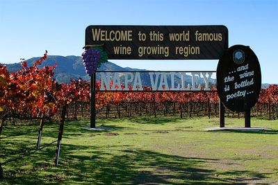
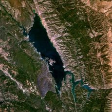
Napa Valley AVA, American Viticultural Area in Napa County, California.

Description

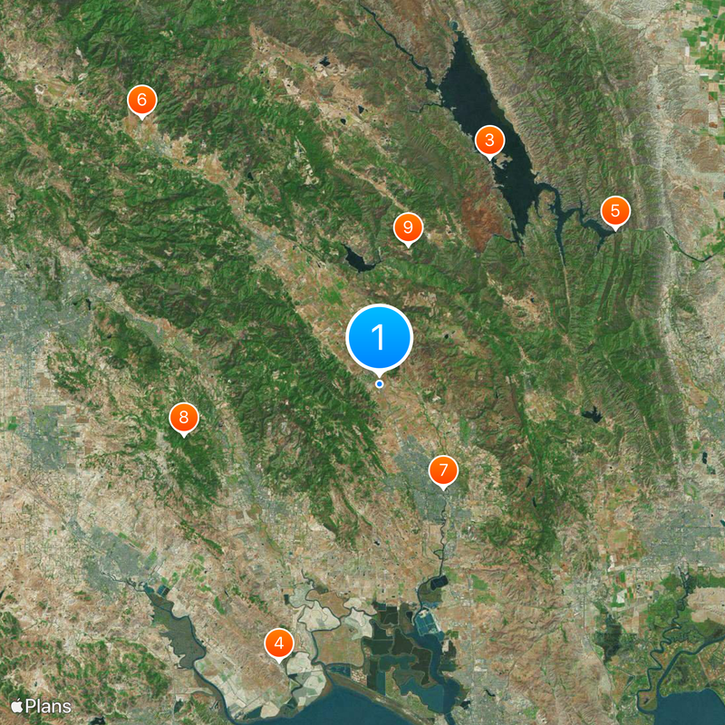
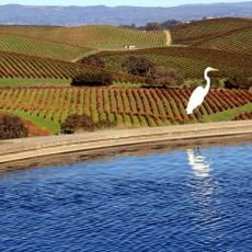
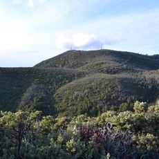
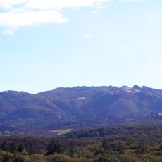
Napa Valley AVA stretches across 30 miles (48 km) in length with varying widths and contains 16 nested viticulture areas at different elevations and soil types. These subzones range from flat valley floors to gentle slopes along the Mayacamas and Vaca mountain ridges.

History

The region obtained its AVA status in 1981, becoming California's first designated wine area and setting standards for American wine production classification. In the decades that followed, increasingly smaller and more specific subzones emerged, each highlighting distinct climatic characteristics.

Culture

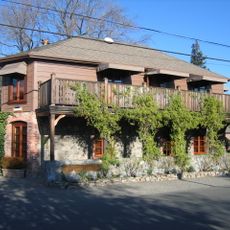
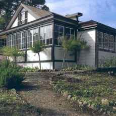
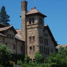
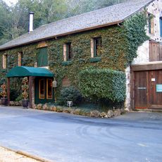
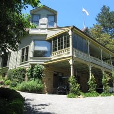
More than 450 wineries preserve personal touches in their winemaking and place great importance on long-term relationships with visitors and wine lovers. Many operations offer tastings in small groups while sharing stories about the grape varieties and how they work with the soil.

Practical

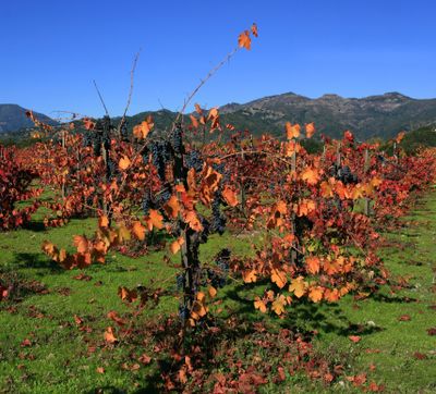
The Mediterranean climate creates consistent growing conditions throughout the year, with fog from San Pablo Bay moderating summer temperatures. The best time to visit is in spring or fall, when the vineyards either show fresh greenery or are bathed in warm colors.

Did you know?

The region represents only 4 percent of California's wine production yet maintains the strictest land use regulations among North American wine regions. These regulations protect agricultural land from development and preserve the open landscapes between wineries.

Location
Inception
1981
Elevation above the sea
110 m
GPS coordinates
38.38670,-122.35000
Latest update
December 12, 2025 18:14

AroundUs brings together thousands of curated places, local tips, and hidden gems, enriched daily by 60,000 contributors worldwide. Discover all places nearby (Napa County).

Romantic destinations for couples worldwide

This collection guides travelers to destinations around the world sought by couples for romantic stays. The selection includes natural wonders such as Niagara Falls on the Ontario and New York border, Victoria Falls between Zambia and Zimbabwe, and Milford Sound in New Zealand. Historic sites like...

Around this place
The French Laundry
United States of America

The French Laundry

2.3 km
Lake Berryessa
United States of America

Lake Berryessa

22.8 km
Sonoma Raceway
United States of America

Sonoma Raceway

26.8 km
Monticello Dam
United States of America

Monticello Dam

25.6 km
Chateau Montelena
United States of America

Chateau Montelena

32.4 km
Napa Valley Wine Train
United States of America

Napa Valley Wine Train

11 km
Jack London State Historic Park
United States of America

Jack London State Historic Park

18.4 km
Valle de Napa
United States of America

Valle de Napa

12.9 km
Petrified Forest
United States of America

Petrified Forest

31.5 km
Culinary Institute of America at Greystone
United States of America

Culinary Institute of America at Greystone

18.4 km
Buena Vista Winery
United States of America

Buena Vista Winery

11.6 km
Wolf House
United States of America

Wolf House

17.3 km
Sonoma Developmental Center
United States of America

Sonoma Developmental Center

15.4 km
COPIA
United States of America

COPIA

11.1 km
Sugarloaf Ridge State Park
United States of America

Sugarloaf Ridge State Park

14.4 km
Robert Louis Stevenson State Park
United States of America

Robert Louis Stevenson State Park

37 km
Bothe-Napa Valley State Park
United States of America

Bothe-Napa Valley State Park

23.3 km
Sonoma Mountain
United States of America

Sonoma Mountain

20.9 km
Schramsberg Vineyards
United States of America

Schramsberg Vineyards

24.6 km
United States of America

Skaggs Island Naval Communication Station

22.2 km
Sonoma Plaza
United States of America

Sonoma Plaza

13.7 km
Sonoma TrainTown Railroad
United States of America

Sonoma TrainTown Railroad

15.4 km
Trione-Annadel State Park
United States of America

Trione-Annadel State Park

24.5 km
St. Helena High School
United States of America

St. Helena High School

15.7 km
Sonoma Barracks
United States of America

Sonoma Barracks

13.9 km
Charles Krug Winery
United States of America

Charles Krug Winery

18.5 km
Stebbins Cold Canyon Reserve
United States of America

Stebbins Cold Canyon Reserve

25.9 km
Elmshaven
United States of America

Elmshaven

20.2 km
Show the full map
« Napa Valley AVA - American Viticultural Area in Napa County, California » is provided by Around Us (aroundus.com). Images and texts are derived from Wikimedia project under a Creative Commons license. You are allowed to copy, distribute, and modify copies of this page, under the conditions set by the license, as long as this note is clearly visible.

Discover hidden gems everywhere you go!

From secret cafés to breathtaking viewpoints, skip the crowded tourist spots and find places that match your style. Our app makes it easy with voice search, smart filtering, route optimization, and insider tips from travelers worldwide. Download now for the complete mobile experience.

Around Us App Screenshot

A unique approach to discovering new places

Le Figaro

All the places worth exploring

France Info

A tailor-made excursion in just a few clicks

20 Minutes

Around Us
Travel Guide & Maps
Download

Send to your phone

QR Code
1

Open the camera app on your mobile.

2

Point at the QR code with your camera. A notification will appear.

3

Tap the notification to open the link.