Chest opened
+${chestReward.xp} XP
Explorer
NOUVEAU ×${chestReward.collectible.quantity}
tapez pour fermer
Chest locked

Open chests in the app

Around Us is built for your phone — chests unlock when you walk, explore and capture nearby places.

Enable Location

We need your location to show you interesting places around you

Discover nearby places

Find interesting locations and hidden gems around you

Precise directions

Get accurate directions and distances to places

Your location is never shared with other users. It's only used when you tap the location button.

Cape Mendocino

Log in to your account

Start exploring — it's free

Trusted by 72,957 travelers worldwide

Continue with Google
Continue with Apple
or

We will send you a code to connect

By continuing, you accept our Terms and Conditions and our Privacy Policy

Check your inbox

We've sent a pincode in your inbox. Please enter the code below.

Cape Mendocino
Discussion Reviews 1 Photos
18.1k Popularity

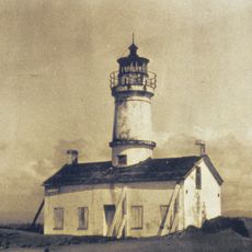
Cape Mendocino, Westernmost cape on the California coast, United States.

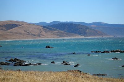
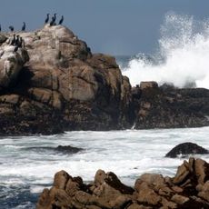
Cape Mendocino is the westernmost cape on the California coast, extending far into the Pacific Ocean. Steep cliffs with black sand beaches define the landscape, with the King Range mountains rising behind the shoreline.

Spanish navigators discovered and named the cape in the 16th century after Antonio de Mendoza, the Viceroy of New Spain. The name preserves the memory of this early European exploration of the California coast.

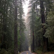
The cape marks the beginning of the Lost Coast, a remote stretch of shoreline without major settlements or development. This name reflects the wild and undeveloped character that visitors experience here.

The area is popular with hikers but has few amenities and requires good preparation. Waterproof clothing and sturdy footwear are recommended, as weather can change quickly and trails can be demanding.

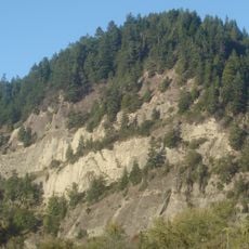
The location sits at the Mendocino Triple Junction, where three tectonic plates meet, creating one of California's most seismically active zones. This geological feature shapes the dramatic landscape that visitors see today.

The community of curious travelers

AroundUs brings together thousands of curated places, local tips, and hidden gems, enriched daily by 60,000 contributors worldwide.

Start exploring
Location
GPS coordinates
40.44000,-124.40944
Latest update
December 7, 2025 19:23
Around this place
Humboldt Redwoods State Park
United States of America

Humboldt Redwoods State Park

39.7 km
Fort Humboldt State Historic Park
United States of America

Fort Humboldt State Historic Park

41.9 km
King Range
United States of America

King Range

38.5 km
Patrick's Point State Park
United States of America

Patrick's Point State Park

39.9 km
Headwaters Forest Reserve
United States of America

Headwaters Forest Reserve

36.1 km
Humboldt Bay National Wildlife Refuge
United States of America

Humboldt Bay National Wildlife Refuge

32.1 km
Cape Mendocino Light
United States of America

Cape Mendocino Light

292 m
Fernbridge
United States of America

Fernbridge

25.9 km
Gingerbread Mansion
United States of America

Gingerbread Mansion

19.6 km
King Range Wilderness
United States of America

King Range Wilderness

38.5 km
Punta Gorda Light
United States of America

Punta Gorda Light

21.8 km
Table Bluff Light
United States of America

Table Bluff Light

30.7 km
Humboldt Bay Life-Saving Station
United States of America

Humboldt Bay Life-Saving Station

39.8 km
Shaw House
United States of America

Shaw House

20 km
Ferndale Main Street Historic District
United States of America

Ferndale Main Street Historic District

35.9 km
Centerville Beach Cross
United States of America

Centerville Beach Cross

15.3 km
Humboldt Harbor Light
United States of America

Humboldt Harbor Light

39.9 km
A. Berding House
United States of America

A. Berding House

19.6 km
Ferndale Library
United States of America

Ferndale Library

20 km
Humboldt Botanical Gardens
United States of America

Humboldt Botanical Gardens

33.6 km
Ferndale Museum
United States of America

Ferndale Museum

19.7 km
Scotia Bluffs
United States of America

Scotia Bluffs

27.5 km
South Cape Mendocino State Marine Reserve
United States of America

South Cape Mendocino State Marine Reserve

327 m
Rectory, Catholic Church of the Assumption
United States of America

Rectory, Catholic Church of the Assumption

19.6 km
Grizzly Bluff School
United States of America

Grizzly Bluff School

24.3 km
Masonic Temple
United States of America

Masonic Temple

19.4 km
Alford-Nielson House
United States of America

Alford-Nielson House

20 km
F. W. Andreasen-John Rossen House
United States of America

F. W. Andreasen-John Rossen House

20.7 km
Show the full map
Reviews
Share your experience

No review yet

Discussions
Start a discussion...

No discussion yet

« Cape Mendocino - Westernmost cape on the California coast, United States » is provided by Around Us (aroundus.com). Images and texts are derived from Wikimedia project under a Creative Commons license. You are allowed to copy, distribute, and modify copies of this page, under the conditions set by the license, as long as this note is clearly visible.

Discover hidden gems everywhere you go!

From secret cafés to breathtaking viewpoints, skip the crowded tourist spots and find places that match your style. Our app makes it easy with voice search, smart filtering, route optimization, and insider tips from travelers worldwide. Download now for the complete mobile experience.

Around Us App Screenshot

A unique approach to discovering new places

Le Figaro

All the places worth exploring

France Info

A tailor-made excursion in just a few clicks

20 Minutes

Around Us
Travel Guide & Maps
Download

Send to your phone

QR Code
1

Open the camera app on your mobile.

2

Point at the QR code with your camera. A notification will appear.

3

Tap the notification to open the link.