Chest opened
+${chestReward.xp} XP
Explorer
NOUVEAU ×${chestReward.collectible.quantity}
tapez pour fermer
Chest locked

Open chests in the app

Around Us is built for your phone — chests unlock when you walk, explore and capture nearby places.

Enable Location

We need your location to show you interesting places around you

Discover nearby places

Find interesting locations and hidden gems around you

Precise directions

Get accurate directions and distances to places

Your location is never shared with other users. It's only used when you tap the location button.

Wheatland

Log in to your account

Start exploring — it's free

Trusted by 72,878 travelers worldwide

Continue with Google
Continue with Apple
or

We will send you a code to connect

By continuing, you accept our Terms and Conditions and our Privacy Policy

Check your inbox

We've sent a pincode in your inbox. Please enter the code below.

Discussion Reviews 1 Photos
19.4k Popularity

Wheatland, city in California, United States

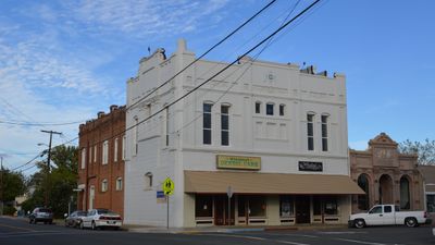
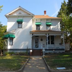
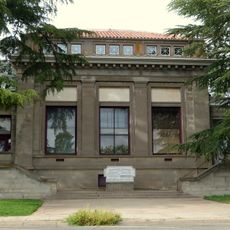
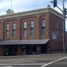
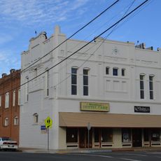
Wheatland is a small city in Yuba County in northern California, situated near the Feather River. The town is defined by simple homes, small shops, and older buildings that reflect its origins as a farming community.

Wheatland was established in the late 1800s when the railroad reached the area and brought merchants and farmers to settle here. The historic train depot stands as a reminder of this period of growth and connection to the broader region.

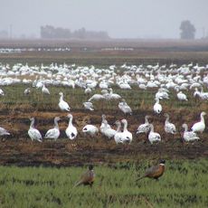
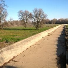
The name Wheatland comes from the wheat fields that once dominated the area and still shape how the landscape looks today. The community keeps its farming roots alive through local events and markets where residents gather and share locally grown products.

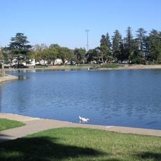
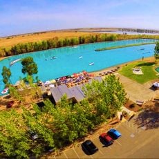
The streets are easy to walk through at a relaxed pace with quiet traffic. Parks offer open spaces to spend time, while a few small shops and restaurants provide basic services for visitors and residents.

The town has deliberately maintained its small-scale character despite slow growth, which many visitors find refreshing compared to nearby bustling areas. This preservation of a genuine small-town feeling makes it a notable place for those seeking an authentic rural experience.

The community of curious travelers

AroundUs brings together thousands of curated places, local tips, and hidden gems, enriched daily by 60,000 contributors worldwide.

Start exploring
Location
GPS coordinates
39.01000,-121.42306
Latest update
February 16, 2026 22:40
Around this place
Foresthill Bridge
United States of America

Foresthill Bridge

34.6 km
Auburn Dam
United States of America

Auburn Dam

34.4 km
Roseville Golfland Sunsplash
United States of America

Roseville Golfland Sunsplash

31.2 km
Bok Kai Temple
United States of America

Bok Kai Temple

19.9 km
Englebright Lake
United States of America

Englebright Lake

28.8 km
Camp Far West Reservoir
United States of America

Camp Far West Reservoir

10.5 km
Sutter National Wildlife Refuge
United States of America

Sutter National Wildlife Refuge

29.9 km
All-American Speedway
United States of America

All-American Speedway

30.4 km
Ellis Lake
United States of America

Ellis Lake

20.9 km
Fremont Weir Wildlife Area
United States of America

Fremont Weir Wildlife Area

35 km
Griffith Quarry
United States of America

Griffith Quarry

28.5 km
Englebright Dam
United States of America

Englebright Dam

28.9 km
Mountain Quarries Bridge
United States of America

Mountain Quarries Bridge

34.9 km
Maidu Museum & Historic Site
United States of America

Maidu Museum & Historic Site

33.9 km
Bernhard Museum Complex
United States of America

Bernhard Museum Complex

32.8 km
Community Memorial Museum of Sutter County
United States of America

Community Memorial Museum of Sutter County

23.9 km
Rusch Botanical Gardens
United States of America

Rusch Botanical Gardens

35.3 km
Yuba City Astronomical Observatory
United States of America

Yuba City Astronomical Observatory

21.6 km
Auburn Public Library
United States of America

Auburn Public Library

32.8 km
Hart Building
United States of America

Hart Building

20.3 km
Auburn Masonic Temple
United States of America

Auburn Masonic Temple

32.9 km
Wake Island Water Park
United States of America

Wake Island Water Park

28.3 km
Packard Library
United States of America

Packard Library

20.3 km
Oddfellows Hall
United States of America

Oddfellows Hall

32.6 km
Wheatland Masonic Temple
United States of America

Wheatland Masonic Temple

143 m
Marysville Historic Commercial District
United States of America

Marysville Historic Commercial District

20.2 km
Griffith Quarry Park & Museum
United States of America

Griffith Quarry Park & Museum

28.7 km
Placer County Courthouse
United States of America

Placer County Courthouse

32.5 km
Show the full map
Reviews
Share your experience

No review yet

Discussions
Start a discussion...

No discussion yet

« Wheatland - city in California, United States » is provided by Around Us (aroundus.com). Images and texts are derived from Wikimedia project under a Creative Commons license. You are allowed to copy, distribute, and modify copies of this page, under the conditions set by the license, as long as this note is clearly visible.

Discover hidden gems everywhere you go!

From secret cafés to breathtaking viewpoints, skip the crowded tourist spots and find places that match your style. Our app makes it easy with voice search, smart filtering, route optimization, and insider tips from travelers worldwide. Download now for the complete mobile experience.

Around Us App Screenshot

A unique approach to discovering new places

Le Figaro

All the places worth exploring

France Info

A tailor-made excursion in just a few clicks

20 Minutes

Around Us
Travel Guide & Maps
Download

Send to your phone

QR Code
1

Open the camera app on your mobile.

2

Point at the QR code with your camera. A notification will appear.

3

Tap the notification to open the link.