Chest opened
+${chestReward.xp} XP
Explorer
NOUVEAU ×${chestReward.collectible.quantity}
tapez pour fermer
Chest locked

Open chests in the app

Around Us is built for your phone — chests unlock when you walk, explore and capture nearby places.

Enable Location

We need your location to show you interesting places around you

Discover nearby places

Find interesting locations and hidden gems around you

Precise directions

Get accurate directions and distances to places

Your location is never shared with other users. It's only used when you tap the location button.

Log in to your account

Start exploring — it's free

Trusted by 72,883 travelers worldwide

Continue with Google
Continue with Apple
or

We will send you a code to connect

By continuing, you accept our Terms and Conditions and our Privacy Policy

Check your inbox

We've sent a pincode in your inbox. Please enter the code below.

Discussion Reviews Photo
16.3k Popularity

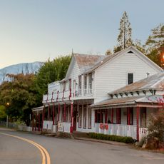
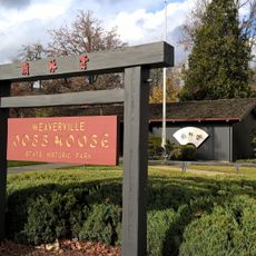
Shasta, town in Shasta County, California, United States

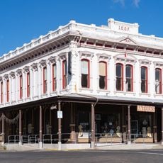
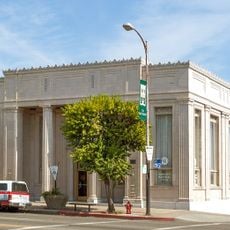
Shasta is a census-designated place in Shasta County that functions today as a ghost town with preserved buildings from the mid-1800s. The settlement contains roughly a dozen remaining structures, most built from brick after fires destroyed earlier wooden buildings, along with cemeteries and a state historic park that protects and interprets the remaining ruins.

The settlement began in 1849 as Reading's Springs during the gold rush and became the largest commercial center in northern California. Decline began in the 1880s when the railroad chose Redding instead, and the town lost its county seat status in 1888, causing most residents to depart.

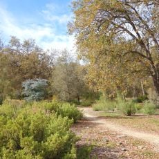
The site is easily accessible from the highway near Redding and allows for either a brief stop or extended exploration. A marked trail behind the brick buildings offers different views of the ruins and helps visitors understand the layout of the former settlement.

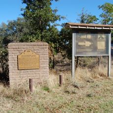
The location once housed California's oldest Masonic lodge and holds a collection of historic graves including a notable Pioneer baby grave with a story visitors can read. A large mid-1800s barn stands beside antique stagecoaches and farm tools, creating a snapshot of life and work from that era.

The community of curious travelers

AroundUs brings together thousands of curated places, local tips, and hidden gems, enriched daily by 60,000 contributors worldwide.

Start exploring
Location
GPS coordinates
40.59222,-122.47778
Latest update
February 17, 2026 02:20
Around this place
Shasta Lake
United States of America

Shasta Lake

20.7 km
Sundial Bridge at Turtle Bay
United States of America

Sundial Bridge at Turtle Bay

8.5 km
Trinity Lake
United States of America

Trinity Lake

35.3 km
Whiskeytown Lake
United States of America

Whiskeytown Lake

5.4 km
Lake Shasta Caverns
United States of America

Lake Shasta Caverns

27.8 km
Saint Herman of Alaska Brotherhood
United States of America

Saint Herman of Alaska Brotherhood

45 km
Pit River Bridge
United States of America

Pit River Bridge

23.2 km
Turtle Bay Exploration Park
United States of America

Turtle Bay Exploration Park

8.7 km
Keswick Dam
United States of America

Keswick Dam

3.5 km
Whiskeytown Dam
United States of America

Whiskeytown Dam

5.4 km
Cascade Theatre
United States of America

Cascade Theatre

7.6 km
Lewiston Lake
United States of America

Lewiston Lake

30.5 km
Lewiston Dam
United States of America

Lewiston Dam

30.7 km
WaterWorks Park
United States of America

WaterWorks Park

9.5 km
Spring Creek Reservoir
United States of America

Spring Creek Reservoir

4.2 km
Odd Fellows Building
United States of America

Odd Fellows Building

50.7 km
Old Bank of America Building
United States of America

Old Bank of America Building

50.5 km
McConnell Arboretum & Botanical Gardens
United States of America

McConnell Arboretum & Botanical Gardens

8.1 km
Oasis Fun Center
United States of America

Oasis Fun Center

12 km
Cottonwood Historic District
United States of America

Cottonwood Historic District

28.7 km
Bowerman Barn
United States of America

Bowerman Barn

42.1 km
Edward Frisbie House
United States of America

Edward Frisbie House

7.6 km
French Gulch Historic District
United States of America

French Gulch Historic District

18.5 km
Brandy Creek Beach
United States of America

Brandy Creek Beach

8.4 km
Historic Hawes Farms
United States of America

Historic Hawes Farms

24.1 km
Weaverville Joss House State Historic Park
United States of America

Weaverville Joss House State Historic Park

42.1 km
Fantasy Fountain
United States of America

Fantasy Fountain

12.7 km
Reading Adobe Site
United States of America

Reading Adobe Site

32.5 km
Show the full map
Reviews
Share your experience

No review yet

Discussions
Start a discussion...

No discussion yet

« Shasta - town in Shasta County, California, United States » is provided by Around Us (aroundus.com). Images and texts are derived from Wikimedia project under a Creative Commons license. You are allowed to copy, distribute, and modify copies of this page, under the conditions set by the license, as long as this note is clearly visible.

Discover hidden gems everywhere you go!

From secret cafés to breathtaking viewpoints, skip the crowded tourist spots and find places that match your style. Our app makes it easy with voice search, smart filtering, route optimization, and insider tips from travelers worldwide. Download now for the complete mobile experience.

Around Us App Screenshot

A unique approach to discovering new places

Le Figaro

All the places worth exploring

France Info

A tailor-made excursion in just a few clicks

20 Minutes

Around Us
Travel Guide & Maps
Download

Send to your phone

QR Code
1

Open the camera app on your mobile.

2

Point at the QR code with your camera. A notification will appear.

3

Tap the notification to open the link.