Enable Location

We need your location to show you interesting places around you

Discover nearby places

Find interesting locations and hidden gems around you

Precise directions

Get accurate directions and distances to places

Your location is never shared with other users. It's only used when you tap the location button.

Log in to your account

Start exploring — it's free

Trusted by 62,398 travelers worldwide

Continue with Google
Continue with Apple
or

We will send you a code to connect

By continuing, you accept our Terms and Conditions and our Privacy Policy

Check your inbox

We've sent a pincode in your inbox. Please enter the code below.

Red Dog, ghost town in Nevada County, California

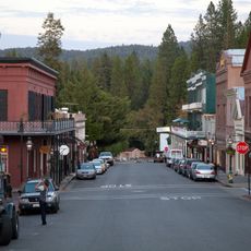
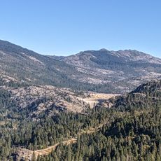
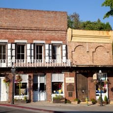
Red Dog is a former mining town in Nevada County that exists today as a ghost town. The site includes a cemetery located about a quarter mile away with old headstones and iron fencing, along with scattered building foundations that mark where the settlement once stood.

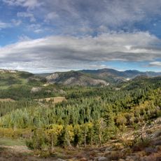
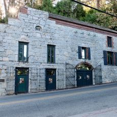
Red Dog began in the early 1850s as a gold rush settlement and took its name from a zinc mine named by a young 15-year-old prospector. The town suffered multiple destructive fires in 1859 and 1862, which the residents rebuilt after, but eventually heavy rains damaged the water systems that powered the mines, leading to the town's decline by the late 1860s.

Red Dog was originally a settlement built around the hopes and work of miners seeking fortune in the hills. The remaining cemetery reflects the diverse backgrounds of those who came from various places to build lives in this small community.

Visitors can walk through the remains of Red Dog and the nearby cemetery on foot, following paths once used by miners. Wear sturdy shoes and be prepared for uneven ground and old structures, as some areas are fragile and certain parts are off limits to protect the historical remains.

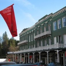
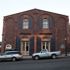
Mark Twain visited Red Dog in 1866 to give a lecture, and it was at this event that he was introduced publicly as Mark Twain for the first time. This visit shows that even small remote mining settlements attracted notable figures and had connections to larger cultural happenings.

The community of curious travelers

AroundUs brings together thousands of curated places, local tips, and hidden gems, enriched daily by 60,000 contributors worldwide.

Start exploring
Location
Elevation above the sea
797 m
GPS coordinates
39.21667,-120.89944
Latest update
February 9, 2026 08:23
Around this place
Empire Mine State Historic Park
United States of America

Empire Mine State Historic Park

12.5 km
New Bullards Bar Reservoir
United States of America

New Bullards Bar Reservoir

28.6 km
Emigrant Gap
United States of America

Emigrant Gap

22.3 km
Auburn State Recreation Area
United States of America

Auburn State Recreation Area

26.7 km
New Bullards Bar Dam
United States of America

New Bullards Bar Dam

28.8 km
South Yuba River State Park
United States of America

South Yuba River State Park

26.8 km
Bridgeport Covered Bridge
United States of America

Bridgeport Covered Bridge

26.8 km
Scotts Flat Reservoir
United States of America

Scotts Flat Reservoir

6.8 km
Sugar Pine Reservoir
United States of America

Sugar Pine Reservoir

13.1 km
Home of Lola Montez
United States of America

Home of Lola Montez

14.2 km
North Star House
United States of America

North Star House

15.5 km
National Exchange Hotel
United States of America

National Exchange Hotel

11.3 km
Nevada City Downtown Historic District
United States of America

Nevada City Downtown Historic District

11.5 km
Lake Spaulding Dam
United States of America

Lake Spaulding Dam

25.3 km
Englebright Dam
United States of America

Englebright Dam

32 km
Mount Saint Mary's Convent and Academy
United States of America

Mount Saint Mary's Convent and Academy

14.5 km
Nevada Brewery
United States of America

Nevada Brewery

11.1 km
Nevada Theatre
United States of America

Nevada Theatre

11.6 km
Grass Valley Public Library
United States of America

Grass Valley Public Library

14.2 km
Oregon Creek Covered Bridge
United States of America

Oregon Creek Covered Bridge

25.5 km
Doris Foley Library for Historical Research
United States of America

Doris Foley Library for Historical Research

11.6 km
Martin Luther Marsh House
United States of America

Martin Luther Marsh House

11 km
Trinity Church (Nevada City)
United States of America

Trinity Church (Nevada City)

11.3 km
Aaron A. Sargent House
United States of America

Aaron A. Sargent House

11.7 km
Ott's Assay Office
United States of America

Ott's Assay Office

11.3 km
Hoyt Crossing Nude Beach
United States of America

Hoyt Crossing Nude Beach

18.3 km
Northstar Mining Museum
United States of America

Northstar Mining Museum

14.7 km
Purdon Crossing Bridge
United States of America

Purdon Crossing Bridge

17.7 km
Show the full map
« Red Dog - ghost town in Nevada County, California » is provided by Around Us (aroundus.com). Images and texts are derived from Wikimedia project under a Creative Commons license. You are allowed to copy, distribute, and modify copies of this page, under the conditions set by the license, as long as this note is clearly visible.

Discover hidden gems everywhere you go!

From secret cafés to breathtaking viewpoints, skip the crowded tourist spots and find places that match your style. Our app makes it easy with voice search, smart filtering, route optimization, and insider tips from travelers worldwide. Download now for the complete mobile experience.

Around Us App Screenshot

A unique approach to discovering new places

Le Figaro

All the places worth exploring

France Info

A tailor-made excursion in just a few clicks

20 Minutes

Around Us
Travel Guide & Maps
Download

Send to your phone

QR Code
1

Open the camera app on your mobile.

2

Point at the QR code with your camera. A notification will appear.

3

Tap the notification to open the link.