Enable Location

We need your location to show you interesting places around you

Discover nearby places

Find interesting locations and hidden gems around you

Precise directions

Get accurate directions and distances to places

Your location is never shared with other users. It's only used when you tap the location button.

Ellmaker State Wayside

Log in to your account

Start exploring — it's free

Trusted by 61,878 travelers worldwide

Continue with Google
Continue with Apple
or

We will send you a code to connect

By continuing, you accept our Terms and Conditions and our Privacy Policy

Check your inbox

We've sent a pincode in your inbox. Please enter the code below.

Ellmaker State Wayside

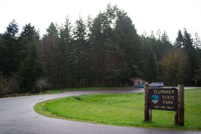
Ellmaker State Wayside, Rest area and state park in Lincoln County, Oregon.

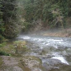
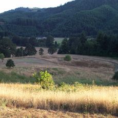
Ellmaker State Wayside is a rest area and state park covering about 80 acres of mixed timber and open grassland north of Burnt Woods on U.S. Route 20. The property includes two creeks that have been naturally dammed by beavers, creating small water features throughout the landscape.

The property was donated to Oregon State Parks in 1961 by Harlan D. Ellmaker, a retired Forest Service employee. His gift reflected a personal commitment to preserving the natural landscape and making it available to the public.

The park stands as the first established state recreational area on Route 20 between Corvallis and Newport, marking a milestone in public land accessibility.

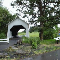
The site features four picnic tables beside a grassy area, public restrooms, and parking spaces for travelers stopping along the Corvallis-Newport Highway. The facilities work well for short breaks during a longer drive.

The park contains Tum Tum Creek, which forms where two streams converge within the park boundaries. This naturally formed waterway often goes unnoticed by visitors passing through.

The community of curious travelers

AroundUs brings together thousands of curated places, local tips, and hidden gems, enriched daily by 60,000 contributors worldwide.

Start exploring
Location
GPS coordinates
44.61460,-123.63200
Latest update
December 14, 2025 11:25
Around this place
Show the full map
« Ellmaker State Wayside - Rest area and state park in Lincoln County, Oregon » is provided by Around Us (aroundus.com). Images and texts are derived from Wikimedia project under a Creative Commons license. You are allowed to copy, distribute, and modify copies of this page, under the conditions set by the license, as long as this note is clearly visible.

Discover hidden gems everywhere you go!

From secret cafés to breathtaking viewpoints, skip the crowded tourist spots and find places that match your style. Our app makes it easy with voice search, smart filtering, route optimization, and insider tips from travelers worldwide. Download now for the complete mobile experience.

Around Us App Screenshot

A unique approach to discovering new places

Le Figaro

All the places worth exploring

France Info

A tailor-made excursion in just a few clicks

20 Minutes

Around Us
Travel Guide & Maps
Download

Send to your phone

QR Code
1

Open the camera app on your mobile.

2

Point at the QR code with your camera. A notification will appear.

3

Tap the notification to open the link.