Mongold Day-Use Area
Mongold Day-Use Area is a public recreation spot beside Detroit Lake in Oregon, roughly 1.5 miles west of Detroit Lake State Park. It features the only public boat launch on the lake, a grass beach for swimming, picnic tables, parking for vehicles and trailers, and restroom facilities.
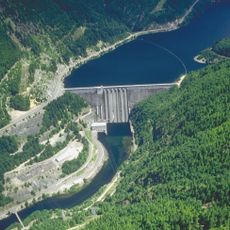
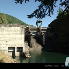
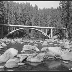
Detroit Lake was created in 1953 when a dam was built to control floods and generate electricity. Since then, this area has grown into a destination where both locals and visitors come to enjoy outdoor recreation and water activities.
The name Mongold reflects the early settlement history of this region. Visitors today see how this spot brings together locals and travelers who come simply to enjoy time by the water and share outdoor meals together.
Check water levels before heading out on the lake and use life jackets available in various sizes at the site. Water stays cold year-round and underwater obstacles may be present, so verify conditions with the Oregon State Marine Board and swim with a buddy.
Firewood and tree materials cannot be transported out of Marion County due to pest control measures, especially to prevent spread of the emerald ash borer. Visitors should buy certified heat-treated firewood or source materials locally to protect Oregon's forests.
The community of curious travelers
AroundUs brings together thousands of curated places, local tips, and hidden gems, enriched daily by 60,000 contributors worldwide.