Yamhill County

Log in to your account

AroundUs is a community-driven map of interesting places, built by curious explorers like you. It grows with every review, story, and photo you share.
Connect to save your favorite spots, contribute locations, and create personalized routes.
By continuing, you accept our Terms and Conditions and our Privacy Policy
Add to collection
Map
Suggest a change
Share

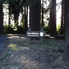
Yamhill County, Administrative county in Willamette Valley, Oregon, United States.

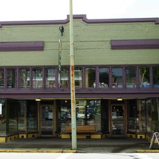
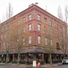
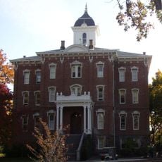
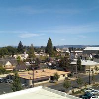
Yamhill County occupies the Willamette Valley in northwestern Oregon, blending towns and rural areas that support farming and wine production. Communities like McMinnville serve as hubs within the county's broader agricultural landscape.

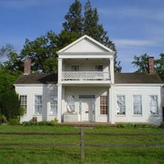
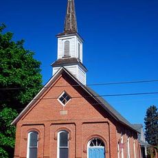
Established in 1843, the county takes its name from the Yamhelas people of the Kalapuya Tribe, who lived in the region for thousands of years. European settlement in the 1800s transformed the land and eventually led to the agricultural and wine-growing traditions seen today.

The McMinnville UFO Festival each year draws people interested in unexplained aerial events, featuring parades and talks about sightings. The region has become a gathering place for those exploring these mysteries.

Spring through fall offers the best visiting conditions, with pleasant weather and active events throughout the region. A car is helpful for navigating between towns and rural areas, as public transit is limited.

Six distinct wine regions within the county contain over 80 wineries focused on Pinot Noir, Chardonnay, and Riesling production. This concentration of wine-growing areas draws people who want to explore these specific grape varieties.

Location: Oregon

Inception: 1843

Capital city: McMinnville

Shares border with: Washington County, Clackamas County, Marion County, Polk County, Tillamook County

Website: http://co.yamhill.or.us

GPS coordinates: 45.23000,-123.31000

Latest update: December 7, 2025 09:27

Photos
Around this place
Show the full map
Evergreen Aviation & Space Museum
United States of America

Evergreen Aviation & Space Museum

13.4 km
Champoeg
United States of America

Champoeg

32.4 km
Erratic Rock State Natural Site
United States of America

Erratic Rock State Natural Site

10.1 km
Willamette Mission State Park
United States of America

Willamette Mission State Park

26.7 km
French Prairie
United States of America

French Prairie

28 km
Bald Peak State Scenic Viewpoint
United States of America

Bald Peak State Scenic Viewpoint

27.1 km
Our Lady of Guadalupe Trappist Abbey
United States of America

Our Lady of Guadalupe Trappist Abbey

18.2 km
Hoover–Minthorn House
United States of America

Hoover–Minthorn House

27.8 km
St. Paul Roman Catholic Church
United States of America

St. Paul Roman Catholic Church

26.1 km
Munson Creek Falls State Natural Site
United States of America

Munson Creek Falls State Natural Site

39.2 km
Yamhill River lock and dam
United States of America

Yamhill River lock and dam

16.2 km
Evergreen Wings and Waves Waterpark
United States of America

Evergreen Wings and Waves Waterpark

12.9 km
Bald Peak
United States of America

Bald Peak

27.1 km
Maud Williamson State Recreation Site
United States of America

Maud Williamson State Recreation Site

24.2 km
Dayton High School
United States of America

Dayton High School

17.8 km
Palmer House
United States of America

Palmer House

18.2 km
J. C. Penney Building (Newberg, Oregon)
United States of America

J. C. Penney Building (Newberg, Oregon)

27.5 km
Sam Brown House
United States of America

Sam Brown House

36 km
Hotel Oregon
United States of America

Hotel Oregon

9.3 km
Jesse H. Settlemier House
United States of America

Jesse H. Settlemier House

36.4 km
Yamhill County Courthouse
United States of America

Yamhill County Courthouse

9.4 km
Pioneer Hall
United States of America

Pioneer Hall

9.3 km
Newberg Public Library
United States of America

Newberg Public Library

27.5 km
Pioneer Mothers Memorial Cabin Museum
United States of America

Pioneer Mothers Memorial Cabin Museum

32.2 km
First Baptist Church
United States of America

First Baptist Church

18.4 km
Free Methodist Church
United States of America

Free Methodist Church

18.1 km
Newell House Museum
United States of America

Newell House Museum

32.4 km
Sheridan Bridge
United States of America

Sheridan Bridge

16.1 km
Show the full map
Reviews

Visited this place? Tap the stars to rate it and share your experience / photos with the community! Try now! You can cancel it anytime.

Administrative divisions
« Yamhill County - Administrative county in Willamette Valley, Oregon, United States » is provided by Around Us (aroundus.com). Images and texts are derived from Wikimedia project under a Creative Commons license. You are allowed to copy, distribute, and modify copies of this page, under the conditions set by the license, as long as this note is clearly visible.

Discover hidden gems everywhere you go!

From secret cafés to breathtaking viewpoints, skip the crowded tourist spots and find places that match your style. Our app makes it easy with voice search, smart filtering, route optimization, and insider tips from travelers worldwide. Download now for the complete mobile experience.

Around Us App Screenshot

A unique approach to discovering new places

Le Figaro

All the places worth exploring

France Info

A tailor-made excursion in just a few clicks

20 Minutes