Enable Location

We need your location to show you interesting places around you

Discover nearby places

Find interesting locations and hidden gems around you

Precise directions

Get accurate directions and distances to places

Your location is never shared with other users. It's only used when you tap the location button.

Oysterville

Log in to your account

Start exploring — it's free

Trusted by 62,863 travelers worldwide

Continue with Google
Continue with Apple
or

We will send you a code to connect

By continuing, you accept our Terms and Conditions and our Privacy Policy

Check your inbox

We've sent a pincode in your inbox. Please enter the code below.

Oysterville, Historic coastal community in Pacific County, United States.

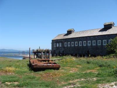
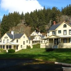
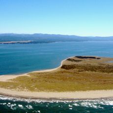
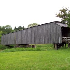
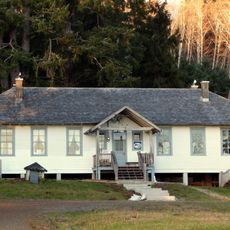
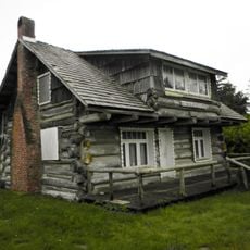
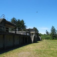
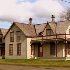
Oysterville is a small settlement near Willapa Bay where original 19th-century buildings line quiet streets beneath mature trees. The arrangement of structures and their proximity to the water reflect the practical needs of a community built on shellfish trade.

The settlement began in the 1850s when people arrived to harvest oysters from the abundant bay and quickly became the main trading hub for the region's seafood. The buildings standing today were built during this prosperous period driven by shellfish commerce.

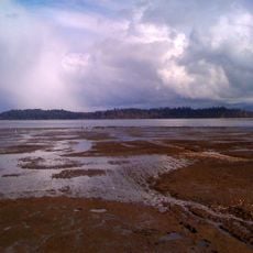
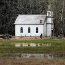
The place retains a strong connection to oyster fishing heritage, visible in how the buildings cluster near the water and in local gatherings that mark seasonal changes. People here still speak of the bay's rhythms and the families who made their living from it, keeping that knowledge alive through everyday routines.

The community is accessible via State Route 105 and is best explored on foot at a leisurely pace. The waterfront paths offer the clearest views of both the historic buildings and the bay landscape.

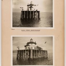
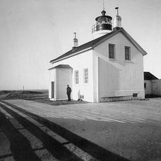
Despite its quiet appearance today, Oysterville was prosperous enough around 1900 to support schools, churches, and substantial commercial buildings. These structures reveal a time when oyster trade made this small bay one of the region's greatest sources of wealth.

The community of curious travelers

AroundUs brings together thousands of curated places, local tips, and hidden gems, enriched daily by 60,000 contributors worldwide.

Start exploring
Location
Elevation above the sea
4 m
GPS coordinates
46.54890,-124.02700
Latest update
December 6, 2025 17:40
Unknown locations in Washington State

Washington holds far more than the well-known attractions of Seattle and Mount Rainier. Across the state, dozens of less-visited sites offer insight into the region's geological history, military past, and natural diversity. From waterfalls to ancient forests to historic lighthouses and military...

Around this place
Astoria–Megler Bridge
United States of America

Astoria–Megler Bridge

39 km
Fort Stevens
United States of America

Fort Stevens

38.9 km
Cape Disappointment State Park
United States of America

Cape Disappointment State Park

28.9 km
Cape Disappointment Light
United States of America

Cape Disappointment Light

30.5 km
Fort Columbia State Park
United States of America

Fort Columbia State Park

33.2 km
North Head Light
United States of America

North Head Light

28.1 km
Grayland Beach State Park
United States of America

Grayland Beach State Park

27.2 km
Twin Harbors State Park
United States of America

Twin Harbors State Park

34.8 km
Leadbetter Point State Park
United States of America

Leadbetter Point State Park

7.8 km
Willapa National Wildlife Refuge
United States of America

Willapa National Wildlife Refuge

12.8 km
Grays Harbor Light
United States of America

Grays Harbor Light

38.4 km
Westport Light State Park
United States of America

Westport Light State Park

39 km
Waikiki Beach
United States of America

Waikiki Beach

29.8 km
Grays River Covered Bridge
United States of America

Grays River Covered Bridge

40.5 km
Bottle Beach State Park
United States of America

Bottle Beach State Park

37.8 km
Pacific Pines State Park
United States of America

Pacific Pines State Park

4.9 km
Columbia River Quarantine Station
United States of America

Columbia River Quarantine Station

34.5 km
Desdemona Sands Light
United States of America

Desdemona Sands Light

36.5 km
The Wreckage
United States of America

The Wreckage

7.1 km
Deep River Pioneer Lutheran Church
United States of America

Deep River Pioneer Lutheran Church

33.8 km
Willapa Bay Light
United States of America

Willapa Bay Light

18.4 km
Fort Stevens State Park
United States of America

Fort Stevens State Park

40.9 km
Colbert House
United States of America

Colbert House

26.8 km
Raymond Theatre
United States of America

Raymond Theatre

27.4 km
Battery Russell
United States of America

Battery Russell

39.7 km
World Kite Museum
United States of America

World Kite Museum

22.8 km
Columbia Pacific Heritage Museum
United States of America

Columbia Pacific Heritage Museum

26.9 km
International Mermaid Museum
United States of America

International Mermaid Museum

41 km
Show the full map
« Oysterville - Historic coastal community in Pacific County, United States » is provided by Around Us (aroundus.com). Images and texts are derived from Wikimedia project under a Creative Commons license. You are allowed to copy, distribute, and modify copies of this page, under the conditions set by the license, as long as this note is clearly visible.

Discover hidden gems everywhere you go!

From secret cafés to breathtaking viewpoints, skip the crowded tourist spots and find places that match your style. Our app makes it easy with voice search, smart filtering, route optimization, and insider tips from travelers worldwide. Download now for the complete mobile experience.

Around Us App Screenshot

A unique approach to discovering new places

Le Figaro

All the places worth exploring

France Info

A tailor-made excursion in just a few clicks

20 Minutes

Around Us
Travel Guide & Maps
Download

Send to your phone

QR Code
1

Open the camera app on your mobile.

2

Point at the QR code with your camera. A notification will appear.

3

Tap the notification to open the link.