Chest opened
+${chestReward.xp} XP
Explorer
NOUVEAU ×${chestReward.collectible.quantity}
tapez pour fermer
Chest locked

Open chests in the app

Around Us is built for your phone — chests unlock when you walk, explore and capture nearby places.

Enable Location

We need your location to show you interesting places around you

Discover nearby places

Find interesting locations and hidden gems around you

Precise directions

Get accurate directions and distances to places

Your location is never shared with other users. It's only used when you tap the location button.

Bull Run River

Log in to your account

Start exploring — it's free

Trusted by 72,880 travelers worldwide

Continue with Google
Continue with Apple
or

We will send you a code to connect

By continuing, you accept our Terms and Conditions and our Privacy Policy

Check your inbox

We've sent a pincode in your inbox. Please enter the code below.

Bull Run River
Discussion Reviews 1 Photos
10.4k Popularity

Bull Run River, Protected river in Oregon, United States.

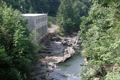
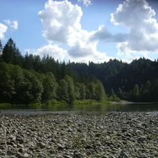
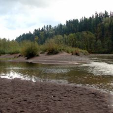
The Bull Run River is a river in Oregon's Cascade Range that originates at Bull Run Lake and flows westward into the Sandy River. Two dams along its course create reservoirs that store water during the dry summer months.

Native peoples inhabited the Bull Run watershed area for thousands of years, using it for hunting and gathering around the surrounding mountains. Their trails and knowledge of the landscape shaped early use of this region.

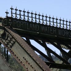
The river supplies drinking water to Portland and the surrounding communities, making it essential to daily life in the region. Local residents value the protection of this watershed as fundamental to their well-being.

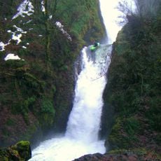
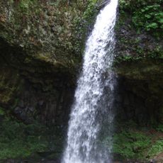
The river is located in the Cascade Mountains and is accessible through hiking trails and viewpoints from various nearby parking areas. The best time to visit is during drier months when trails are more accessible.

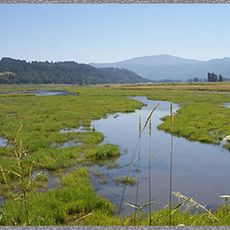
The watershed receives vastly different amounts of rainfall depending on elevation, creating distinct water patterns and landscapes from the headwaters to lower sections. These differences support diverse ecosystems throughout the river system.

The community of curious travelers

AroundUs brings together thousands of curated places, local tips, and hidden gems, enriched daily by 60,000 contributors worldwide.

Start exploring
Location
GPS coordinates
45.44610,-122.24700
Latest update
December 10, 2025 15:54
Around this place
Historic Columbia River Highway
United States of America

Historic Columbia River Highway

14.4 km
Vista House
United States of America

Vista House

10.5 km
Rooster Rock State Park
United States of America

Rooster Rock State Park

11 km
Crown Point
United States of America

Crown Point

10.4 km
Latourell Falls
United States of America

Latourell Falls

10.4 km
Oxbow Regional Park
United States of America

Oxbow Regional Park

6.3 km
Bridal Veil Falls
United States of America

Bridal Veil Falls

13.2 km
United States of America

Chanticleer Point

10.3 km
Steigerwald Lake National Wildlife Refuge
United States of America

Steigerwald Lake National Wildlife Refuge

14 km
Guy W. Talbot State Park
United States of America

Guy W. Talbot State Park

10.1 km
Camp Namanu
United States of America

Camp Namanu

484 m
Philip Foster Farm
United States of America

Philip Foster Farm

12.8 km
Dabney State Recreation Area
United States of America

Dabney State Recreation Area

11.3 km
George W. Joseph State Natural Area
United States of America

George W. Joseph State Natural Area

9.6 km
Stark Street Bridge
United States of America

Stark Street Bridge

11.8 km
Coopey Falls
United States of America

Coopey Falls

14.4 km
Springdale School
United States of America

Springdale School

10.4 km
Andreas Graf House
United States of America

Andreas Graf House

7.8 km
William Gedamke House
United States of America

William Gedamke House

14.4 km
Emanuel and Christina Anderson House
United States of America

Emanuel and Christina Anderson House

14 km
R. S. Smith Motor Company Building
United States of America

R. S. Smith Motor Company Building

5.7 km
Lusted Road Bridge
United States of America

Lusted Road Bridge

538 m
North American Bigfoot Center
United States of America

North American Bigfoot Center

7.5 km
Sunrise Park
United States of America

Sunrise Park

14.4 km
David and Marianne Ott House
United States of America

David and Marianne Ott House

12.9 km
Pillars of Hercules
United States of America

Pillars of Hercules

12.7 km
Mount Hood National Forest Headquarters
United States of America

Mount Hood National Forest Headquarters

5.8 km
Rooster Rock
United States of America

Rooster Rock

10.9 km
Show the full map
Reviews
Share your experience

No review yet

Discussions
Start a discussion...

No discussion yet

« Bull Run River - Protected river in Oregon, United States » is provided by Around Us (aroundus.com). Images and texts are derived from Wikimedia project under a Creative Commons license. You are allowed to copy, distribute, and modify copies of this page, under the conditions set by the license, as long as this note is clearly visible.

Discover hidden gems everywhere you go!

From secret cafés to breathtaking viewpoints, skip the crowded tourist spots and find places that match your style. Our app makes it easy with voice search, smart filtering, route optimization, and insider tips from travelers worldwide. Download now for the complete mobile experience.

Around Us App Screenshot

A unique approach to discovering new places

Le Figaro

All the places worth exploring

France Info

A tailor-made excursion in just a few clicks

20 Minutes

Around Us
Travel Guide & Maps
Download

Send to your phone

QR Code
1

Open the camera app on your mobile.

2

Point at the QR code with your camera. A notification will appear.

3

Tap the notification to open the link.