Chest opened
+${chestReward.xp} XP
Explorer
NOUVEAU ×${chestReward.collectible.quantity}
tapez pour fermer
Chest locked

Open chests in the app

Around Us is built for your phone — chests unlock when you walk, explore and capture nearby places.

Enable Location

We need your location to show you interesting places around you

Discover nearby places

Find interesting locations and hidden gems around you

Precise directions

Get accurate directions and distances to places

Your location is never shared with other users. It's only used when you tap the location button.

Log in to your account

Start exploring — it's free

Trusted by 72,919 travelers worldwide

Continue with Google
Continue with Apple
or

We will send you a code to connect

By continuing, you accept our Terms and Conditions and our Privacy Policy

Check your inbox

We've sent a pincode in your inbox. Please enter the code below.

Yacolt Burn State Forest
Discussion Reviews Photo
2.1k Popularity

Yacolt Burn State Forest, Nature reserve in Skamania County, United States

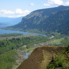
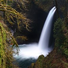
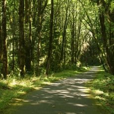
Yacolt Burn State Forest is a woodland area in the Cascade Range foothills of southern Washington featuring an extensive trail network and multiple camping facilities. The protected forest spans a large area and provides access to diverse recreational opportunities for visitors of varying skill levels.

The forest received its name from the massive wildfires of 1902 that destroyed thousands of acres across this region. These fires led to changes in how wildfire was managed in Washington state and the development of better protection systems.

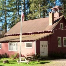
The Washington State Department of Natural Resources manages this land for both timber production and public recreation, supporting local educational funding.

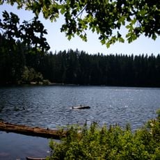
The forest offers multiple camping areas for different visitor types, including spots for hikers and areas specifically set up for horseback riders. The trails are accessible during various seasons, though visitors should be prepared for conditions that vary depending on the weather.

A notable hiking trail passes through the forest and connects to a larger system of pathways that extends across several states. This connection allows hikers to become part of a much larger hiking experience.

The community of curious travelers

AroundUs brings together thousands of curated places, local tips, and hidden gems, enriched daily by 60,000 contributors worldwide.

Start exploring
Location
Operator
Washington State Department of Natural Resources
GPS coordinates
45.74614,-122.14529
Latest update
December 14, 2025 09:45
Around this place
Columbia River Gorge
United States of America

Columbia River Gorge

27.9 km
Bridge of the Gods
United States of America

Bridge of the Gods

21.2 km
Bonneville Dam
United States of America

Bonneville Dam

19.5 km
United States of America

Bridge of the Gods

20.3 km
Beacon Rock State Park
United States of America

Beacon Rock State Park

13.8 km
Battle Ground Lake State Park
United States of America

Battle Ground Lake State Park

27.9 km
Cascade Locks and Canal
United States of America

Cascade Locks and Canal

21.2 km
United States of America

Larch Mountain

12.1 km
Table Mountain
United States of America

Table Mountain

14 km
United States of America

Camp Bonneville

21.1 km
Metlako Falls
United States of America

Metlako Falls

23.5 km
United States of America

Fort Cascades

18.4 km
United States of America

Pierce National Wildlife Refuge

17.2 km
Sheridan State Scenic Corridor
United States of America

Sheridan State Scenic Corridor

21.4 km
Greenleaf Peak
United States of America

Greenleaf Peak

14.3 km
Lake Bonneville
United States of America

Lake Bonneville

26.4 km
Wind River Experimental Forest
United States of America

Wind River Experimental Forest

14.5 km
Wind River Arboretum
United States of America

Wind River Arboretum

17.4 km
Fort Raines
United States of America

Fort Raines

20.5 km
Cascade Locks Work Center
United States of America

Cascade Locks Work Center

24.5 km
United States of America

Elkhorn Mountain

17.6 km
Venersborg School
United States of America

Venersborg School

21.8 km
Columbia Gorge Interpretive Center Museum
United States of America

Columbia Gorge Interpretive Center Museum

20.3 km
Beacon Rock
United States of America

Beacon Rock

16.4 km
Home Valley Beach
United States of America

Home Valley Beach

28.9 km
Bonneville Dam Historic District
United States of America

Bonneville Dam Historic District

19.5 km
United States of America

Lacamas Prairie Natural Resources Conservation Area

28.1 km
United States of America

Aldrich Butte

16.5 km
Show the full map
Reviews
Share your experience

No review yet

Discussions
Start a discussion...

No discussion yet

« Yacolt Burn State Forest - Nature reserve in Skamania County, United States » is provided by Around Us (aroundus.com). Images and texts are derived from Wikimedia project under a Creative Commons license. You are allowed to copy, distribute, and modify copies of this page, under the conditions set by the license, as long as this note is clearly visible.

Discover hidden gems everywhere you go!

From secret cafés to breathtaking viewpoints, skip the crowded tourist spots and find places that match your style. Our app makes it easy with voice search, smart filtering, route optimization, and insider tips from travelers worldwide. Download now for the complete mobile experience.

Around Us App Screenshot

A unique approach to discovering new places

Le Figaro

All the places worth exploring

France Info

A tailor-made excursion in just a few clicks

20 Minutes

Around Us
Travel Guide & Maps
Download

Send to your phone

QR Code
1

Open the camera app on your mobile.

2

Point at the QR code with your camera. A notification will appear.

3

Tap the notification to open the link.