Chest opened
+${chestReward.xp} XP
Explorer
NOUVEAU ×${chestReward.collectible.quantity}
tapez pour fermer
Chest locked

Open chests in the app

Around Us is built for your phone — chests unlock when you walk, explore and capture nearby places.

Enable Location

We need your location to show you interesting places around you

Discover nearby places

Find interesting locations and hidden gems around you

Precise directions

Get accurate directions and distances to places

Your location is never shared with other users. It's only used when you tap the location button.

Victor Valley, California

Log in to your account

Start exploring — it's free

Trusted by 72,996 travelers worldwide

Continue with Google
Continue with Apple
or

We will send you a code to connect

By continuing, you accept our Terms and Conditions and our Privacy Policy

Check your inbox

We've sent a pincode in your inbox. Please enter the code below.

Victor Valley, California
Discussion Reviews 2 Photos
21.6k Popularity

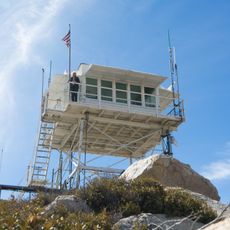
Victor Valley, California, Valley region in Southern California, United States.

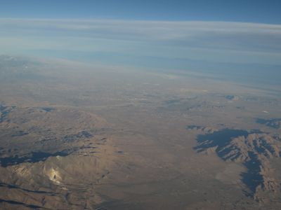
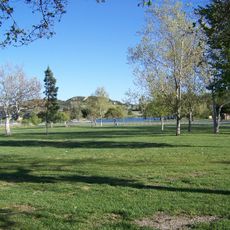
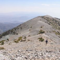
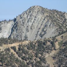
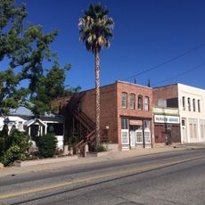
Victor Valley is a valley region spanning multiple cities across San Bernardino County in Southern California. The landscape is shaped by the Mojave Desert, featuring an arid climate with wide, open terrain.

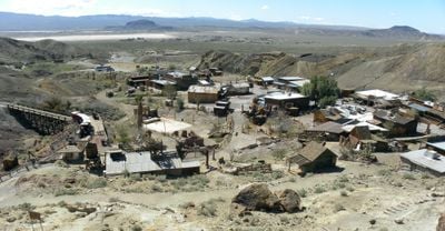
The Serrano and Mohave peoples were the first inhabitants before European settlement arrived in the region. Railroad development in the 19th century brought growth and changed how the land was used.

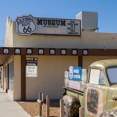
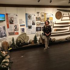
The Victor Valley Museum in Apple Valley displays exhibitions about the region's history, nature, and local art that reflect life here. Through these collections, visitors gain insight into what shapes this place and its people.

Interstate 15 connects the valley to Los Angeles and Las Vegas for easy vehicle access. The Victor Valley Transportation Center provides train and bus options for travelers without their own transportation.

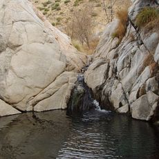
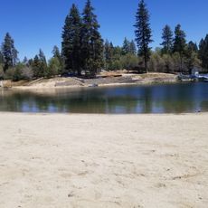
The Mojave River flows underground through the valley, feeding aquifers that supply water to the entire region. This hidden water system is crucial for sustaining life in this desert landscape.

The community of curious travelers

AroundUs brings together thousands of curated places, local tips, and hidden gems, enriched daily by 60,000 contributors worldwide.

Start exploring
Location
GPS coordinates
34.50000,-117.30000
Latest update
December 7, 2025 10:04
Around this place
Mount San Antonio
United States of America

Mount San Antonio

39.5 km
Big Bear Lake
United States of America

Big Bear Lake

41.3 km
United States Penitentiary, Victorville
United States of America

United States Penitentiary, Victorville

9.7 km
CEDU
United States of America

CEDU

39.3 km
Glen Helen Amphitheater
United States of America

Glen Helen Amphitheater

34.2 km
Deep Creek Hot Springs
United States of America

Deep Creek Hot Springs

21.1 km
Lake Arrowhead Reservoir
United States of America

Lake Arrowhead Reservoir

29 km
Cucamonga Peak
United States of America

Cucamonga Peak

40.5 km
Lake Arrowhead Village Beach
United States of America

Lake Arrowhead Village Beach

29.3 km
Mount Baldy Zen Center
United States of America

Mount Baldy Zen Center

41.8 km
Glen Helen Regional Park
United States of America

Glen Helen Regional Park

34.2 km
Table Mountain Observatory
United States of America

Table Mountain Observatory

37.4 km
California Route 66 Museum
United States of America

California Route 66 Museum

4.2 km
Bonita Falls
United States of America

Bonita Falls

35.4 km
Devil Canyon
United States of America

Devil Canyon

33.9 km
Mount Harwood
United States of America

Mount Harwood

38.7 km
Telegraph Peak
United States of America

Telegraph Peak

38.1 km
Santa Fe And Salt Lake Trail Monument
United States of America

Santa Fe And Salt Lake Trail Monument

26.4 km
Monument Peak
United States of America

Monument Peak

28.8 km
Santos Manuel Student Union
United States of America

Santos Manuel Student Union

35.5 km
Mormon Trail Monument
United States of America

Mormon Trail Monument

26.6 km
San Bernardino Valley Water Conservation Demonstration Garden
United States of America

San Bernardino Valley Water Conservation Demonstration Garden

35.3 km
Highland Historic District
United States of America

Highland Historic District

42.3 km
Aquatic Center
United States of America

Aquatic Center

41.6 km
Arboreto Heaps Peak
United States of America

Arboreto Heaps Peak

32.9 km
Mountain History Museum
United States of America

Mountain History Museum

27.8 km
Keller Peak Lookout
United States of America

Keller Peak Lookout

40.9 km
Tavern Bay Beach
United States of America

Tavern Bay Beach

28.3 km
Show the full map
Reviews
Share your experience

No review yet

Discussions
Start a discussion...

No discussion yet

« Victor Valley, California - Valley region in Southern California, United States » is provided by Around Us (aroundus.com). Images and texts are derived from Wikimedia project under a Creative Commons license. You are allowed to copy, distribute, and modify copies of this page, under the conditions set by the license, as long as this note is clearly visible.

Discover hidden gems everywhere you go!

From secret cafés to breathtaking viewpoints, skip the crowded tourist spots and find places that match your style. Our app makes it easy with voice search, smart filtering, route optimization, and insider tips from travelers worldwide. Download now for the complete mobile experience.

Around Us App Screenshot

A unique approach to discovering new places

Le Figaro

All the places worth exploring

France Info

A tailor-made excursion in just a few clicks

20 Minutes

Around Us
Travel Guide & Maps
Download

Send to your phone

QR Code
1

Open the camera app on your mobile.

2

Point at the QR code with your camera. A notification will appear.

3

Tap the notification to open the link.