Chest opened
+${chestReward.xp} XP
Explorer
NOUVEAU ×${chestReward.collectible.quantity}
tapez pour fermer
Chest locked

Open chests in the app

Around Us is built for your phone — chests unlock when you walk, explore and capture nearby places.

Enable Location

We need your location to show you interesting places around you

Discover nearby places

Find interesting locations and hidden gems around you

Precise directions

Get accurate directions and distances to places

Your location is never shared with other users. It's only used when you tap the location button.

Baker

Log in to your account

Start exploring — it's free

Trusted by 72,966 travelers worldwide

Continue with Google
Continue with Apple
or

We will send you a code to connect

By continuing, you accept our Terms and Conditions and our Privacy Policy

Check your inbox

We've sent a pincode in your inbox. Please enter the code below.

Discussion Reviews 4 Photos
42.2k Popularity

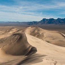
Baker, Desert rest stop along Interstate 15 in San Bernardino County, USA.

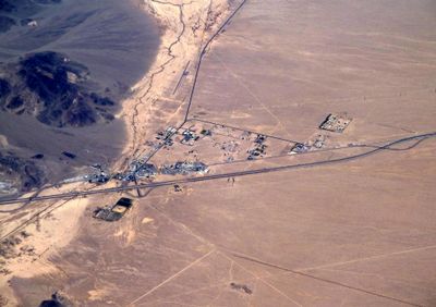
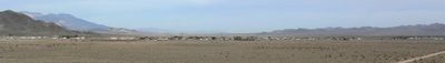
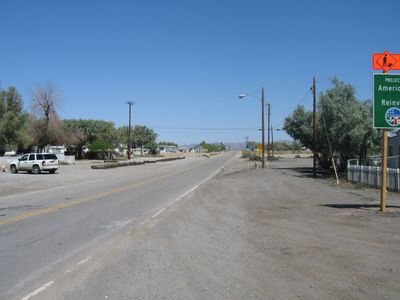
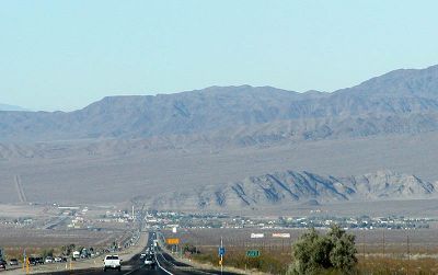
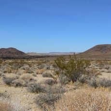
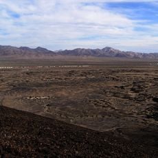
Baker is a community in the Mojave Desert in San Bernardino County at an elevation of around 1,900 feet (580 meters). The place sits along Interstate 15 and contains multiple gas stations and dining establishments spread along its main road.

The settlement began in 1908 as a railroad station for the Tonopah and Tidewater Railroad, taking its name from Richard C. Baker who helped develop that line. This founding marked the start of human settlement in this desert region along an important rail route.

The community serves as a stopping point for travelers moving between Los Angeles and Las Vegas, featuring different dining options that reflect the needs of passing visitors. The Mad Greek Café operates around the clock and shows how the place has adapted to serve its transient population over the years.

Visitors should bring plenty of water and prepare for intense heat, especially during summer months. The area offers gas stations and food options where travelers can refuel and take a quick break.

A tall thermometer marks the spot and references extreme temperatures recorded in the nearby Death Valley area. This landmark thermometer has become a popular photo stop for travelers passing through.

The community of curious travelers

AroundUs brings together thousands of curated places, local tips, and hidden gems, enriched daily by 60,000 contributors worldwide.

Start exploring
Elevation above the sea
287 m
GPS coordinates
35.27583,-116.06583
Latest update
December 18, 2025 20:02
Around this place
Mojave National Preserve
United States of America

Mojave National Preserve

54 km
Kelso Dunes
United States of America

Kelso Dunes

48.9 km
World's Tallest Thermometer
United States of America

World's Tallest Thermometer

1.2 km
Cima volcanic field
United States of America

Cima volcanic field

28.9 km
Mojave Memorial Cross
United States of America

Mojave Memorial Cross

47 km
Cima Dome & Volcanic Field National Natural Landmark
United States of America

Cima Dome & Volcanic Field National Natural Landmark

28.9 km
Clark Mountain
United States of America

Clark Mountain

51.4 km
Saddle Peak Hills Wilderness
United States of America

Saddle Peak Hills Wilderness

61.8 km
Bristol Mountains
United States of America

Bristol Mountains

47.5 km
Saratoga Springs
United States of America

Saratoga Springs

55.6 km
United States of America

Aiken's Wash

29.1 km
United States of America

Rasor Off-Highway Vehicle Area

19.9 km
United States of America

Spanish Canyon

54.1 km
United States of America

Otto mountain

3 km
United States of America

Bull Spring Mountain

28.2 km
United States of America

The Palisades

57.3 km
United States of America

Teutonia Peak

45.7 km
United States of America

Seventeenmile Point

17.1 km
United States of America

Mohave Peak

23.4 km
United States of America

Fountain Peak

60.5 km
United States of America

Bull Canyon

54.6 km
Afton Canyon
United States of America

Afton Canyon

32.7 km
United States of America

China Ranch Date Farm

59.6 km
United States of America

Travelers Monument

16.4 km
United States of America

Dumont Dunes Off-Highway Vehicle (OHV) Recreation Area

46.9 km
United States of America

Trail to dunes

56.4 km
United States of America

Willow Creek Canyon Overlook

59.6 km
United States of America

Scenic viewpoint

58.9 km
Show the full map
Reviews
Share your experience

No review yet

Discussions
Start a discussion...

No discussion yet

« Baker - Desert rest stop along Interstate 15 in San Bernardino County, USA » is provided by Around Us (aroundus.com). Images and texts are derived from Wikimedia project under a Creative Commons license. You are allowed to copy, distribute, and modify copies of this page, under the conditions set by the license, as long as this note is clearly visible.

Discover hidden gems everywhere you go!

From secret cafés to breathtaking viewpoints, skip the crowded tourist spots and find places that match your style. Our app makes it easy with voice search, smart filtering, route optimization, and insider tips from travelers worldwide. Download now for the complete mobile experience.

Around Us App Screenshot

A unique approach to discovering new places

Le Figaro

All the places worth exploring

France Info

A tailor-made excursion in just a few clicks

20 Minutes

Around Us
Travel Guide & Maps
Download

Send to your phone

QR Code
1

Open the camera app on your mobile.

2

Point at the QR code with your camera. A notification will appear.

3

Tap the notification to open the link.