Enable Location

We need your location to show you interesting places around you

Discover nearby places

Find interesting locations and hidden gems around you

Precise directions

Get accurate directions and distances to places

Your location is never shared with other users. It's only used when you tap the location button.

Saratoga Springs

Log in to your account

Start exploring — it's free

Trusted by 62,060 travelers worldwide

Continue with Google
Continue with Apple
or

We will send you a code to connect

By continuing, you accept our Terms and Conditions and our Privacy Policy

Check your inbox

We've sent a pincode in your inbox. Please enter the code below.

Saratoga Springs

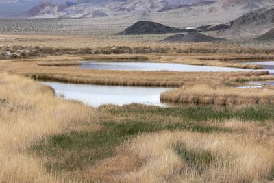
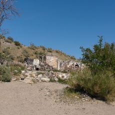
Saratoga Springs, Natural oasis in San Bernardino County, United States.

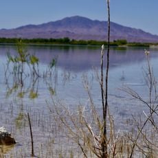
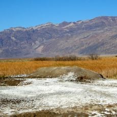
Saratoga Springs is a natural oasis in San Bernardino County where mineral-rich water flows from multiple underground sources. The water maintains a steady temperature year-round and carries high concentrations of calcium and iron.

The Pomo Native Americans valued these springs for their healing properties long before European settlers discovered the location in 1871. The discovery sparked interest in developing the site as a wellness destination.

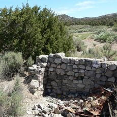
The springs became a gathering point for visitors seeking mineral water treatments, leading to the construction of accommodations for 250 guests.

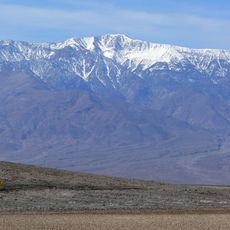
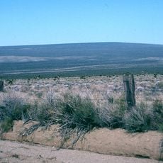
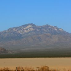
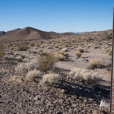
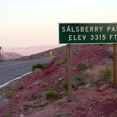
The springs are accessible by car in an open desert setting with minimal shade available. Bring plenty of water and sun protection, as the area receives intense direct sunlight throughout the day.

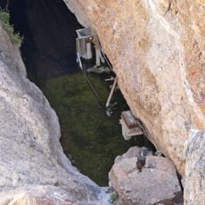
A few of the springs have received individual names, including two called Appetizer and Digester. One source produces water with a noticeable sulfur smell that some visitors specifically seek out.

The community of curious travelers

AroundUs brings together thousands of curated places, local tips, and hidden gems, enriched daily by 60,000 contributors worldwide.

Start exploring
GPS coordinates
35.68167,-116.42361
Latest update
December 13, 2025 12:24
Around this place
Chicken Ranch
United States of America

Chicken Ranch

60.6 km
Deep Space Network
United States of America

Deep Space Network

50.9 km
Devils Hole
United States of America

Devils Hole

83.6 km
Lake Dolores Waterpark
United States of America

Lake Dolores Waterpark

85.1 km
Barker Ranch
United States of America

Barker Ranch

63.2 km
Goldstone Deep Space Communications Complex
United States of America

Goldstone Deep Space Communications Complex

50.9 km
Trona Pinnacles
United States of America

Trona Pinnacles

85.8 km
Dante's View
United States of America

Dante's View

65.9 km
Telescope Peak
United States of America

Telescope Peak

81 km
Amargosa Opera House and Hotel
United States of America

Amargosa Opera House and Hotel

69.1 km
World's Tallest Thermometer
United States of America

World's Tallest Thermometer

56.1 km
Ash Meadows National Wildlife Refuge
United States of America

Ash Meadows National Wildlife Refuge

83.5 km
Spring Mountain Motorsports Ranch
United States of America

Spring Mountain Motorsports Ranch

71.4 km
Cima Dome & Volcanic Field National Natural Landmark
United States of America

Cima Dome & Volcanic Field National Natural Landmark

77.7 km
Goldstone Solar System Radar
United States of America

Goldstone Solar System Radar

50.9 km
Clark Mountain
United States of America

Clark Mountain

77.5 km
United States of America

Carpenter Canyon

79.6 km
Potosi Mining District
United States of America

Potosi Mining District

85.9 km
Saddle Peak Hills Wilderness
United States of America

Saddle Peak Hills Wilderness

13.6 km
Eagle Borax Works
United States of America

Eagle Borax Works

70.3 km
Jubilee Pass
United States of America

Jubilee Pass

29.1 km
DSS 14
United States of America

DSS 14

50.9 km
Salsberry Pass
United States of America

Salsberry Pass

27.2 km
DSS 13
United States of America

DSS 13

50.9 km
Gold Town Casino
United States of America

Gold Town Casino

70.9 km
Badwater Observation Point
United States of America

Badwater Observation Point

68.5 km
Death Valley Junction Historic District
United States of America

Death Valley Junction Historic District

69.1 km
Afton Canyon
United States of America

Afton Canyon

72.1 km
Show the full map
« Saratoga Springs - Natural oasis in San Bernardino County, United States » is provided by Around Us (aroundus.com). Images and texts are derived from Wikimedia project under a Creative Commons license. You are allowed to copy, distribute, and modify copies of this page, under the conditions set by the license, as long as this note is clearly visible.

Discover hidden gems everywhere you go!

From secret cafés to breathtaking viewpoints, skip the crowded tourist spots and find places that match your style. Our app makes it easy with voice search, smart filtering, route optimization, and insider tips from travelers worldwide. Download now for the complete mobile experience.

Around Us App Screenshot

A unique approach to discovering new places

Le Figaro

All the places worth exploring

France Info

A tailor-made excursion in just a few clicks

20 Minutes

Around Us
Travel Guide & Maps
Download

Send to your phone

QR Code
1

Open the camera app on your mobile.

2

Point at the QR code with your camera. A notification will appear.

3

Tap the notification to open the link.