Enable Location

We need your location to show you interesting places around you

Discover nearby places

Find interesting locations and hidden gems around you

Precise directions

Get accurate directions and distances to places

Your location is never shared with other users. It's only used when you tap the location button.

Cima Dome & Volcanic Field National Natural Landmark

Log in to your account

Start exploring — it's free

Trusted by 64,559 travelers worldwide

Continue with Google
Continue with Apple
or

We will send you a code to connect

By continuing, you accept our Terms and Conditions and our Privacy Policy

Check your inbox

We've sent a pincode in your inbox. Please enter the code below.

Cima Dome & Volcanic Field National Natural Landmark
Discussion Reviews 1 Photos
5.6k Popularity

Cima Dome & Volcanic Field National Natural Landmark, Volcanic field and national natural landmark in San Bernardino County, California.

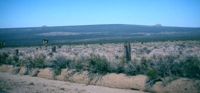
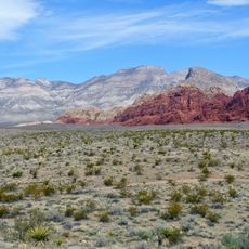
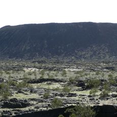
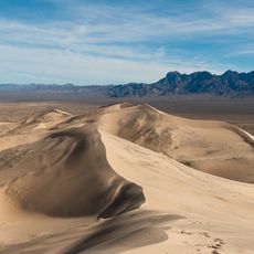
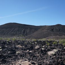
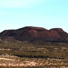
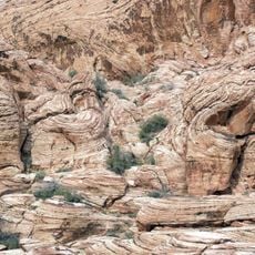
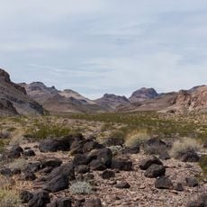
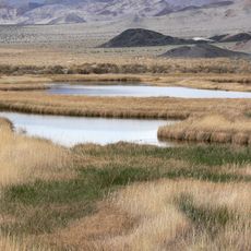
Cima Dome and Volcanic Field National Natural Landmark is a protected geological site in the Mojave Desert, San Bernardino County, California, made up of a broad, gently rounded granite dome and one of the most intact volcanic fields in North America. The site contains dozens of cinder cones and lava flows that rise visibly above the flat desert floor.

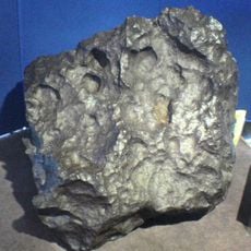
The volcanic field built up through many eruptions spread over hundreds of thousands of years, layering black lava across the desert surface. The granite dome at the center is far older and was exposed gradually as softer surrounding rock wore away.

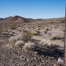
Rock carvings left by people who traveled through this area thousands of years ago can still be seen on the lava surfaces. These markings are one of the few visible signs of human presence in an otherwise remote stretch of desert.

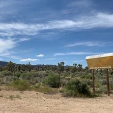
The roads leading into the area are unpaved and rough, so a high-clearance vehicle is strongly recommended. Visitors should carry more water than they think they need, especially outside the cooler months of spring and fall.

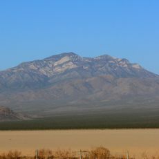
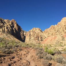
The Cima Dome is not a volcanic formation at all, which surprises many visitors who come expecting a single peak shaped by lava. It is a granite dome so gently rounded that people often walk across it without realizing they have crossed its summit.

The community of curious travelers

AroundUs brings together thousands of curated places, local tips, and hidden gems, enriched daily by 60,000 contributors worldwide.

Start exploring
GPS coordinates
35.25000,-115.75000
Latest update
March 3, 2026 10:08
Around this place
Red Rock Canyon National Conservation Area
United States of America

Red Rock Canyon National Conservation Area

102.8 km
Lake Dolores Waterpark
United States of America

Lake Dolores Waterpark

91.7 km
United States of America

AN/URC-117 Ground Wave Emergency Network

73 km
Amboy Crater
United States of America

Amboy Crater

78.7 km
Desperado
United States of America

Desperado

52.4 km
Kelso Dunes
United States of America

Kelso Dunes

38 km
Pisgah Crater
United States of America

Pisgah Crater

80 km
World's Tallest Thermometer
United States of America

World's Tallest Thermometer

29.4 km
Mitchell Caverns
United States of America

Mitchell Caverns

40.6 km
Castle Mountains National Monument
United States of America

Castle Mountains National Monument

62.2 km
Mojave Trails National Monument
United States of America

Mojave Trails National Monument

68 km
Lavic Lake volcanic field
United States of America

Lavic Lake volcanic field

79.9 km
Mojave Memorial Cross
United States of America

Mojave Memorial Cross

19.5 km
Old Woman meteorite
United States of America

Old Woman meteorite

88.5 km
Providence Mountains State Recreation Area
United States of America

Providence Mountains State Recreation Area

40.3 km
Clark Mountain
United States of America

Clark Mountain

33.9 km
Aztec Sandstone
United States of America

Aztec Sandstone

79.7 km
Bigelow Cholla Garden Wilderness
United States of America

Bigelow Cholla Garden Wilderness

90.9 km
Clipper Mountain Wilderness
United States of America

Clipper Mountain Wilderness

64.5 km
Goodsprings Schoolhouse
United States of America

Goodsprings Schoolhouse

70.7 km
Potosi Mining District
United States of America

Potosi Mining District

82.4 km
Saddle Peak Hills Wilderness
United States of America

Saddle Peak Hills Wilderness

80 km
Saratoga Springs
United States of America

Saratoga Springs

77.7 km
Goffs Schoolhouse
United States of America

Goffs Schoolhouse

73.2 km
Wee Thump Joshua Tree Wilderness, Nevada
United States of America

Wee Thump Joshua Tree Wilderness, Nevada

66.9 km
Seven Magic Mountains
United States of America

Seven Magic Mountains

78.7 km
Black Velvet Canyon
United States of America

Black Velvet Canyon

91.5 km
Pioneer Saloon
United States of America

Pioneer Saloon

71 km
Show the full map
Reviews
Share your experience

No review yet

Discussions
Start a discussion...

No discussion yet

« Cima Dome & Volcanic Field National Natural Landmark - Volcanic field and national natural landmark in San Bernardino County, California » is provided by Around Us (aroundus.com). Images and texts are derived from Wikimedia project under a Creative Commons license. You are allowed to copy, distribute, and modify copies of this page, under the conditions set by the license, as long as this note is clearly visible.

Discover hidden gems everywhere you go!

From secret cafés to breathtaking viewpoints, skip the crowded tourist spots and find places that match your style. Our app makes it easy with voice search, smart filtering, route optimization, and insider tips from travelers worldwide. Download now for the complete mobile experience.

Around Us App Screenshot

A unique approach to discovering new places

Le Figaro

All the places worth exploring

France Info

A tailor-made excursion in just a few clicks

20 Minutes

Around Us
Travel Guide & Maps
Download

Send to your phone

QR Code
1

Open the camera app on your mobile.

2

Point at the QR code with your camera. A notification will appear.

3

Tap the notification to open the link.