Enable Location

We need your location to show you interesting places around you

Discover nearby places

Find interesting locations and hidden gems around you

Precise directions

Get accurate directions and distances to places

Your location is never shared with other users. It's only used when you tap the location button.

Providence Mountains State Recreation Area

Log in to your account

Start exploring — it's free

Trusted by 60,661 travelers worldwide

Continue with Google
Continue with Apple
or

We will send you a code to connect

By continuing, you accept our Terms and Conditions and our Privacy Policy

Check your inbox

We've sent a pincode in your inbox. Please enter the code below.

Providence Mountains State Recreation Area

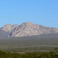
Providence Mountains State Recreation Area, Recreation area in Mojave Desert, California

Description

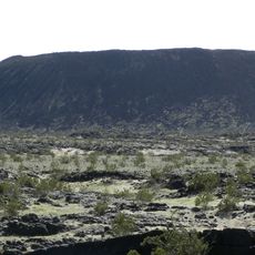
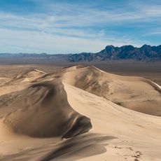
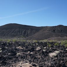
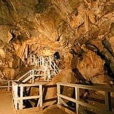
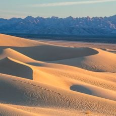
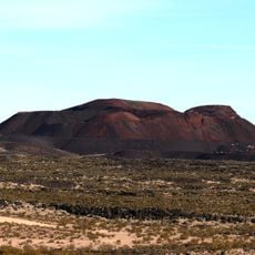
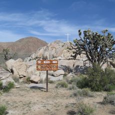
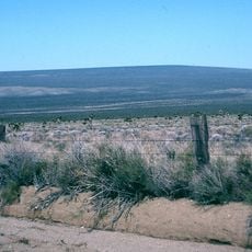
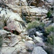
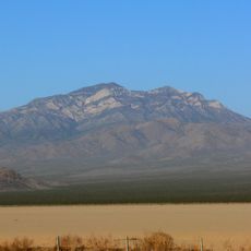
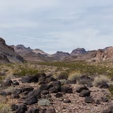
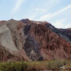
Providence Mountains State Recreation Area sprawls across 5,900 acres of desert and features limestone formations with hiking trails through different vegetation zones. The area also includes Mitchell Caverns, a cave system with geological features and rock structures.

History

Indigenous peoples inhabited this region for centuries before it received protection in the 20th century. The conservation of the land preserves both natural landscapes and traces of early settlement.

Culture

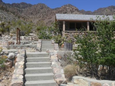
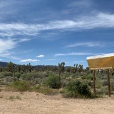
The visitor center, housed in a 1934 stone building, displays exhibits about local wildlife and how Native American peoples connected with the Mojave Desert landscape. The collections show how people adapted to life in this remote region.

Practical

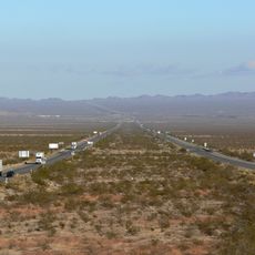
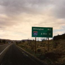
Access the area via Essex Road from Interstate 40, where rangers lead guided tours along marked trails. Visit during cooler months when desert heat is less intense.

Did you know?

Mitchell Caverns shelter two insect species found nowhere else on Earth. These rare creatures have evolved in the isolated cave environment over long periods.

Location
GPS coordinates
34.94722,-115.50806
Latest update
December 10, 2025 20:03

AroundUs brings together thousands of curated places, local tips, and hidden gems, enriched daily by 60,000 contributors worldwide. Discover all places nearby (California).

Around this place
Interstate 40
United States of America

Interstate 40

25.4 km
United States of America

AN/URC-117 Ground Wave Emergency Network

33.4 km
Amboy Crater
United States of America

Amboy Crater

51.8 km
Desperado
United States of America

Desperado

75.1 km
Interstate 40 in California
United States of America

Interstate 40 in California

59.8 km
Kelso Dunes
United States of America

Kelso Dunes

24.2 km
Pisgah Crater
United States of America

Pisgah Crater

82.3 km
World's Tallest Thermometer
United States of America

World's Tallest Thermometer

62.5 km
Mitchell Caverns
United States of America

Mitchell Caverns

920 m
Castle Mountains National Monument
United States of America

Castle Mountains National Monument

55.6 km
Mojave Trails National Monument
United States of America

Mojave Trails National Monument

50.6 km
Lavic Lake volcanic field
United States of America

Lavic Lake volcanic field

82.3 km
Grapevine Canyon Petroglyphs
United States of America

Grapevine Canyon Petroglyphs

81.1 km
Mojave Memorial Cross
United States of America

Mojave Memorial Cross

41.1 km
Cima Dome & Volcanic Field National Natural Landmark
United States of America

Cima Dome & Volcanic Field National Natural Landmark

40.3 km
Old Woman meteorite
United States of America

Old Woman meteorite

48.2 km
Old Woman Mountains Wilderness
United States of America

Old Woman Mountains Wilderness

61.1 km
Clark Mountain
United States of America

Clark Mountain

64.8 km
Spirit Mountain
United States of America

Spirit Mountain

80.2 km
Bigelow Cholla Garden Wilderness
United States of America

Bigelow Cholla Garden Wilderness

57.8 km
Clipper Mountain Wilderness
United States of America

Clipper Mountain Wilderness

24.7 km
Dead Mountains
United States of America

Dead Mountains

70.6 km
United States of America

Bridge Canyon Wilderness

80.3 km
Grapevine Canyon
United States of America

Grapevine Canyon

81.1 km
United States of America

Alexey W. Von Schmidt

77.5 km
Goffs Schoolhouse
United States of America

Goffs Schoolhouse

41.5 km
Wee Thump Joshua Tree Wilderness, Nevada
United States of America

Wee Thump Joshua Tree Wilderness, Nevada

75.1 km
Afton Canyon
United States of America

Afton Canyon

71.7 km
Show the full map
« Providence Mountains State Recreation Area - Recreation area in Mojave Desert, California » is provided by Around Us (aroundus.com). Images and texts are derived from Wikimedia project under a Creative Commons license. You are allowed to copy, distribute, and modify copies of this page, under the conditions set by the license, as long as this note is clearly visible.

Discover hidden gems everywhere you go!

From secret cafés to breathtaking viewpoints, skip the crowded tourist spots and find places that match your style. Our app makes it easy with voice search, smart filtering, route optimization, and insider tips from travelers worldwide. Download now for the complete mobile experience.

Around Us App Screenshot

A unique approach to discovering new places

Le Figaro

All the places worth exploring

France Info

A tailor-made excursion in just a few clicks

20 Minutes

Around Us
Travel Guide & Maps
Download

Send to your phone

QR Code
1

Open the camera app on your mobile.

2

Point at the QR code with your camera. A notification will appear.

3

Tap the notification to open the link.