Enable Location

We need your location to show you interesting places around you

Discover nearby places

Find interesting locations and hidden gems around you

Precise directions

Get accurate directions and distances to places

Your location is never shared with other users. It's only used when you tap the location button.

Mitchell Caverns

Log in to your account

Start exploring — it's free

Trusted by 66,250 travelers worldwide

Continue with Google
Continue with Apple
or

We will send you a code to connect

By continuing, you accept our Terms and Conditions and our Privacy Policy

Check your inbox

We've sent a pincode in your inbox. Please enter the code below.

Discussion Reviews 1 Photos
10.5k Popularity

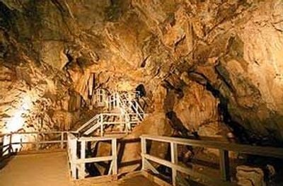
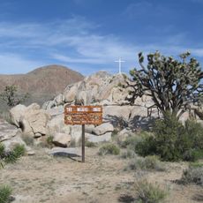
Mitchell Caverns, Limestone caves in Providence Mountains State Recreation Area, California, US.

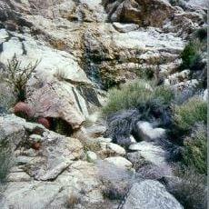
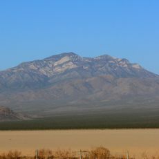
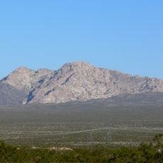
Mitchell Caverns is a system of three connected limestone caves in the Providence Mountains, set within the Mojave Desert in California. The cave walls and ceilings are covered with stalactites, stalagmites, and smooth sheets of flowstone that formed over thousands of years.

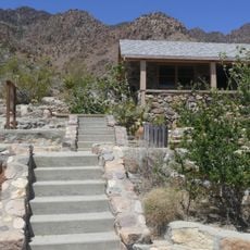
Jack and Ida Mitchell opened the caves to visitors in 1934 and ran them as a roadside attraction along Route 66 for about twenty years. After the Mitchells left, California took over the site and brought it into the state park system.

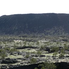
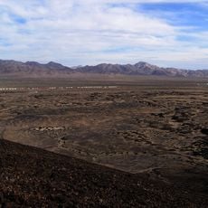
The Chemehuevi people called these caves 'the eyes of the mountain' because the two openings on the rock face look like eyes when seen from a distance. Standing at the base of the Providence Mountains today, it is easy to see why that image stuck.

The caves can only be visited on a guided tour, and reservations should be made in advance since spots fill up quickly. Sturdy shoes are a good idea, as the paths inside are narrow and uneven in places.

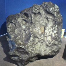
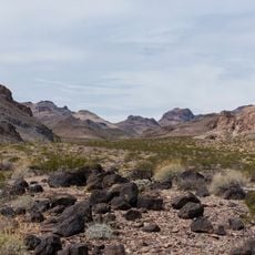
These caves are the only limestone formations found within California's entire state park system and contain fossilized remains of animals that lived here long before humans arrived. Looking closely at the rock in certain passages, visitors can sometimes spot traces of ancient bones embedded in the stone.

The community of curious travelers

AroundUs brings together thousands of curated places, local tips, and hidden gems, enriched daily by 60,000 contributors worldwide.

Start exploring
GPS coordinates
34.94082,-115.51444
Latest update
March 3, 2026 08:21
Around this place
Mojave National Preserve
United States of America

Mojave National Preserve

19.5 km
United States of America

AN/URC-117 Ground Wave Emergency Network

33.4 km
Amboy Crater
United States of America

Amboy Crater

50.9 km
Desperado
United States of America

Desperado

75.9 km
Kelso Dunes
United States of America

Kelso Dunes

23.5 km
Pisgah Crater
United States of America

Pisgah Crater

81.6 km
World's Tallest Thermometer
United States of America

World's Tallest Thermometer

62.4 km
Castle Mountains National Monument
United States of America

Castle Mountains National Monument

56.5 km
Mojave Trails National Monument
United States of America

Mojave Trails National Monument

49.7 km
Lavic Lake volcanic field
United States of America

Lavic Lake volcanic field

81.5 km
Cima volcanic field
United States of America

Cima volcanic field

40.6 km
Grapevine Canyon Petroglyphs
United States of America

Grapevine Canyon Petroglyphs

81.9 km
Mojave Memorial Cross
United States of America

Mojave Memorial Cross

41.8 km
Cima Dome & Volcanic Field National Natural Landmark
United States of America

Cima Dome & Volcanic Field National Natural Landmark

40.6 km
Old Woman meteorite
United States of America

Old Woman meteorite

47.9 km
Old Woman Mountains Wilderness
United States of America

Old Woman Mountains Wilderness

60.8 km
Providence Mountains State Recreation Area
United States of America

Providence Mountains State Recreation Area

920 m
Clark Mountain
United States of America

Clark Mountain

65.4 km
Spirit Mountain
United States of America

Spirit Mountain

81 km
Bigelow Cholla Garden Wilderness
United States of America

Bigelow Cholla Garden Wilderness

58.2 km
Clipper Mountain Wilderness
United States of America

Clipper Mountain Wilderness

24.2 km
Dead Mountains
United States of America

Dead Mountains

71.2 km
Bristol Mountains
United States of America

Bristol Mountains

50.4 km
United States of America

Bridge Canyon Wilderness

81.1 km
Grapevine Canyon
United States of America

Grapevine Canyon

81.9 km
United States of America

Alexey W. Von Schmidt

78.2 km
Goffs Schoolhouse
United States of America

Goffs Schoolhouse

42 km
Wee Thump Joshua Tree Wilderness, Nevada
United States of America

Wee Thump Joshua Tree Wilderness, Nevada

76 km
Show the full map
Reviews
Share your experience

No review yet

Discussions
Start a discussion...

No discussion yet

« Mitchell Caverns - Limestone caves in Providence Mountains State Recreation Area, California, US » is provided by Around Us (aroundus.com). Images and texts are derived from Wikimedia project under a Creative Commons license. You are allowed to copy, distribute, and modify copies of this page, under the conditions set by the license, as long as this note is clearly visible.

Discover hidden gems everywhere you go!

From secret cafés to breathtaking viewpoints, skip the crowded tourist spots and find places that match your style. Our app makes it easy with voice search, smart filtering, route optimization, and insider tips from travelers worldwide. Download now for the complete mobile experience.

Around Us App Screenshot

A unique approach to discovering new places

Le Figaro

All the places worth exploring

France Info

A tailor-made excursion in just a few clicks

20 Minutes

Around Us
Travel Guide & Maps
Download

Send to your phone

QR Code
1

Open the camera app on your mobile.

2

Point at the QR code with your camera. A notification will appear.

3

Tap the notification to open the link.