Cima volcanic field

Log in to your account

AroundUs is a community-driven map of interesting places, built by curious explorers like you. It grows with every review, story, and photo you share.
Connect to save your favorite spots, contribute locations, and create personalized routes.
Continue with Google
Continue with Apple
Continue with X
Continue with Facebook
Continue with email
By continuing, you accept our Terms and Conditions and our Privacy Policy
Create an account
Add to collection
Map
Suggest a change
Share

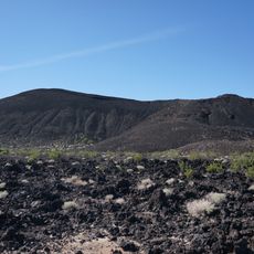
Cima volcanic field, Volcanic formation in Mojave National Preserve, US

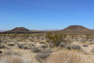
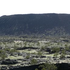
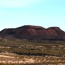
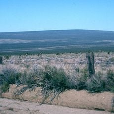
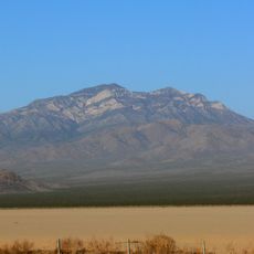
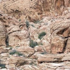
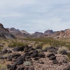
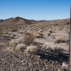
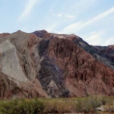
The Cima volcanic field is a geological formation in the eastern Mojave Desert containing numerous volcanic cones and lava flows spread across the landscape. The terrain displays various types of volcanic structures and patterns created by ancient eruptions.

Volcanic activity shaped this area over an extended period, with the most recent eruptions occurring thousands of years ago. This pattern shows how the landscape developed through repeated geological events spanning vast stretches of time.

People who lived here long ago carved images into the rock surfaces of the lava flows, and these markings remain visible as you walk through the field today.

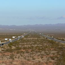
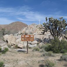
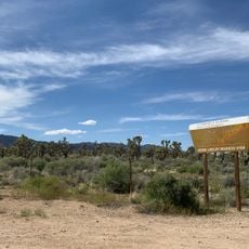
You can explore the field by driving along Kelbaker Road or hiking dirt trails that wind through the volcanic landscape. Plan your visit for cooler months when water and shade are scarce in the open desert environment.

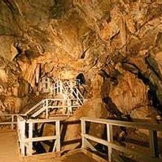
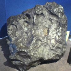
The field features an accessible lava tube that lets visitors step into an underground passage formed by ancient flows. Walking through this tunnel offers an unusual perspective on how the volcanic rock shaped the subsurface landscape.

Location: Mojave National Preserve

GPS coordinates: 35.25000,-115.75000

Latest update: December 10, 2025 15:49

Photos
Around this place
Interstate 40
United States of America

Interstate 40

64.9 km
Red Rock Canyon National Conservation Area
United States of America

Red Rock Canyon National Conservation Area

102.8 km
United States of America

AN/URC-117 Ground Wave Emergency Network

73 km
Amboy Crater
United States of America

Amboy Crater

78.7 km
Desperado
United States of America

Desperado

52.4 km
Kelso Dunes
United States of America

Kelso Dunes

38 km
Pisgah Crater
United States of America

Pisgah Crater

80 km
World's Tallest Thermometer
United States of America

World's Tallest Thermometer

29.4 km
Mitchell Caverns
United States of America

Mitchell Caverns

40.6 km
Castle Mountains National Monument
United States of America

Castle Mountains National Monument

62.2 km
Mojave Trails National Monument
United States of America

Mojave Trails National Monument

68 km
Lavic Lake volcanic field
United States of America

Lavic Lake volcanic field

79.9 km
Mojave Memorial Cross
United States of America

Mojave Memorial Cross

19.5 km
Cima Dome & Volcanic Field National Natural Landmark
United States of America

Cima Dome & Volcanic Field National Natural Landmark

0 m
Old Woman meteorite
United States of America

Old Woman meteorite

88.5 km
Providence Mountains State Recreation Area
United States of America

Providence Mountains State Recreation Area

40.3 km
Clark Mountain
United States of America

Clark Mountain

33.9 km
Aztec Sandstone
United States of America

Aztec Sandstone

79.7 km
Clipper Mountain Wilderness
United States of America

Clipper Mountain Wilderness

64.5 km
Goodsprings Schoolhouse
United States of America

Goodsprings Schoolhouse

70.7 km
Potosi Mining District
United States of America

Potosi Mining District

82.4 km
Saddle Peak Hills Wilderness
United States of America

Saddle Peak Hills Wilderness

80 km
Saratoga Springs
United States of America

Saratoga Springs

77.7 km
Goffs Schoolhouse
United States of America

Goffs Schoolhouse

73.2 km
Wee Thump Joshua Tree Wilderness, Nevada
United States of America

Wee Thump Joshua Tree Wilderness, Nevada

66.9 km
Seven Magic Mountains
United States of America

Seven Magic Mountains

78.7 km
Pioneer Saloon
United States of America

Pioneer Saloon

71 km
Afton Canyon
United States of America

Afton Canyon

53.9 km
Show the full map
Reviews

Visited this place? Tap the stars to rate it and share your experience / photos with the community! Try now! You can cancel it anytime.

« Cima volcanic field - Volcanic formation in Mojave National Preserve, US » is provided by Around Us (aroundus.com). Images and texts are derived from Wikimedia project under a Creative Commons license. You are allowed to copy, distribute, and modify copies of this page, under the conditions set by the license, as long as this note is clearly visible.

Discover hidden gems everywhere you go!

From secret cafés to breathtaking viewpoints, skip the crowded tourist spots and find places that match your style. Our app makes it easy with voice search, smart filtering, route optimization, and insider tips from travelers worldwide. Download now for the complete mobile experience.

Around Us App Screenshot

A unique approach to discovering new places

Le Figaro

All the places worth exploring

France Info

A tailor-made excursion in just a few clicks

20 Minutes