Mojave National Preserve

Log in to your account

AroundUs is a community-driven map of interesting places, built by curious explorers like you. It grows with every review, story, and photo you share.
Connect to save your favorite spots, contribute locations, and create personalized routes.
Continue with Google
Continue with Apple
Continue with X
Continue with Facebook
Continue with email
By continuing, you accept our Terms and Conditions and our Privacy Policy
Create an account
Add to collection
Map
Suggest a change
Share

Mojave National Preserve, Nature reserve in San Bernardino County, California, US.

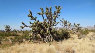
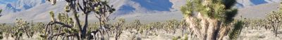
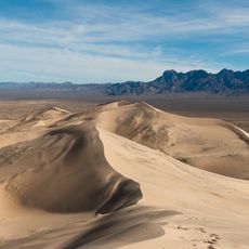
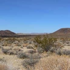
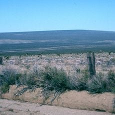
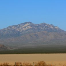
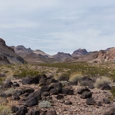
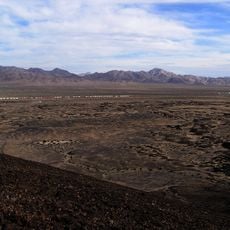
Mojave National Preserve is a large protected area in the Mojave Desert spanning over 1.5 million acres of public land. It contains Joshua tree forests, volcanic rock formations, sand dunes, mountains, and canyons scattered across the desert terrain.

The preserve was established in 1994 through the California Desert Protection Act, creating a protected wilderness area between two major interstates. This designation followed efforts to safeguard the region's natural landscape from further development.

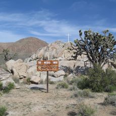
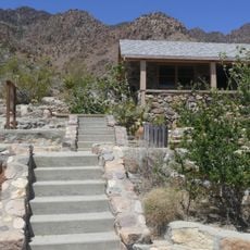
The former railroad depot in Kelso ghost town now serves as the Visitor Center, showcasing how people adapted to desert life through exhibits on local customs and survival. You can see artifacts and displays that reflect how residents worked and lived in this harsh environment.

Summer temperatures in the area rise above 41°C (105°F), so bring plenty of water and plan outdoor activities for cooler morning and evening hours. Spring and fall offer the most comfortable conditions for exploring the landscape.

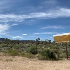
The Cima Dome area holds the world's largest and most concentrated Joshua tree forest, though a 2020 wildfire destroyed nearly 1.3 million of these trees. Today, visitors can witness how the landscape is recovering from this natural event.

Location: San Bernardino County

Inception: October 31, 1994

Operator: National Park Service

Address: Mojave Desert, California 92332, USA

Phone: +17607334040

Website: https://nps.gov/moja

GPS coordinates: 34.88333,-115.71667

Latest update: December 19, 2025 22:52

Photos
The Largest Deserts (Hot and Cold) in the World

The world's largest desert expanses range from the poles to subtropical areas. From Antarctica with its 14 million square kilometers to the Mojave plains, these regions are characterized by extreme conditions and low rainfall. Polar deserts dominate in area, followed by hot deserts like the Sahara...

Around this place
Kelso Dunes
United States of America

Kelso Dunes

5.6 km
World's Tallest Thermometer
United States of America

World's Tallest Thermometer

53.6 km
Mitchell Caverns
United States of America

Mitchell Caverns

19.5 km
Castle Mountains National Monument
United States of America

Castle Mountains National Monument

74.7 km
Cima volcanic field
United States of America

Cima volcanic field

40.9 km
Mojave Memorial Cross
United States of America

Mojave Memorial Cross

50.4 km
Cima Dome & Volcanic Field National Natural Landmark
United States of America

Cima Dome & Volcanic Field National Natural Landmark

40.9 km
Providence Mountains State Recreation Area
United States of America

Providence Mountains State Recreation Area

20.3 km
Clark Mountain
United States of America

Clark Mountain

72.4 km
Clipper Mountain Wilderness
United States of America

Clipper Mountain Wilderness

31.7 km
Bristol Mountains
United States of America

Bristol Mountains

31.1 km
United States of America

Aiken's Wash

39.7 km
United States of America

Rasor Off-Highway Vehicle Area

46.3 km
Goffs Schoolhouse
United States of America

Goffs Schoolhouse

60.5 km
United States of America

Fort Piute

71.5 km
Wee Thump Joshua Tree Wilderness, Nevada
United States of America

Wee Thump Joshua Tree Wilderness, Nevada

91.6 km
United States of America

Otto mountain

56 km
United States of America

Bull Spring Mountain

66.7 km
United States of America

Signal Hill

66 km
United States of America

Seventeenmile Point

40.1 km
United States of America

Teutonia Peak

48.4 km
United States of America

Twin Buttes

40.3 km
United States of America

Mohave Peak

54.4 km
United States of America

Fountain Peak

17.8 km
United States of America

Bull Canyon

3.3 km
United States of America

Pinto Valley observatory

51.3 km
United States of America

Ivanpah Lake

79.5 km
United States of America

Travelers Monument

44.2 km
Show the full map
Reviews

Visited this place? Tap the stars to rate it and share your experience / photos with the community! Try now! You can cancel it anytime.

« Mojave National Preserve - Nature reserve in San Bernardino County, California, US » is provided by Around Us (aroundus.com). Images and texts are derived from Wikimedia project under a Creative Commons license. You are allowed to copy, distribute, and modify copies of this page, under the conditions set by the license, as long as this note is clearly visible.

Discover hidden gems everywhere you go!

From secret cafés to breathtaking viewpoints, skip the crowded tourist spots and find places that match your style. Our app makes it easy with voice search, smart filtering, route optimization, and insider tips from travelers worldwide. Download now for the complete mobile experience.

Around Us App Screenshot

A unique approach to discovering new places

Le Figaro

All the places worth exploring

France Info

A tailor-made excursion in just a few clicks

20 Minutes