Enable Location

We need your location to show you interesting places around you

Discover nearby places

Find interesting locations and hidden gems around you

Precise directions

Get accurate directions and distances to places

Your location is never shared with other users. It's only used when you tap the location button.

Log in to your account

Start exploring — it's free

Trusted by travelers worldwide

Continue with Google
Continue with Apple
or

We will send you a code to connect

By continuing, you accept our Terms and Conditions and our Privacy Policy

Check your inbox

We've sent a pincode in your inbox. Please enter the code below.

Rasor Off-Highway Vehicle Area

Rasor Off-Highway Vehicle Area, Off-highway vehicle recreation area in Mojave Desert, California.

Description

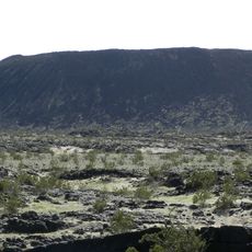
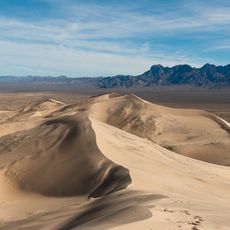
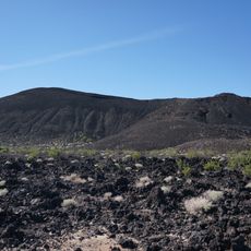
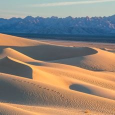
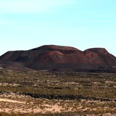
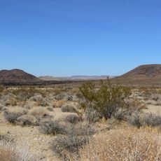
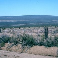
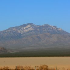
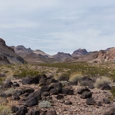
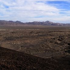
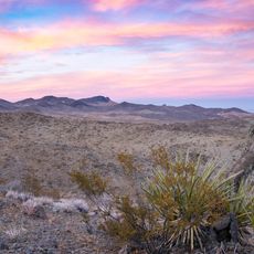
The Rasor Off-Highway Vehicle Area is a designated recreation zone in the Mojave Desert where riders can drive motorcycles, ATVs, and other off-road vehicles across varied terrain. The landscape features rolling hills, wide valleys, and sandy washes that create different riding conditions throughout the region.

History

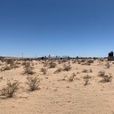
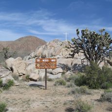
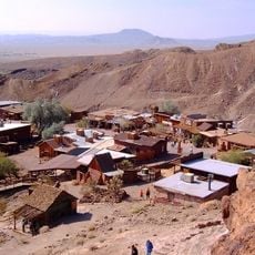
An old settlement route from the 1800s passes through the area, once used by settlers traveling across the California desert. Modern visitors can follow these same paths and connect with the region's frontier history.

Culture

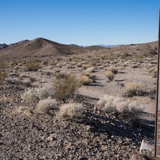
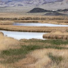
The Bureau of Land Management monitors this area to maintain balance between recreational vehicle access and protection of desert tortoises, listed as threatened species.

Practical

Access to the area is available from Interstate 15 with free entry for all visitors. Camping is permitted anywhere in the region as long as you do not block established roads and paths.

Did you know?

The area is home to threatened desert tortoises protected by land management agencies. Riders share the terrain with this vulnerable animal population and play a role in its conservation.

Location
GPS coordinates
35.10878,-116.14363
Latest update
December 14, 2025 13:03

AroundUs brings together thousands of curated places, local tips, and hidden gems, enriched daily by 60,000 contributors worldwide. Discover all places nearby (California).

Around this place
Deep Space Network
United States of America

Deep Space Network

76.5 km
Lake Dolores Waterpark
United States of America

Lake Dolores Waterpark

52.7 km
Goldstone Deep Space Communications Complex
United States of America

Goldstone Deep Space Communications Complex

76.5 km
Mojave National Preserve
United States of America

Mojave National Preserve

46.3 km
Amboy Crater
United States of America

Amboy Crater

70.7 km
Calico Early Man Site
United States of America

Calico Early Man Site

59.1 km
Kelso Dunes
United States of America

Kelso Dunes

40.7 km
Pisgah Crater
United States of America

Pisgah Crater

45.6 km
World's Tallest Thermometer
United States of America

World's Tallest Thermometer

18.7 km
Mitchell Caverns
United States of America

Mitchell Caverns

60.3 km
Mojave Trails National Monument
United States of America

Mojave Trails National Monument

53.6 km
Lavic Lake volcanic field
United States of America

Lavic Lake volcanic field

45.5 km
Liberty Sculpture Park
United States of America

Liberty Sculpture Park

67.5 km
Cima volcanic field
United States of America

Cima volcanic field

39.1 km
Mojave Memorial Cross
United States of America

Mojave Memorial Cross

58.6 km
Cima Dome & Volcanic Field National Natural Landmark
United States of America

Cima Dome & Volcanic Field National Natural Landmark

39.1 km
Goldstone Solar System Radar
United States of America

Goldstone Solar System Radar

76.5 km
Providence Mountains State Recreation Area
United States of America

Providence Mountains State Recreation Area

60.7 km
Clark Mountain
United States of America

Clark Mountain

68.5 km
Calico and Odessa Railroad
United States of America

Calico and Odessa Railroad

68 km
Clipper Mountain Wilderness
United States of America

Clipper Mountain Wilderness

78 km
Saddle Peak Hills Wilderness
United States of America

Saddle Peak Hills Wilderness

77.3 km
Bristol Mountains
United States of America

Bristol Mountains

30 km
Saratoga Springs
United States of America

Saratoga Springs

68.6 km
Rodman Mountains
United States of America

Rodman Mountains

63.8 km
Bagdad Cafe
United States of America

Bagdad Cafe

55.8 km
DSS 14
United States of America

DSS 14

76.4 km
DSS 13
United States of America

DSS 13

76.4 km
Show the full map
« Rasor Off-Highway Vehicle Area - Off-highway vehicle recreation area in Mojave Desert, California » is provided by Around Us (aroundus.com). Images and texts are derived from Wikimedia project under a Creative Commons license. You are allowed to copy, distribute, and modify copies of this page, under the conditions set by the license, as long as this note is clearly visible.

Discover hidden gems everywhere you go!

From secret cafés to breathtaking viewpoints, skip the crowded tourist spots and find places that match your style. Our app makes it easy with voice search, smart filtering, route optimization, and insider tips from travelers worldwide. Download now for the complete mobile experience.

Around Us App Screenshot

A unique approach to discovering new places

Le Figaro

All the places worth exploring

France Info

A tailor-made excursion in just a few clicks

20 Minutes

Around Us
Travel Guide & Maps
Download

Send to your phone

QR Code
1

Open the camera app on your mobile.

2

Point at the QR code with your camera. A notification will appear.

3

Tap the notification to open the link.