Enable Location

We need your location to show you interesting places around you

Discover nearby places

Find interesting locations and hidden gems around you

Precise directions

Get accurate directions and distances to places

Your location is never shared with other users. It's only used when you tap the location button.

Clipper Mountain Wilderness

Log in to your account

Start exploring — it's free

Trusted by 62,586 travelers worldwide

Continue with Google
Continue with Apple
or

We will send you a code to connect

By continuing, you accept our Terms and Conditions and our Privacy Policy

Check your inbox

We've sent a pincode in your inbox. Please enter the code below.

Clipper Mountain Wilderness

Clipper Mountain Wilderness, Desert wilderness area in San Bernardino County, California.

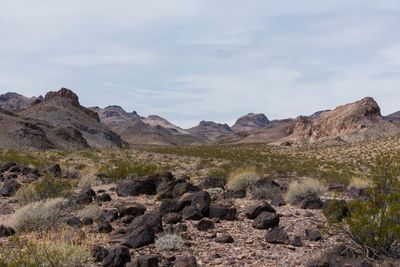
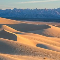
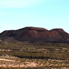
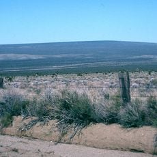
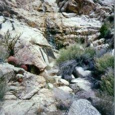
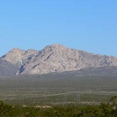
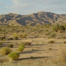
Clipper Mountain Wilderness is a protected area in the Mojave Desert marked by yellow and brown striped mesas and narrow canyons with hidden springs. The landscape spreads across alluvial fans with minimal vegetation coverage and exposed rock formations throughout.

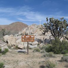
Federal protection came through the California Desert Protection Act of 1994, when this desert section was designated as a wilderness area. Its location between Interstate 40 and the former path of Route 66 connects it to the region's transportation history.

The name comes from Clipper Peak, and locals view this space as a remote desert retreat beyond everyday reach. Visitors experience the sparse desert plants and rock formations in their unaltered state.

Preparation is essential because water is scarce and summer temperatures regularly exceed 115 degrees Fahrenheit (46 degrees Celsius). Bring plenty of water, strong sun protection, and reliable gear to stay safe in this harsh environment.

A small herd of 40 to 50 desert bighorn sheep lives here in this remote landscape. These animals are perfectly adapted to the rocky terrain and canyons, making them a remarkable sight for patient observers.

The community of curious travelers

AroundUs brings together thousands of curated places, local tips, and hidden gems, enriched daily by 60,000 contributors worldwide.

Start exploring
Location
GPS coordinates
34.73800,-115.41800
Latest update
December 12, 2025 07:51
Around this place
United States of America

AN/URC-117 Ground Wave Emergency Network

17.2 km
Amboy Crater
United States of America

Amboy Crater

40.4 km
Kelso Dunes
United States of America

Kelso Dunes

37.3 km
Pisgah Crater
United States of America

Pisgah Crater

87.6 km
World's Tallest Thermometer
United States of America

World's Tallest Thermometer

83.8 km
Mitchell Caverns
United States of America

Mitchell Caverns

24.2 km
Castle Mountains National Monument
United States of America

Castle Mountains National Monument

69.5 km
Mojave Trails National Monument
United States of America

Mojave Trails National Monument

48.2 km
Lavic Lake volcanic field
United States of America

Lavic Lake volcanic field

87.5 km
Grapevine Canyon Petroglyphs
United States of America

Grapevine Canyon Petroglyphs

86.1 km
Mojave Memorial Cross
United States of America

Mojave Memorial Cross

65.3 km
Cima Dome & Volcanic Field National Natural Landmark
United States of America

Cima Dome & Volcanic Field National Natural Landmark

64.5 km
Old Woman meteorite
United States of America

Old Woman meteorite

24.7 km
Old Woman Mountains Wilderness
United States of America

Old Woman Mountains Wilderness

36.9 km
Providence Mountains State Recreation Area
United States of America

Providence Mountains State Recreation Area

24.7 km
Havasu National Wildlife Refuge
United States of America

Havasu National Wildlife Refuge

81.4 km
Spirit Mountain
United States of America

Spirit Mountain

87.1 km
Bigelow Cholla Garden Wilderness
United States of America

Bigelow Cholla Garden Wilderness

49.5 km
Old Trails Bridge
United States of America

Old Trails Bridge

85.4 km
Dead Mountains
United States of America

Dead Mountains

68.5 km
Red Rock Bridge
United States of America

Red Rock Bridge

85.1 km
Turtle Mountains
United States of America

Turtle Mountains

72.4 km
United States of America

Bridge Canyon Wilderness

85.5 km
Grapevine Canyon
United States of America

Grapevine Canyon

86.1 km
United States of America

Alexey W. Von Schmidt

75.6 km
Goffs Schoolhouse
United States of America

Goffs Schoolhouse

38.9 km
Joshua Tree Wilderness
United States of America

Joshua Tree Wilderness

80.5 km
Riverview Resort Golf Course
United States of America

Riverview Resort Golf Course

87.3 km
Show the full map
« Clipper Mountain Wilderness - Desert wilderness area in San Bernardino County, California » is provided by Around Us (aroundus.com). Images and texts are derived from Wikimedia project under a Creative Commons license. You are allowed to copy, distribute, and modify copies of this page, under the conditions set by the license, as long as this note is clearly visible.

Discover hidden gems everywhere you go!

From secret cafés to breathtaking viewpoints, skip the crowded tourist spots and find places that match your style. Our app makes it easy with voice search, smart filtering, route optimization, and insider tips from travelers worldwide. Download now for the complete mobile experience.

Around Us App Screenshot

A unique approach to discovering new places

Le Figaro

All the places worth exploring

France Info

A tailor-made excursion in just a few clicks

20 Minutes

Around Us
Travel Guide & Maps
Download

Send to your phone

QR Code
1

Open the camera app on your mobile.

2

Point at the QR code with your camera. A notification will appear.

3

Tap the notification to open the link.