Log in to your account

AroundUs is a community-driven map of interesting places, built by curious explorers like you. It grows with every review, story, and photo you share.
Connect to save your favorite spots, contribute locations, and create personalized routes.
Continue with Google
Continue with Apple
Continue with X
Continue with Facebook
Continue with email
By continuing, you accept our Terms and Conditions and our Privacy Policy
Create an account

AN/URC-117 Ground Wave Emergency Network

Add to collection
Map
Suggest a change
Share

AN/URC-117 Ground Wave Emergency Network, Military communication system in California, United States.

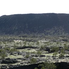
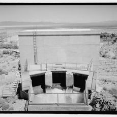
The AN/URC-117 Ground Wave Emergency Network is a military communication system with relay nodes connected by tall transmission towers designed for emergency use. Each site contains specialized radio equipment arranged on secured ground that can operate independently when needed.

The system was developed in the 1990s to ensure communication could continue under extreme circumstances. It was specifically designed as a protective measure against failures that could result from massive electromagnetic interference.

The system demonstrates American commitment to maintaining communication capabilities during national emergencies through specialized military infrastructure. It reflects decades of focus on creating reliable networks that can function when standard systems fail.

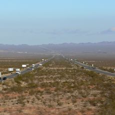
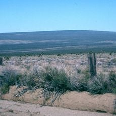
These sites are protected by high fences and security measures and are not open to public access. Visitors can observe the tall towers from a distance if near any location, but approaching the perimeter is restricted.

The transmission towers operate on extremely low frequency, a wave form that uses the earth itself as a conductor. This allows the signal to reach across vast distances and through obstacles that would normally block other signals.

Inception: 1992

GPS coordinates: 34.75165,-115.23028

Latest update: December 20, 2025 12:36

Photos
Around this place
Interstate 40
United States of America

Interstate 40

8.1 km
Amboy Crater
United States of America

Amboy Crater

56.3 km
Interstate 40 in California
United States of America

Interstate 40 in California

35.9 km
Kelso Dunes
United States of America

Kelso Dunes

52.3 km
Mitchell Caverns
United States of America

Mitchell Caverns

33.4 km
Castle Mountains National Monument
United States of America

Castle Mountains National Monument

62 km
Mojave Trails National Monument
United States of America

Mojave Trails National Monument

65.4 km
Grapevine Canyon Petroglyphs
United States of America

Grapevine Canyon Petroglyphs

72.6 km
Mojave Memorial Cross
United States of America

Mojave Memorial Cross

69.2 km
Cima Dome & Volcanic Field National Natural Landmark
United States of America

Cima Dome & Volcanic Field National Natural Landmark

73 km
Old Woman meteorite
United States of America

Old Woman meteorite

19 km
Old Woman Mountains Wilderness
United States of America

Old Woman Mountains Wilderness

32.3 km
The Needles
United States of America

The Needles

73 km
Providence Mountains State Recreation Area
United States of America

Providence Mountains State Recreation Area

33.4 km
Havasu National Wildlife Refuge
United States of America

Havasu National Wildlife Refuge

64.2 km
Bigelow Cholla Garden Wilderness
United States of America

Bigelow Cholla Garden Wilderness

32.5 km
Clipper Mountain Wilderness
United States of America

Clipper Mountain Wilderness

17.2 km
Old Trails Bridge
United States of America

Old Trails Bridge

68.3 km
Dead Mountains
United States of America

Dead Mountains

52.6 km
Red Rock Bridge
United States of America

Red Rock Bridge

68 km
United States of America

Topock Gorge

72.2 km
Turtle Mountains
United States of America

Turtle Mountains

62.4 km
United States of America

Bridge Canyon Wilderness

72.1 km
Grapevine Canyon
United States of America

Grapevine Canyon

72.6 km
United States of America

Alexey W. Von Schmidt

59.5 km
Goffs Schoolhouse
United States of America

Goffs Schoolhouse

24.7 km
Mohave Canyon
United States of America

Mohave Canyon

72.6 km
Riverview Resort Golf Course
United States of America

Riverview Resort Golf Course

71.8 km
Show the full map
Reviews

Visited this place? Tap the stars to rate it and share your experience / photos with the community! Try now! You can cancel it anytime.

« AN/URC-117 Ground Wave Emergency Network - Military communication system in California, United States » is provided by Around Us (aroundus.com). Images and texts are derived from Wikimedia project under a Creative Commons license. You are allowed to copy, distribute, and modify copies of this page, under the conditions set by the license, as long as this note is clearly visible.

Discover hidden gems everywhere you go!

From secret cafés to breathtaking viewpoints, skip the crowded tourist spots and find places that match your style. Our app makes it easy with voice search, smart filtering, route optimization, and insider tips from travelers worldwide. Download now for the complete mobile experience.

Around Us App Screenshot

A unique approach to discovering new places

Le Figaro

All the places worth exploring

France Info

A tailor-made excursion in just a few clicks

20 Minutes