Enable Location

We need your location to show you interesting places around you

Discover nearby places

Find interesting locations and hidden gems around you

Precise directions

Get accurate directions and distances to places

Your location is never shared with other users. It's only used when you tap the location button.

Log in to your account

Start exploring — it's free

Trusted by travelers worldwide

Continue with Google
Continue with Apple
or

We will send you a code to connect

By continuing, you accept our Terms and Conditions and our Privacy Policy

Check your inbox

We've sent a pincode in your inbox. Please enter the code below.

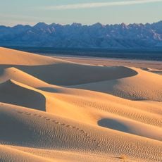
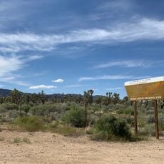
Aiken's Wash, Archaeological site in Mojave Desert, San Bernardino County, USA.

Description

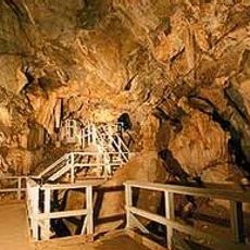
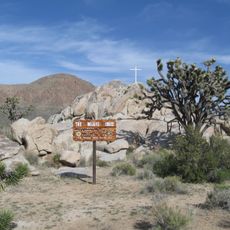
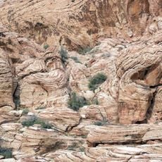
Aiken's Wash is a 1,450-acre archaeological district in the Mojave Desert containing multiple rock art locations, including Aiken's Arch and Milky Way Caves. These sites hold petroglyphs and pictographs that document thousands of years of human history in the region.

History

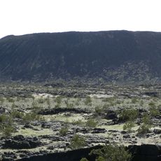
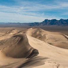
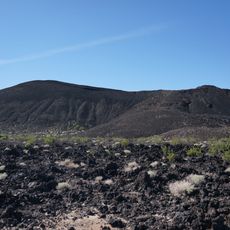
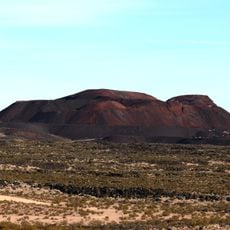
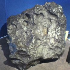
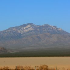
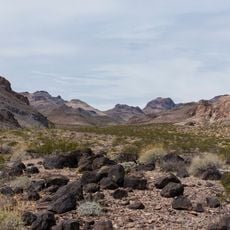
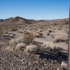
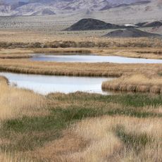
The site shows evidence of continuous human occupation spanning 10,000 to 12,000 years, making it a valuable window into prehistoric times. The landscape was also shaped by volcanic activity, with the most recent eruptions occurring roughly 800 to 1,000 years ago.

Culture

The rockshelters display red-colored pictographs with patterns of human figures, circles, grids, and occasional depictions of animals or plants left by past inhabitants. These images offer insight into the artistic traditions of people who called this place home for thousands of years.

Practical

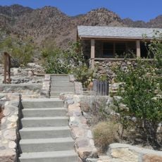
Visitors need appropriate permits and must follow archaeological guidelines to protect valuable historical resources at the site. Visiting with a knowledgeable guide is recommended to fully understand the significance of the various artworks and features found here.

Did you know?

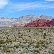
The area contains extinct cinder cones and lava flows from two separate periods of volcanic activity that shaped the landscape. These geological features form a dramatic backdrop to the rock art and show how human presence and natural forces interacted across thousands of years.

GPS coordinates
35.23944,-115.74861
Latest update
December 14, 2025 13:06

AroundUs brings together thousands of curated places, local tips, and hidden gems, enriched daily by 60,000 contributors worldwide. Discover all places nearby (San Bernardino County).

Around this place
Red Rock Canyon National Conservation Area
United States of America

Red Rock Canyon National Conservation Area

103.9 km
Lake Dolores Waterpark
United States of America

Lake Dolores Waterpark

91.4 km
United States of America

AN/URC-117 Ground Wave Emergency Network

72 km
Amboy Crater
United States of America

Amboy Crater

77.5 km
Desperado
United States of America

Desperado

53.2 km
Kelso Dunes
United States of America

Kelso Dunes

36.8 km
Pisgah Crater
United States of America

Pisgah Crater

79.3 km
World's Tallest Thermometer
United States of America

World's Tallest Thermometer

29.6 km
Mitchell Caverns
United States of America

Mitchell Caverns

39.5 km
Castle Mountains National Monument
United States of America

Castle Mountains National Monument

62.2 km
Mojave Trails National Monument
United States of America

Mojave Trails National Monument

66.9 km
Lavic Lake volcanic field
United States of America

Lavic Lake volcanic field

79.2 km
Mojave Memorial Cross
United States of America

Mojave Memorial Cross

19.9 km
Cima Dome & Volcanic Field National Natural Landmark
United States of America

Cima Dome & Volcanic Field National Natural Landmark

1.2 km
Old Woman meteorite
United States of America

Old Woman meteorite

87.4 km
Providence Mountains State Recreation Area
United States of America

Providence Mountains State Recreation Area

39.2 km
Clark Mountain
United States of America

Clark Mountain

35 km
Aztec Sandstone
United States of America

Aztec Sandstone

80.8 km
Bigelow Cholla Garden Wilderness
United States of America

Bigelow Cholla Garden Wilderness

90.3 km
Clipper Mountain Wilderness
United States of America

Clipper Mountain Wilderness

63.4 km
Goodsprings Schoolhouse
United States of America

Goodsprings Schoolhouse

71.8 km
Potosi Mining District
United States of America

Potosi Mining District

83.6 km
Saddle Peak Hills Wilderness
United States of America

Saddle Peak Hills Wilderness

81 km
Saratoga Springs
United States of America

Saratoga Springs

78.5 km
Goffs Schoolhouse
United States of America

Goffs Schoolhouse

72.5 km
Wee Thump Joshua Tree Wilderness, Nevada
United States of America

Wee Thump Joshua Tree Wilderness, Nevada

67.3 km
Seven Magic Mountains
United States of America

Seven Magic Mountains

79.6 km
Desert Winds Bowling Center
United States of America

Desert Winds Bowling Center

85.3 km
Show the full map
« Aiken's Wash - Archaeological site in Mojave Desert, San Bernardino County, USA » is provided by Around Us (aroundus.com). Images and texts are derived from Wikimedia project under a Creative Commons license. You are allowed to copy, distribute, and modify copies of this page, under the conditions set by the license, as long as this note is clearly visible.

Discover hidden gems everywhere you go!

From secret cafés to breathtaking viewpoints, skip the crowded tourist spots and find places that match your style. Our app makes it easy with voice search, smart filtering, route optimization, and insider tips from travelers worldwide. Download now for the complete mobile experience.

Around Us App Screenshot

A unique approach to discovering new places

Le Figaro

All the places worth exploring

France Info

A tailor-made excursion in just a few clicks

20 Minutes

Around Us
Travel Guide & Maps
Download

Send to your phone

QR Code
1

Open the camera app on your mobile.

2

Point at the QR code with your camera. A notification will appear.

3

Tap the notification to open the link.