Chest opened
+${chestReward.xp} XP
Explorer
NOUVEAU ×${chestReward.collectible.quantity}
tapez pour fermer
Chest locked

Open chests in the app

Around Us is built for your phone — chests unlock when you walk, explore and capture nearby places.

Enable Location

We need your location to show you interesting places around you

Discover nearby places

Find interesting locations and hidden gems around you

Precise directions

Get accurate directions and distances to places

Your location is never shared with other users. It's only used when you tap the location button.

Littlerock

Log in to your account

Start exploring — it's free

Trusted by 72,878 travelers worldwide

Continue with Google
Continue with Apple
or

We will send you a code to connect

By continuing, you accept our Terms and Conditions and our Privacy Policy

Check your inbox

We've sent a pincode in your inbox. Please enter the code below.

Discussion Reviews 1 Photos
19.8k Popularity

Littlerock, Census-designated place in Los Angeles County, California

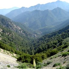
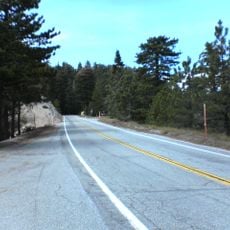
Littlerock is a census-designated place in Los Angeles County with rolling terrain and an agricultural character throughout the area. The settlement sits along Highway 138, which serves as the main route through the community.

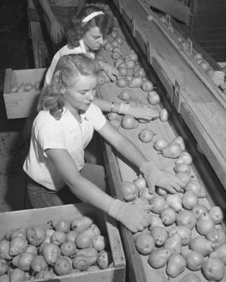
The settlement was named after the Little Rock Wash that flows through the valley and grew as Los Angeles County expanded eastward. Agriculture became the foundation of the community's early development.

The community is recognized for its fruit farming heritage, with orchards visible along Highway 138. Visitors can see how agriculture still shapes the local landscape today.

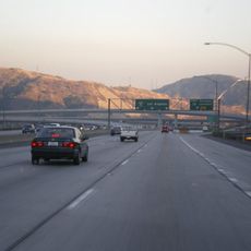
State Route 138 connects the area to neighboring communities and is the main driving route through the region. Public transportation from the Antelope Valley Transit Authority serves those without personal vehicles.

The area gained recognition as the Fruit Basket of the Antelope Valley for its extensive growing of almonds, apples, peaches, and pears. This nickname reflects how central farming was to the region's identity.

The community of curious travelers

AroundUs brings together thousands of curated places, local tips, and hidden gems, enriched daily by 60,000 contributors worldwide.

Start exploring
Elevation above the sea
881 m
Shares border with
Palmdale
GPS coordinates
34.52500,-117.99000
Latest update
December 7, 2025 10:06
Around this place
Angeles National Forest
United States of America

Angeles National Forest

25.1 km
Angeles Crest Highway
United States of America

Angeles Crest Highway

19.7 km
California State Route 14
United States of America

California State Route 14

13.2 km
Shambala Preserve
United States of America

Shambala Preserve

25.8 km
Devil's Punchbowl
United States of America

Devil's Punchbowl

18.4 km
Crystal Lake Recreation Area
United States of America

Crystal Lake Recreation Area

26.2 km
Scaled Composites Triumph
United States of America

Scaled Composites Triumph

12.5 km
San Gabriel Mountains National Monument
United States of America

San Gabriel Mountains National Monument

25.1 km
Joe Davies Heritage Airpark
United States of America

Joe Davies Heritage Airpark

12.5 km
Los Angeles Air Route Traffic Control Center
United States of America

Los Angeles Air Route Traffic Control Center

12.2 km
Antelope Valley Indian Museum State Historic Park
United States of America

Antelope Valley Indian Museum State Historic Park

19 km
Saddleback Butte State Park
United States of America

Saddleback Butte State Park

24.1 km
Dry Town Water Park
United States of America

Dry Town Water Park

7.4 km
Littlerock Dam
United States of America

Littlerock Dam

5.3 km
Mount Islip
United States of America

Mount Islip

24.3 km
Vetter Mountain
United States of America

Vetter Mountain

25.6 km
United States of America

Waterman Mountain

21.5 km
Throop Peak
United States of America

Throop Peak

26.2 km
Windy Gap Trail
United States of America

Windy Gap Trail

25.1 km
Western Hotel
United States of America

Western Hotel

23.6 km
Stony Ridge Observatory
United States of America

Stony Ridge Observatory

24.9 km
Blackbird Airpark
United States of America

Blackbird Airpark

12.3 km
Elyze Clifford Interpretive Center
United States of America

Elyze Clifford Interpretive Center

24.5 km
Moah:cedar
United States of America

Moah:cedar

23.6 km
Blackbird Airpark
United States of America

Blackbird Airpark

12.3 km
Vetter Mountain Lookout
United States of America

Vetter Mountain Lookout

25.6 km
Armstrong Aircraft Operations Facility
United States of America

Armstrong Aircraft Operations Facility

12.6 km
Lockheed A-12 Blackbird monument
United States of America

Lockheed A-12 Blackbird monument

12.3 km
Show the full map
Reviews
Share your experience

No review yet

Discussions
Start a discussion...

No discussion yet

« Littlerock - Census-designated place in Los Angeles County, California » is provided by Around Us (aroundus.com). Images and texts are derived from Wikimedia project under a Creative Commons license. You are allowed to copy, distribute, and modify copies of this page, under the conditions set by the license, as long as this note is clearly visible.

Discover hidden gems everywhere you go!

From secret cafés to breathtaking viewpoints, skip the crowded tourist spots and find places that match your style. Our app makes it easy with voice search, smart filtering, route optimization, and insider tips from travelers worldwide. Download now for the complete mobile experience.

Around Us App Screenshot

A unique approach to discovering new places

Le Figaro

All the places worth exploring

France Info

A tailor-made excursion in just a few clicks

20 Minutes

Around Us
Travel Guide & Maps
Download

Send to your phone

QR Code
1

Open the camera app on your mobile.

2

Point at the QR code with your camera. A notification will appear.

3

Tap the notification to open the link.