Enable Location

We need your location to show you interesting places around you

Discover nearby places

Find interesting locations and hidden gems around you

Precise directions

Get accurate directions and distances to places

Your location is never shared with other users. It's only used when you tap the location button.

Log in to your account

Start exploring — it's free

Trusted by 62,855 travelers worldwide

Continue with Google
Continue with Apple
or

We will send you a code to connect

By continuing, you accept our Terms and Conditions and our Privacy Policy

Check your inbox

We've sent a pincode in your inbox. Please enter the code below.

Mount Stewart

Mount Stewart, Mountain summit in Tulare County, California, USA

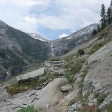
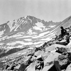
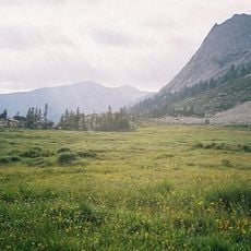
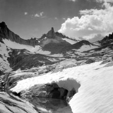
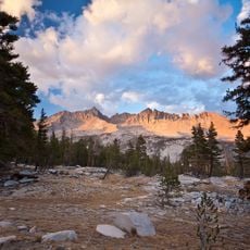
Mount Stewart is a 3708-meter summit located within Sequoia National Park's remote backcountry, with the Lilliput Glacier visible on its northern exposure. It links to the High Sierra Trail system and sits amid granite formations typical of the central Sierra Nevada range.

The first recorded ascent occurred in 1932 when mountaineer Norman Clyde established a climbing route via the southern approach. This early achievement made the peak accessible to climbers and contributed to documented mountaineering in the Sequoia region.

The summit honors George W. Stewart, a newspaper editor from Visalia who championed protection for giant sequoia forests in the region. Climbers ascending this peak connect with a broader story of early conservation efforts in the Sierra Nevada.

Climbers reach the summit by way of Kaweah Gap, following mountain trails that demand solid navigation skills and mountaineering gear. The high-altitude terrain requires experience with exposed ridges and scrambling sections that can change based on seasonal conditions.

The northern face holds technical climbing routes including the North Face and Dawn Pillar that challenge experienced climbers with exposed rock passages. These more difficult lines offer a stark contrast to the easier southern scramble, giving the summit appeal to a wide range of abilities.

The community of curious travelers

AroundUs brings together thousands of curated places, local tips, and hidden gems, enriched daily by 60,000 contributors worldwide.

Start exploring
Location
Location
Elevation above the sea
3,708 m
Part of
Sierra Peaks Section Peaks List
GPS coordinates
36.56975,-118.55464
Latest update
December 14, 2025 12:27
« Mount Stewart - Mountain summit in Tulare County, California, USA » is provided by Around Us (aroundus.com). Images and texts are derived from Wikimedia project under a Creative Commons license. You are allowed to copy, distribute, and modify copies of this page, under the conditions set by the license, as long as this note is clearly visible.

Discover hidden gems everywhere you go!

From secret cafés to breathtaking viewpoints, skip the crowded tourist spots and find places that match your style. Our app makes it easy with voice search, smart filtering, route optimization, and insider tips from travelers worldwide. Download now for the complete mobile experience.

Around Us App Screenshot

A unique approach to discovering new places

Le Figaro

All the places worth exploring

France Info

A tailor-made excursion in just a few clicks

20 Minutes

Around Us
Travel Guide & Maps
Download

Send to your phone

QR Code
1

Open the camera app on your mobile.

2

Point at the QR code with your camera. A notification will appear.

3

Tap the notification to open the link.