Chest opened
+${chestReward.xp} XP
Explorer
NOUVEAU ×${chestReward.collectible.quantity}
tapez pour fermer
Chest locked

Open chests in the app

Around Us is built for your phone — chests unlock when you walk, explore and capture nearby places.

Enable Location

We need your location to show you interesting places around you

Discover nearby places

Find interesting locations and hidden gems around you

Precise directions

Get accurate directions and distances to places

Your location is never shared with other users. It's only used when you tap the location button.

Log in to your account

Start exploring — it's free

Trusted by 72,888 travelers worldwide

Continue with Google
Continue with Apple
or

We will send you a code to connect

By continuing, you accept our Terms and Conditions and our Privacy Policy

Check your inbox

We've sent a pincode in your inbox. Please enter the code below.

Discussion Reviews Photo
15.7k Popularity

Project 57, U.S. nuclear test

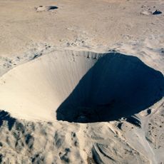
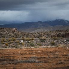
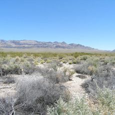
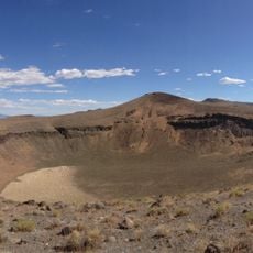
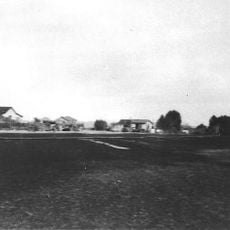
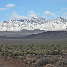
Project 57 was a safety test conducted in 1957 at the Nellis Air Force Range in Nevada. The test took place in Area 13, a remote and flat region next to the Nevada National Security Site, where explosives were detonated inside a nuclear warhead device to check if accidental triggering could be prevented and how much plutonium might be released.

Project 57 took place on April 24, 1957, and was part of early U.S. efforts to improve nuclear weapon safety. The test provided scientists with critical information about how plutonium might be released during accidents and how weapons could be better protected from accidental detonation.

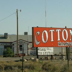
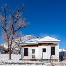
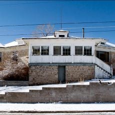
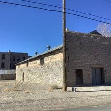
The site is highly remote today and remains under government monitoring, making public access generally impossible. Those interested in learning about the testing history can research from a distance, as the territory stays closed for security reasons.

This test was unusual compared to other atomic experiments because it intentionally produced no nuclear explosion. Instead, scientists only detonated conventional explosives to examine the weapon system's reaction and gather safety data about how plutonium would behave if accidentally triggered.

The community of curious travelers

AroundUs brings together thousands of curated places, local tips, and hidden gems, enriched daily by 60,000 contributors worldwide.

Start exploring
GPS coordinates
37.46100,-116.21700
Latest update
February 19, 2026 23:40
Around this place
Sedan Crater
United States of America

Sedan Crater

35.1 km
Scotty's Castle
United States of America

Scotty's Castle

110.5 km
Yucca Mountain
United States of America

Yucca Mountain

61.5 km
Goldfield Hotel
United States of America

Goldfield Hotel

94 km
Mizpah Hotel
United States of America

Mizpah Hotel

111.9 km
Tikaboo Peak
United States of America

Tikaboo Peak

77 km
Shady Lady Ranch
United States of America

Shady Lady Ranch

73.5 km
Goldwell Open Air Museum
United States of America

Goldwell Open Air Museum

83.9 km
Cottontail Ranch
United States of America

Cottontail Ranch

85.6 km
Basin and Range National Monument
United States of America

Basin and Range National Monument

92.1 km
Angel's Ladies
United States of America

Angel's Ladies

73.9 km
Desert National Wildlife Range
United States of America

Desert National Wildlife Range

104 km
Fallon Range Training Complex
United States of America

Fallon Range Training Complex

7.5 km
Lunar Crater National Natural Landmark
United States of America

Lunar Crater National Natural Landmark

103.6 km
Pahranagat National Wildlife Refuge
United States of America

Pahranagat National Wildlife Refuge

103.4 km
Quinn Canyon Wilderness
United States of America

Quinn Canyon Wilderness

89.9 km
Esmeralda County Courthouse
United States of America

Esmeralda County Courthouse

93.9 km
Goldfield Historic District
United States of America

Goldfield Historic District

93.9 km
Nye County Courthouse
United States of America

Nye County Courthouse

111.5 km
Tonopah Historic Mining Park
United States of America

Tonopah Historic Mining Park

111.9 km
St. Mark's Episcopal Church
United States of America

St. Mark's Episcopal Church

111.8 km
T&T Ranch
United States of America

T&T Ranch

107 km
E.R. Shields House
United States of America

E.R. Shields House

111.6 km
Judge W.A. Sawle House
United States of America

Judge W.A. Sawle House

111.9 km
Uri B. Curtis House
United States of America

Uri B. Curtis House

111.9 km
Grapevine Peak
United States of America

Grapevine Peak

99.4 km
Beatty Museum & Historical Society
United States of America

Beatty Museum & Historical Society

78.4 km
Goldfield Visitor’s Center
United States of America

Goldfield Visitor’s Center

94.2 km
Show the full map
Reviews
Share your experience

No review yet

Discussions
Start a discussion...

No discussion yet

« Project 57 - U.S. nuclear test » is provided by Around Us (aroundus.com). Images and texts are derived from Wikimedia project under a Creative Commons license. You are allowed to copy, distribute, and modify copies of this page, under the conditions set by the license, as long as this note is clearly visible.

Discover hidden gems everywhere you go!

From secret cafés to breathtaking viewpoints, skip the crowded tourist spots and find places that match your style. Our app makes it easy with voice search, smart filtering, route optimization, and insider tips from travelers worldwide. Download now for the complete mobile experience.

Around Us App Screenshot

A unique approach to discovering new places

Le Figaro

All the places worth exploring

France Info

A tailor-made excursion in just a few clicks

20 Minutes

Around Us
Travel Guide & Maps
Download

Send to your phone

QR Code
1

Open the camera app on your mobile.

2

Point at the QR code with your camera. A notification will appear.

3

Tap the notification to open the link.