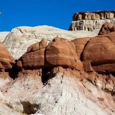
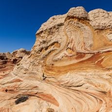
The Wave, Natural sandstone formation in Coyote Buttes, Arizona, United States
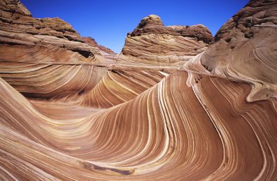
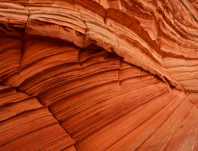
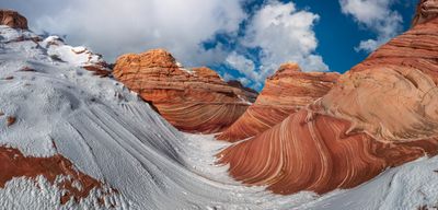
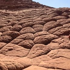
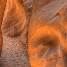
The formation consists of reddish-tinted sandstone troughs extending across approximately 62 feet wide and 118 feet long surfaces that create wave-like surfaces with gentle curves. Alternating layers of lighter and darker rock produce banded patterns resembling frozen water waves. The smooth contours resulted from millennia of erosion that carved away harder and softer sandstone layers differently, forming deep depressions and curved ridges throughout the exposed rock.
The rock formed approximately 190 million years ago during the Jurassic period when wind deposits from migrating desert dunes accumulated layers of sand. Ancient drainage systems carried groundwater through the layers, dissolving minerals and creating the characteristic patterns. Modern scientific recognition occurred during the 1990s, and access became restricted in 2003 to protect the formation from damage caused by increasing visitor numbers.
Geologists and photographers from various countries study and document the formation because of its extraordinary erosion patterns that provide insights into prehistoric environmental conditions. The site serves as a research laboratory for sedimentology and has expanded our understanding of wind deposition in ancient desert environments. Conservationists use it as an example of the need for strict visitor management to protect geological resources from human impact.
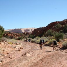
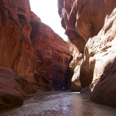
Visitors must secure one of 64 daily permits through an online lottery system or an in-person drawing at Kanab visitor center, with applications accumulating months in advance. The hike of approximately 6 miles roundtrip requires navigation without marked trails through desert terrain with limited shade. Essential equipment includes multiple liters of water, navigation tools, and appropriate footwear for uneven sandstone surfaces that can be slippery.
After rainfall events, water collects in the sandstone depressions to form temporary pools that provide habitat for fairy shrimp, whose eggs can survive for years in the dry sand. These tiny organisms complete their entire life cycle within a few weeks, reproducing before the water evaporates. The pools also reflect the banded rock formations, creating photographic opportunities that differ fundamentally from the typical desert landscape surrounding the site.
The community of curious travelers
AroundUs brings together thousands of curated places, local tips, and hidden gems, enriched daily by 60,000 contributors worldwide.