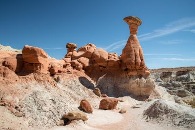
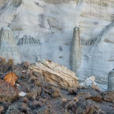
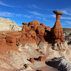
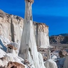
Toadstool Hoodoos, Mushroom rock formations in Kane County, Utah.
Description
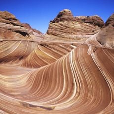
The Toadstool Hoodoos are sandstone formations shaped like mushrooms, with a wider base that narrows toward the top. Each pedestal consists of harder Dakota Sandstone that sits atop softer Entrada Sandstone layers, creating the distinctive two-part structure.
History
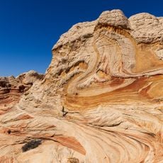
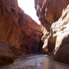
These stone formations developed over millions of years as softer layers beneath the harder rocks were slowly worn away. The erosion process that created them continues to reshape the landscape today.
Culture
These rock formations capture the imagination of visitors who encounter unusual shapes in the desert landscape. The structures have earned their name because their appearance resembles giant toadstools rising from the sandy ground.
Practical
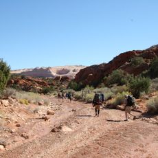
Access comes from a short hiking trail that starts directly from Highway 89 and is free to use. The route is relatively level and takes little time, making it manageable for most visitors.
Did you know?
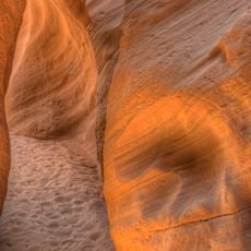
Each of these stone pillars displays its own color tones, ranging from deep orange to pale brown, because minerals are distributed differently throughout the rock. Visiting in early morning light makes these color variations glow with particular intensity.
AroundUs brings together thousands of curated places, local tips, and hidden gems, enriched daily by 60,000 contributors worldwide. Discover all places nearby (Kane County).
Utah preserves thousands of years of human history alongside some of North America's most varied geological landscapes. The region contains extensive rock art panels and Ancestral Pueblo ruins, including the 13th-century stone structures at Bears Ears National Monument and the 650-plus petroglyphs...
Lake Powell
39.3 km
Horseshoe Bend
40.7 km
Glen Canyon Dam
39.3 km
The Wave
17.3 km
Marble Canyon
36.9 km
Navajo Bridges
38.7 km
Buckskin Gulch
11.9 kmParia Canyon-Vermilion Cliffs Wilderness
23.9 km
Kodachrome Basin State Park
46.7 km
Glen Canyon Dam Bridge
39.5 km
Wire Pass Trailhead
16.9 km
Wahweap Formation
46.2 km
Grosvenor Arch
39 km
Lee's Ferry and Lonely Dell Ranch
36.6 km
Wrather Arch
18.1 km
Gunsight Butte
47.7 km
Charles H. Spencer Hulk
37.4 km
Navajo Bridge
38.7 km
Cottonwood Canyon
26.2 km
Navajo Bridge
38.7 km
Rimview Trail
41.7 km
White Pocket
17.2 km
Edmaier's Secret
13 km
Paria Rimrocks Toadstool Hoodoos
15 m
Wire Pass
15.9 km
Paria Canyon
36.6 km
Navajo Canyon
45.4 km
Wahweap Hoodoos trail
15.6 kmDiscover hidden gems everywhere you go!
From secret cafés to breathtaking viewpoints, skip the crowded tourist spots and find places that match your style. Our app makes it easy with voice search, smart filtering, route optimization, and insider tips from travelers worldwide. Download now for the complete mobile experience.
A unique approach to discovering new places❞
— Le Figaro
All the places worth exploring❞
— France Info
A tailor-made excursion in just a few clicks❞
— 20 Minutes