Enable Location

We need your location to show you interesting places around you

Discover nearby places

Find interesting locations and hidden gems around you

Precise directions

Get accurate directions and distances to places

Your location is never shared with other users. It's only used when you tap the location button.

Log in to your account

Start exploring — it's free

Trusted by 65,823 travelers worldwide

Continue with Google
Continue with Apple
or

We will send you a code to connect

By continuing, you accept our Terms and Conditions and our Privacy Policy

Check your inbox

We've sent a pincode in your inbox. Please enter the code below.

Discussion Reviews Photo
3.9k Popularity

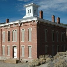
Gatecliff Rockshelter, Archaeological site in Monitor Valley, Nevada, US.

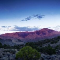
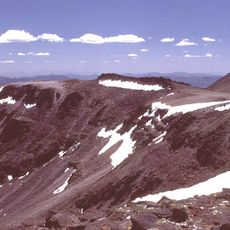
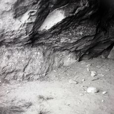
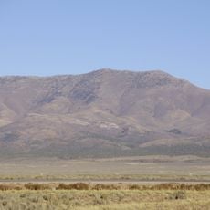
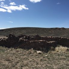
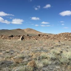
Gatecliff Rockshelter is an archaeological site listed on the National Register of Historic Places, located in the Toquima Range within Monitor Valley, Nevada. The shelter sits high up in Mill Canyon and contains dozens of stacked geological layers that record human activity over a very long period.

The site was found in 1970 and was excavated over the following years, uncovering evidence of occupation going back to around 5500 BCE. The digs showed that the shelter was used during several separate periods of prehistory, not as a permanent home but as a recurring stopping place.

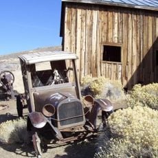
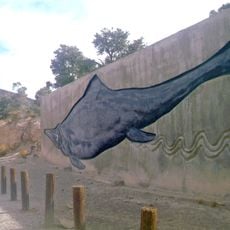
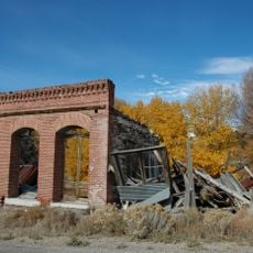
The walls of the rockshelter carry painted figures and geometric shapes that visitors can see today. These images, alongside stone tools and animal bones found at the site, show how the place was used repeatedly over a very long span of time.

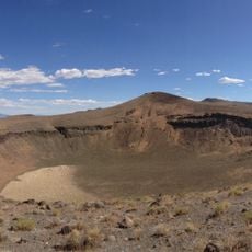
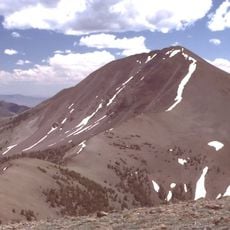
The site sits at high elevation in a mountain setting and the terrain is rough, so good physical condition is needed to reach it. Because it is an active research area, it is worth checking whether access is open before making the trip.

Gatecliff Rockshelter holds one of the deepest stratigraphic records found anywhere in the Americas, with layers reaching several meters down into the ground. This depth makes it one of the most informative sites for understanding how people lived in the Great Basin before written history.

The community of curious travelers

AroundUs brings together thousands of curated places, local tips, and hidden gems, enriched daily by 60,000 contributors worldwide.

Start exploring
Location
GPS coordinates
39.00694,-116.77861
Latest update
March 3, 2026 14:04
Around this place
Berlin Historic District
United States of America

Berlin Historic District

73.1 km
Mizpah Hotel
United States of America

Mizpah Hotel

111.7 km
Berlin–Ichthyosaur State Park
United States of America

Berlin–Ichthyosaur State Park

72.1 km
Stokes Castle
United States of America

Stokes Castle

60.1 km
Belmont
United States of America

Belmont

46.8 km
Lunar Crater National Natural Landmark
United States of America

Lunar Crater National Natural Landmark

92.8 km
Arc Dome
United States of America

Arc Dome

53.4 km
Arc Dome Wilderness
United States of America

Arc Dome Wilderness

52.3 km
Belmont Courthouse State Historic Park
United States of America

Belmont Courthouse State Historic Park

46.5 km
Alta Toquima Wilderness
United States of America

Alta Toquima Wilderness

27.4 km
McGinness Hills Geothermal Complex
United States of America

McGinness Hills Geothermal Complex

65.8 km
Toquima Cave
United States of America

Toquima Cave

20 km
Diamond Peak
United States of America

Diamond Peak

104.8 km
Cold Springs Pony Express Station Ruins
United States of America

Cold Springs Pony Express Station Ruins

102.2 km
George A. Bartlett House
United States of America

George A. Bartlett House

111.9 km
Nye County Courthouse
United States of America

Nye County Courthouse

111.8 km
Cold Springs Station Site
United States of America

Cold Springs Station Site

102.1 km
State Bank and Trust Company Building
United States of America

State Bank and Trust Company Building

111.7 km
Austin Masonic and Odd Fellows Hall
United States of America

Austin Masonic and Odd Fellows Hall

59.6 km
Eureka Historic District
United States of America

Eureka Historic District

90 km
Lander County Courthouse
United States of America

Lander County Courthouse

59.5 km
Lander County High School
United States of America

Lander County High School

60 km
Austin City Hall
United States of America

Austin City Hall

59.6 km
Tonopah Historic Mining Park
United States of America

Tonopah Historic Mining Park

111.5 km
Austin Historic District
United States of America

Austin Historic District

59.8 km
E.R. Shields House
United States of America

E.R. Shields House

111.9 km
John Gregovich House
United States of America

John Gregovich House

111.8 km
Judge W.A. Sawle House
United States of America

Judge W.A. Sawle House

111.8 km
Show the full map
Reviews
Share your experience

No review yet

Discussions
Start a discussion...

No discussion yet

« Gatecliff Rockshelter - Archaeological site in Monitor Valley, Nevada, US » is provided by Around Us (aroundus.com). Images and texts are derived from Wikimedia project under a Creative Commons license. You are allowed to copy, distribute, and modify copies of this page, under the conditions set by the license, as long as this note is clearly visible.

Discover hidden gems everywhere you go!

From secret cafés to breathtaking viewpoints, skip the crowded tourist spots and find places that match your style. Our app makes it easy with voice search, smart filtering, route optimization, and insider tips from travelers worldwide. Download now for the complete mobile experience.

Around Us App Screenshot

A unique approach to discovering new places

Le Figaro

All the places worth exploring

France Info

A tailor-made excursion in just a few clicks

20 Minutes

Around Us
Travel Guide & Maps
Download

Send to your phone

QR Code
1

Open the camera app on your mobile.

2

Point at the QR code with your camera. A notification will appear.

3

Tap the notification to open the link.