·

Enable Location

We need your location to show you interesting places around you

Discover nearby places

Find interesting locations and hidden gems around you

Precise directions

Get accurate directions and distances to places

Your location is never shared with other users. It's only used when you tap the location button.

Pike National Forest

Log in to your account

Start exploring — it's free

Trusted by 62,655 travelers worldwide

Continue with Google
Continue with Apple
or

We will send you a code to connect

By continuing, you accept our Terms and Conditions and our Privacy Policy

Check your inbox

We've sent a pincode in your inbox. Please enter the code below.

Pike National Forest

Pike National Forest, National forest in central Colorado, United States

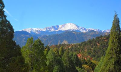
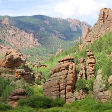
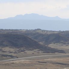
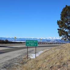
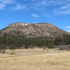
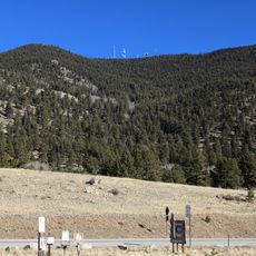
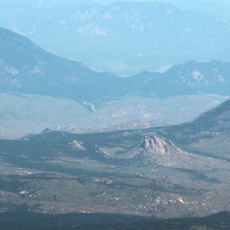
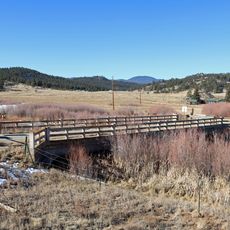
Pike National Forest is a large woodland in central Colorado spanning elevations from 6,000 to 14,000 feet, where dense pine stands give way to open alpine meadows. The terrain shifts across different zones, with varying forest types and cleared areas that change with elevation.

The forest was protected in 1908 and named after explorer Zebulon Pike, who surveyed western American territories in the early 1800s. Its establishment reflected a national effort to preserve forest lands for future generations.

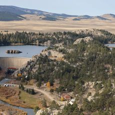
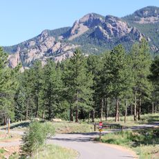
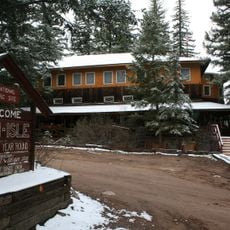
The forest serves as a gathering place where visitors connect with mountain life and outdoor traditions that have shaped the region. People come here to hunt, fish, camp, and hike, reflecting how deeply these activities are woven into local identity.

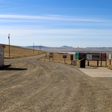
Visitors can explore over 225 miles of trails and choose from more than 250 campsites spread across different areas of the forest. It helps to check ahead which routes and facilities are open by season, as elevation and weather significantly affect accessibility.

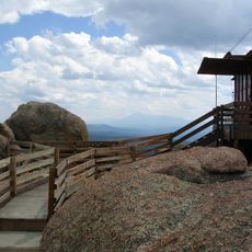
Devil's Head Lookout is a place where visitors can climb to an active fire tower, ascending around 140 steps to reach it. This tower stands as one of the last working fire lookout stations in the country, offering a rare look at how forest fires are still monitored by hand.

The community of curious travelers

AroundUs brings together thousands of curated places, local tips, and hidden gems, enriched daily by 60,000 contributors worldwide.

Start exploring
Location
Inception
July 1, 1908
GPS coordinates
39.18330,-105.31700
Latest update
December 7, 2025 19:23
Around this place
Eleven Mile State Park
United States of America

Eleven Mile State Park

31.8 km
Roxborough State Park
United States of America

Roxborough State Park

34.8 km
Mueller State Park
United States of America

Mueller State Park

35.8 km
Lost Creek Wilderness
United States of America

Lost Creek Wilderness

16.1 km
Staunton State Park
United States of America

Staunton State Park

37.8 km
Devil's Head Lookout
United States of America

Devil's Head Lookout

20.5 km
Rampart Reservoir
United States of America

Rampart Reservoir

37.5 km
Devils Head
United States of America

Devils Head

20.5 km
Rocky Mountain Dinosaur Resource Center
United States of America

Rocky Mountain Dinosaur Resource Center

31.2 km
Ute Pass
United States of America

Ute Pass

30.2 km
Spinney Mountain State Park
United States of America

Spinney Mountain State Park

33.8 km
Colorado Renaissance Festival
United States of America

Colorado Renaissance Festival

36.2 km
Platte Canyon
United States of America

Platte Canyon

38.2 km
Wilkerson Pass
United States of America

Wilkerson Pass

24.2 km
Buffalo Peak
United States of America

Buffalo Peak

11.2 km
Dawson Butte
United States of America

Dawson Butte

35.2 km
Glenisle
United States of America

Glenisle

29.7 km
Badger Mountain
United States of America

Badger Mountain

22.6 km
Green Mountain
United States of America

Green Mountain

13.7 km
Hornbek House
United States of America

Hornbek House

28.8 km
Church of St. Philip-in-the-Field and Bear Canon Cemetery
United States of America

Church of St. Philip-in-the-Field and Bear Canon Cemetery

37.1 km
Colorado Consistory No. 1
United States of America

Colorado Consistory No. 1

16.5 km
Reginald Sinclaire House
United States of America

Reginald Sinclaire House

34.1 km
South Platte River Bridge
United States of America

South Platte River Bridge

22.3 km
John Kinner House
United States of America

John Kinner House

32.5 km
Tarryall School
United States of America

Tarryall School

15.2 km
Colorado Wolf and Wildlife Center
United States of America

Colorado Wolf and Wildlife Center

29.4 km
Florissant Fossil Beds Visitors Center
United States of America

Florissant Fossil Beds Visitors Center

30.1 km
Show the full map
« Pike National Forest - National forest in central Colorado, United States » is provided by Around Us (aroundus.com). Images and texts are derived from Wikimedia project under a Creative Commons license. You are allowed to copy, distribute, and modify copies of this page, under the conditions set by the license, as long as this note is clearly visible.

Discover hidden gems everywhere you go!

From secret cafés to breathtaking viewpoints, skip the crowded tourist spots and find places that match your style. Our app makes it easy with voice search, smart filtering, route optimization, and insider tips from travelers worldwide. Download now for the complete mobile experience.

Around Us App Screenshot

A unique approach to discovering new places

Le Figaro

All the places worth exploring

France Info

A tailor-made excursion in just a few clicks

20 Minutes

Around Us
Travel Guide & Maps
Download

Send to your phone

QR Code
1

Open the camera app on your mobile.

2

Point at the QR code with your camera. A notification will appear.

3

Tap the notification to open the link.