Enable Location

We need your location to show you interesting places around you

Discover nearby places

Find interesting locations and hidden gems around you

Precise directions

Get accurate directions and distances to places

Your location is never shared with other users. It's only used when you tap the location button.

Golden

Log in to your account

Start exploring — it's free

Trusted by 61,552 travelers worldwide

Continue with Google
Continue with Apple
or

We will send you a code to connect

By continuing, you accept our Terms and Conditions and our Privacy Policy

Check your inbox

We've sent a pincode in your inbox. Please enter the code below.

Golden, County seat in Jefferson County, Colorado, United States

Description

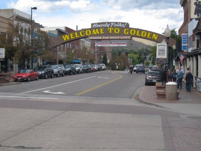
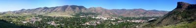
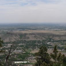
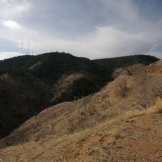
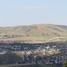
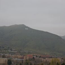
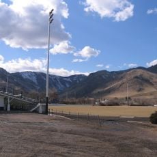
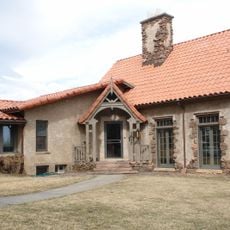
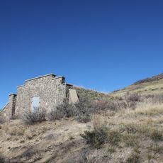
Golden is the county seat of Jefferson County in Colorado and sits at the base of the Front Range of the Rocky Mountains along Clear Creek at an elevation of 1729 meters. The main street runs parallel to the creek and is lined with low brick and wood buildings, while steep rock faces rise immediately behind the western neighborhoods.

History

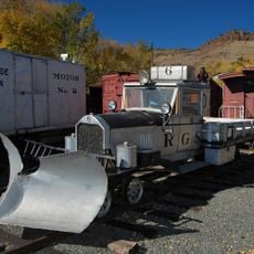
The settlement began in 1859 as a mining camp during the Pikes Peak Gold Rush and drew prospectors and traders into the valley. Between 1862 and 1867 it served as the capital of the Colorado Territory before that role moved to Denver.

Culture

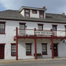
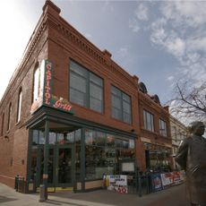
The Coors Brewery at the edge of town has brewed beer for over a century and offers guided tours through its production halls. In the center, preserved brick buildings recall the gold rush origins while students and mountain climbers shape the town's character today.

Practical

The W line of the RTD light rail connects the town to the Denver metropolitan area and stops several times daily at the station downtown. Most shops and restaurants sit along Washington Avenue, which can be crossed on foot in a few minutes.

Did you know?

The National Renewable Energy Laboratory west of town researches technologies for sustainable energy production and develops solutions for photovoltaics, wind power, and storage systems. Visitors can gain insights into ongoing research projects and test facilities during scheduled tours.

Location
Inception
1859
Elevation above the sea
1,729 m
GPS coordinates
39.74694,-105.21083
Latest update
December 14, 2025 22:13

AroundUs brings together thousands of curated places, local tips, and hidden gems, enriched daily by 60,000 contributors worldwide. Discover all places nearby (Jefferson County).

Around this place
Lookout Mountain
United States of America

Lookout Mountain

3 km
Mother Cabrini Shrine
United States of America

Mother Cabrini Shrine

4.9 km
Heritage Square
United States of America

Heritage Square

3.7 km
Colorado Railroad Museum
United States of America

Colorado Railroad Museum

3.2 km
Golden High School
United States of America

Golden High School

1.6 km
South Table Mountain
United States of America

South Table Mountain

946 m
Lookout Mountain Park
United States of America

Lookout Mountain Park

3 km
Green Mountain
United States of America

Green Mountain

5.8 km
Camp George West Historic District
United States of America

Camp George West Historic District

3.5 km
Mount Zion
United States of America

Mount Zion

2.7 km
Campbell Field
United States of America

Campbell Field

1.6 km
Astor House
United States of America

Astor House

1.3 km
Colorado National Guard Armory
United States of America

Colorado National Guard Armory

1.2 km
United States of America

Rocky Mountain Quilt Museum

3.2 km
Herman Coors House
United States of America

Herman Coors House

531 m
Rio Grande Southern Railroad, Motor No. 2
United States of America

Rio Grande Southern Railroad, Motor No. 2

3.1 km
Colorado Amphitheater
United States of America

Colorado Amphitheater

3 km
Colorado School of Mines Geology Museum
United States of America

Colorado School of Mines Geology Museum

1.3 km
Rio Grande Southern Railroad, Motor No. 6
United States of America

Rio Grande Southern Railroad, Motor No. 6

3.1 km
Buffalo Bill Museum And Grave
United States of America

Buffalo Bill Museum And Grave

2.8 km
Ammunition Igloo
United States of America

Ammunition Igloo

3.3 km
Loveland Block and Coors Building
United States of America

Loveland Block and Coors Building

1.3 km
First Presbyterian Church of Golden and Unger House
United States of America

First Presbyterian Church of Golden and Unger House

909 m
Barnes–Peery House
United States of America

Barnes–Peery House

1.5 km
The Splash at Fossil Trace
United States of America

The Splash at Fossil Trace

1.3 km
United States of America

Bradford Washburn American Mountaineering Museum

1.7 km
United States of America

Golden History Park

1.5 km
United States of America

Foothills Art Center

1 km
Show the full map
« Golden - County seat in Jefferson County, Colorado, United States » is provided by Around Us (aroundus.com). Images and texts are derived from Wikimedia project under a Creative Commons license. You are allowed to copy, distribute, and modify copies of this page, under the conditions set by the license, as long as this note is clearly visible.

Discover hidden gems everywhere you go!

From secret cafés to breathtaking viewpoints, skip the crowded tourist spots and find places that match your style. Our app makes it easy with voice search, smart filtering, route optimization, and insider tips from travelers worldwide. Download now for the complete mobile experience.

Around Us App Screenshot

A unique approach to discovering new places

Le Figaro

All the places worth exploring

France Info

A tailor-made excursion in just a few clicks

20 Minutes

Around Us
Travel Guide & Maps
Download

Send to your phone

QR Code
1

Open the camera app on your mobile.

2

Point at the QR code with your camera. A notification will appear.

3

Tap the notification to open the link.