Enable Location

We need your location to show you interesting places around you

Discover nearby places

Find interesting locations and hidden gems around you

Precise directions

Get accurate directions and distances to places

Your location is never shared with other users. It's only used when you tap the location button.

South Table Mountain

Log in to your account

Start exploring — it's free

Trusted by 65,243 travelers worldwide

Continue with Google
Continue with Apple
or

We will send you a code to connect

By continuing, you accept our Terms and Conditions and our Privacy Policy

Check your inbox

We've sent a pincode in your inbox. Please enter the code below.

South Table Mountain
Discussion Reviews 1 Photos
7.3k Popularity

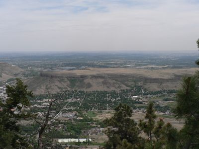
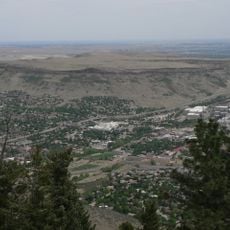
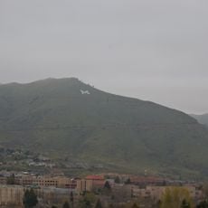
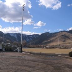
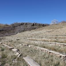
South Table Mountain, Mesa summit in Golden, Colorado.

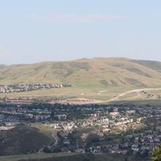
South Table Mountain is a mesa in Golden, Colorado, with a flat summit formed by ancient lava flows that hardened over softer rock below. The sides of the mesa expose layers of reddish and grey rock, making its volcanic origin visible from the surrounding plains.

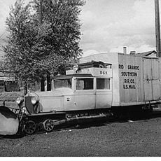
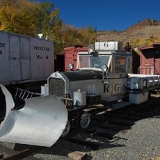
The area around the mountain was already used by Native American groups long before European settlers arrived in the mid-1800s during the Colorado Gold Rush. As Golden grew into a town, the mesa gradually became a local landmark and a place people walked for leisure.

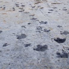
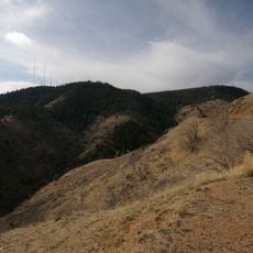
The name "Table Mountain" refers directly to the flat top of the summit, which looks like a tabletop from a distance. On the plateau, visitors can still find areas where archaeological traces of earlier occupation have been recorded, including stone tools left by Native American groups.

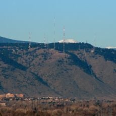
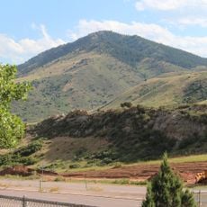
The mesa can be reached from a few trailheads around Golden, and the paths lead up to the open plateau at the top. The summit has no shade or shelter, so bringing water and sun protection is a good idea, especially in summer.

The volcanic rock on South Table Mountain contains zeolite minerals, which formed as crystals inside small cavities within the cooling lava. Some of these mineral samples are on display in local museums in Golden, giving visitors a closer look at what lies beneath the surface of the mesa.

The community of curious travelers

AroundUs brings together thousands of curated places, local tips, and hidden gems, enriched daily by 60,000 contributors worldwide.

Start exploring
Location
GPS coordinates
39.75545,-105.21063
Latest update
March 3, 2026 10:12
Around this place
Sculptured House
United States of America

Sculptured House

8.3 km
Dinosaur Ridge
United States of America

Dinosaur Ridge

9 km
Lookout Mountain
United States of America

Lookout Mountain

3.7 km
Heritage Square
United States of America

Heritage Square

4.7 km
Colorado Railroad Museum
United States of America

Colorado Railroad Museum

2.4 km
North Table Mountain
United States of America

North Table Mountain

4.1 km
Genesee Park
United States of America

Genesee Park

9.8 km
Lookout Mountain Park
United States of America

Lookout Mountain Park

3.6 km
Green Mountain
United States of America

Green Mountain

6.7 km
Camp George West Historic District
United States of America

Camp George West Historic District

3.9 km
Mount Zion
United States of America

Mount Zion

3 km
Mount Morrison
United States of America

Mount Morrison

9.6 km
Campbell Field
United States of America

Campbell Field

1.5 km
Crown Hill Park
United States of America

Crown Hill Park

9.7 km
Pioneer Sod House
United States of America

Pioneer Sod House

7.9 km
Jefferson County Public Library
United States of America

Jefferson County Public Library

8.3 km
Herman Coors House
United States of America

Herman Coors House

816 m
Rio Grande Southern Railroad, Motor No. 2
United States of America

Rio Grande Southern Railroad, Motor No. 2

2.3 km
Colorado Amphitheater
United States of America

Colorado Amphitheater

3.3 km
Colorado School of Mines Geology Museum
United States of America

Colorado School of Mines Geology Museum

1.3 km
Rio Grande Southern Railroad, Motor No. 6
United States of America

Rio Grande Southern Railroad, Motor No. 6

2.3 km
United States of America

Jefferson County Government Center

3.1 km
Buffalo Bill Museum And Grave
United States of America

Buffalo Bill Museum And Grave

3.4 km
Ammunition Igloo
United States of America

Ammunition Igloo

3.5 km
Rooney Ranch
United States of America

Rooney Ranch

7.6 km
Rockland Community Church and Cemetery
United States of America

Rockland Community Church and Cemetery

7.3 km
First Presbyterian Church of Golden and Unger House
United States of America

First Presbyterian Church of Golden and Unger House

758 m
Barnes–Peery House
United States of America

Barnes–Peery House

943 m
Show the full map
Reviews
Share your experience

No review yet

Discussions
Start a discussion...

No discussion yet

« South Table Mountain - Mesa summit in Golden, Colorado » is provided by Around Us (aroundus.com). Images and texts are derived from Wikimedia project under a Creative Commons license. You are allowed to copy, distribute, and modify copies of this page, under the conditions set by the license, as long as this note is clearly visible.

Discover hidden gems everywhere you go!

From secret cafés to breathtaking viewpoints, skip the crowded tourist spots and find places that match your style. Our app makes it easy with voice search, smart filtering, route optimization, and insider tips from travelers worldwide. Download now for the complete mobile experience.

Around Us App Screenshot

A unique approach to discovering new places

Le Figaro

All the places worth exploring

France Info

A tailor-made excursion in just a few clicks

20 Minutes

Around Us
Travel Guide & Maps
Download

Send to your phone

QR Code
1

Open the camera app on your mobile.

2

Point at the QR code with your camera. A notification will appear.

3

Tap the notification to open the link.