Enable Location

We need your location to show you interesting places around you

Discover nearby places

Find interesting locations and hidden gems around you

Precise directions

Get accurate directions and distances to places

Your location is never shared with other users. It's only used when you tap the location button.

Log in to your account

Start exploring — it's free

Trusted by 63,011 travelers worldwide

Continue with Google
Continue with Apple
or

We will send you a code to connect

By continuing, you accept our Terms and Conditions and our Privacy Policy

Check your inbox

We've sent a pincode in your inbox. Please enter the code below.

Bear Gulch Limestone
Discussion Reviews Photo
3.5k Popularity

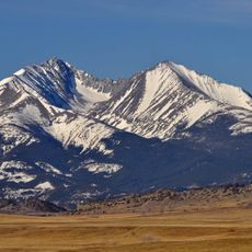
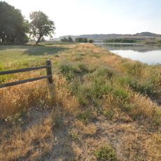
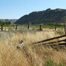
Bear Gulch Limestone, Paleontological site in central Montana, United States

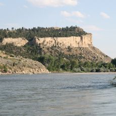
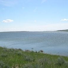
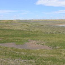
Bear Gulch Limestone comprises multiple limestone outcrops northeast of the Big Snowy Mountains, holding extensive marine fossil deposits from an ancient ocean. The layers reveal remains of a diverse ecosystem with fish, sharks, and other sea creatures found in abundance and often in remarkable condition.

These formations developed around 323 million years ago during the Mississippian period, when the region lay near the equator and was covered by tropical sea. The preserved fossils record a diverse marine ecosystem from this distant geological past.

Scientists worldwide study this location to understand how ancient marine species evolved and adapted to their ocean environments. The site draws researchers interested in the connections between fish body structure and the water conditions where they lived.

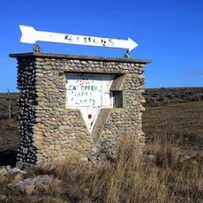
Access to this site requires special permits and coordination with research institutions, as it has protected status as a scientific location. Visitors should contact the relevant authorities in advance to clarify access rules and any necessary preparations.

The site holds fossils of one of the oldest known lampreys and numerous unusual cartilaginous fish with internal organs preserved in remarkable detail. These preservation conditions are rare and make this location exceptionally valuable for scientific study.

The community of curious travelers

AroundUs brings together thousands of curated places, local tips, and hidden gems, enriched daily by 60,000 contributors worldwide.

Start exploring
Location
GPS coordinates
46.95000,-109.00000
Latest update
December 12, 2025 07:54
Around this place
Lewis and Clark National Historic Trail
United States of America

Lewis and Clark National Historic Trail

129.9 km
Rimrocks
United States of America

Rimrocks

131.8 km
Lake Elmo State Park
United States of America

Lake Elmo State Park

130 km
Fred Robinson Bridge
United States of America

Fred Robinson Bridge

79.4 km
Big Baldy Mountain
United States of America

Big Baldy Mountain

122.1 km
UL Bend National Wildlife Refuge
United States of America

UL Bend National Wildlife Refuge

109.2 km
War Horse National Wildlife Refuge
United States of America

War Horse National Wildlife Refuge

38.2 km
Hailstone National Wildlife Refuge
United States of America

Hailstone National Wildlife Refuge

105.9 km
Fergus County High School
United States of America

Fergus County High School

34.6 km
Loco Mountain
United States of America

Loco Mountain

130.2 km
Milwaukee Road Historic District
United States of America

Milwaukee Road Historic District

85.7 km
Judith Landing Historic District
United States of America

Judith Landing Historic District

99.6 km
Judith River Ranger Station
United States of America

Judith River Ranger Station

98.8 km
Masonic Temple
United States of America

Masonic Temple

34.8 km
Roundup Central School
United States of America

Roundup Central School

65.9 km
Lavina State Bank
United States of America

Lavina State Bank

73.1 km
St. Benedict's Catholic School
United States of America

St. Benedict's Catholic School

66.1 km
Prescott Commons
United States of America

Prescott Commons

132.8 km
Lewistown Central Business Historic District
United States of America

Lewistown Central Business Historic District

35 km
Cat Creek Oil Field Sign
United States of America

Cat Creek Oil Field Sign

75.5 km
St. Joseph's Hospital
United States of America

St. Joseph's Hospital

34.4 km
Abraham and Mary Walton Hogeland House
United States of America

Abraham and Mary Walton Hogeland House

35.2 km
Ervin Homestead-Gist Bottom Historic District
United States of America

Ervin Homestead-Gist Bottom Historic District

95.2 km
Lewistown Courthouse Historic District
United States of America

Lewistown Courthouse Historic District

35 km
Anderson House
United States of America

Anderson House

34.9 km
Lewistown Silk Stocking District
United States of America

Lewistown Silk Stocking District

34.9 km
Melville Lutheran Church
United States of America

Melville Lutheran Church

122.3 km
Huntoon Residence
United States of America

Huntoon Residence

34.5 km
Show the full map
Reviews
Share your experience

No review yet

Discussions
Start a discussion...

No discussion yet

« Bear Gulch Limestone - Paleontological site in central Montana, United States » is provided by Around Us (aroundus.com). Images and texts are derived from Wikimedia project under a Creative Commons license. You are allowed to copy, distribute, and modify copies of this page, under the conditions set by the license, as long as this note is clearly visible.

Discover hidden gems everywhere you go!

From secret cafés to breathtaking viewpoints, skip the crowded tourist spots and find places that match your style. Our app makes it easy with voice search, smart filtering, route optimization, and insider tips from travelers worldwide. Download now for the complete mobile experience.

Around Us App Screenshot

A unique approach to discovering new places

Le Figaro

All the places worth exploring

France Info

A tailor-made excursion in just a few clicks

20 Minutes

Around Us
Travel Guide & Maps
Download

Send to your phone

QR Code
1

Open the camera app on your mobile.

2

Point at the QR code with your camera. A notification will appear.

3

Tap the notification to open the link.