Enable Location

We need your location to show you interesting places around you

Discover nearby places

Find interesting locations and hidden gems around you

Precise directions

Get accurate directions and distances to places

Your location is never shared with other users. It's only used when you tap the location button.

Black Hills National Forest

Log in to your account

Start exploring — it's free

Trusted by 68,285 travelers worldwide

Continue with Google
Continue with Apple
or

We will send you a code to connect

By continuing, you accept our Terms and Conditions and our Privacy Policy

Check your inbox

We've sent a pincode in your inbox. Please enter the code below.

Discussion Reviews 2 Photos
21.3k Popularity

Black Hills National Forest, National Forest across South Dakota and Wyoming, United States

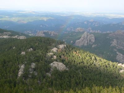
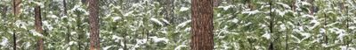
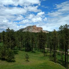
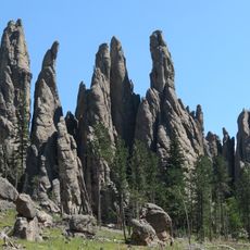
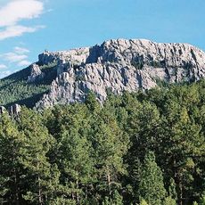
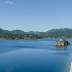
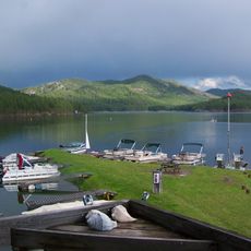
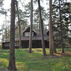
Black Hills National Forest is a vast woodland spanning across South Dakota and Wyoming, characterized by dense pine forests, open grasslands, and rolling mountains. Throughout the landscape, numerous streams and reservoirs create water features that support the diverse ecosystem.

The forest received official protection in 1897 following severe wildfires that had ravaged the region in 1893. This action represented an early government effort to preserve forest resources from further destruction.

The Lakota people called this region "Paha Sapa," which means black hills in their language. Visitors today can see how the forest continues to hold spiritual meaning for tribal communities and remains a gathering place.

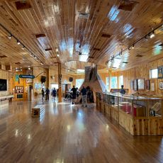
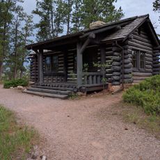
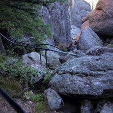
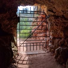
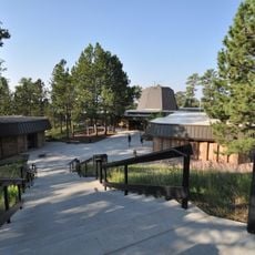
The forest offers multiple campgrounds and marked trails suitable for different skill levels and interests. Visitors should prepare for changing weather conditions and bring appropriate gear for the season.

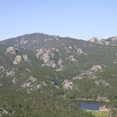
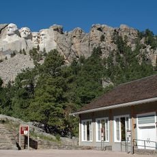
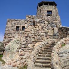
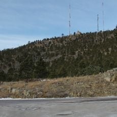
Black Elk Peak, located within the forest, ranks as the highest point east of the Rocky Mountains and offers sweeping views from its summit. The peak holds spiritual significance in Lakota traditions and remains a destination for those seeking elevation and perspective.

The community of curious travelers

AroundUs brings together thousands of curated places, local tips, and hidden gems, enriched daily by 60,000 contributors worldwide.

Start exploring
Location
Location
Inception
February 22, 1897
Founders
Grover Cleveland
Operator
United States Forest Service
Phone
GPS coordinates
43.93640,-103.72800
Latest update
December 7, 2025 10:04
Around this place
Mount Rushmore
United States of America

Mount Rushmore

22.5 km
Mount Rushmore National Memorial
United States of America

Mount Rushmore National Memorial

22.5 km
Crazy Horse Memorial
United States of America

Crazy Horse Memorial

14 km
Needles
United States of America

Needles

18.1 km
Black Elk Peak
United States of America

Black Elk Peak

17.6 km
Pactola Lake
United States of America

Pactola Lake

24.2 km
United States of America

Stratobowl

31 km
Black Hills Institute of Geological Research, Inc.
United States of America

Black Hills Institute of Geological Research, Inc.

12.2 km
Sheridan Lake
United States of America

Sheridan Lake

22.6 km
Black Elk Wilderness
United States of America

Black Elk Wilderness

18.4 km
Keystone Wye
United States of America

Keystone Wye

23 km
Black Hills Playhouse
United States of America

Black Hills Playhouse

28.1 km
Crazy Horse Memorial
United States of America

Crazy Horse Memorial

14.3 km
Lincoln Borglum Museum
United States of America

Lincoln Borglum Museum

22.8 km
Big Thunder Gold Mine
United States of America

Big Thunder Gold Mine

25.3 km
1881 Courthouse Museum
United States of America

1881 Courthouse Museum

21.5 km
The National Presidential Wax Museum
United States of America

The National Presidential Wax Museum

24.8 km
Keystone School
United States of America

Keystone School

25.1 km
Jewel Cave
United States of America

Jewel Cave

24.4 km
Peter Norbeck Summer House
United States of America

Peter Norbeck Summer House

26.8 km
Custer County Courthouse
United States of America

Custer County Courthouse

21.5 km
Jewel Cave Ranger Station
United States of America

Jewel Cave Ranger Station

24.4 km
Black Elk Peak Lookout Tower
United States of America

Black Elk Peak Lookout Tower

17.6 km
Mount Coolidge Lookout Tower
United States of America

Mount Coolidge Lookout Tower

29.1 km
Sunday Gulch Trail
United States of America

Sunday Gulch Trail

16 km
Historic Trail and Cave Entrance
United States of America

Historic Trail and Cave Entrance

24.5 km
Civilian Conservation Corps Museum
United States of America

Civilian Conservation Corps Museum

13.4 km
Jewel Cave Visitor Center
United States of America

Jewel Cave Visitor Center

24.4 km
Show the full map
Reviews
Share your experience

No review yet

Discussions
Start a discussion...

No discussion yet

« Black Hills National Forest - National Forest across South Dakota and Wyoming, United States » is provided by Around Us (aroundus.com). Images and texts are derived from Wikimedia project under a Creative Commons license. You are allowed to copy, distribute, and modify copies of this page, under the conditions set by the license, as long as this note is clearly visible.

Discover hidden gems everywhere you go!

From secret cafés to breathtaking viewpoints, skip the crowded tourist spots and find places that match your style. Our app makes it easy with voice search, smart filtering, route optimization, and insider tips from travelers worldwide. Download now for the complete mobile experience.

Around Us App Screenshot

A unique approach to discovering new places

Le Figaro

All the places worth exploring

France Info

A tailor-made excursion in just a few clicks

20 Minutes

Around Us
Travel Guide & Maps
Download

Send to your phone

QR Code
1

Open the camera app on your mobile.

2

Point at the QR code with your camera. A notification will appear.

3

Tap the notification to open the link.