Chest opened
+${chestReward.xp} XP
Explorer
NOUVEAU ×${chestReward.collectible.quantity}
tapez pour fermer
Chest locked

Open chests in the app

Around Us is built for your phone — chests unlock when you walk, explore and capture nearby places.

Enable Location

We need your location to show you interesting places around you

Discover nearby places

Find interesting locations and hidden gems around you

Precise directions

Get accurate directions and distances to places

Your location is never shared with other users. It's only used when you tap the location button.

Williston

Log in to your account

Start exploring — it's free

Trusted by 72,896 travelers worldwide

Continue with Google
Continue with Apple
or

We will send you a code to connect

By continuing, you accept our Terms and Conditions and our Privacy Policy

Check your inbox

We've sent a pincode in your inbox. Please enter the code below.

Discussion Reviews 3 Photos
92.8k Popularity

Williston, Regional center in Williams County, North Dakota, United States

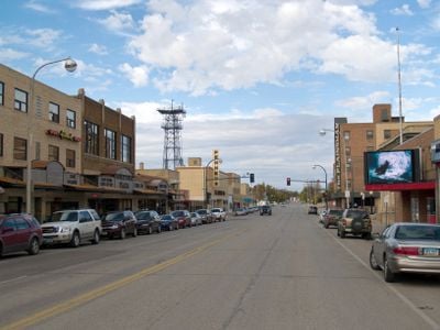
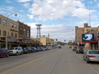
Williston is a regional center in Williams County, North Dakota, spread across a broad area west of the Missouri River. The town connects older residential neighborhoods with newer developments built during the oil boom.

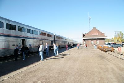
James J. Hill founded the town in 1887 as a railroad junction along his line heading west. A cyclone in 1907 destroyed much of the settlement and claimed several lives.

The name honors merchant Daniel Willis James, who supported the town's early growth. Visitors today encounter a mix of long-established residents and newcomers drawn by the oil industry.

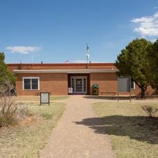
The town sits about an hour south of the Canadian border in flat terrain with hot summers and cold winters. Williston State College and the local school district facilities are spread throughout the area.

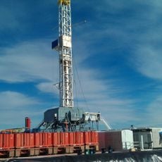
The discovery of the Bakken formation transformed the place from a quiet farming center into a rapidly growing town. Today, visitors see new hotels, shops, and infrastructure built in a short span of time.

The community of curious travelers

AroundUs brings together thousands of curated places, local tips, and hidden gems, enriched daily by 60,000 contributors worldwide.

Start exploring
Location
Inception
1887
Elevation above the sea
572 m
GPS coordinates
48.15639,-103.62806
Latest update
December 14, 2025 17:02
Around this place
Bakken formation
Canada

Bakken formation

57.4 km
Fort Buford
United States of America

Fort Buford

33.6 km
Snowden Bridge
United States of America

Snowden Bridge

38.9 km
United States of America

Brush Lake State Park

61.3 km
Missouri-Yellowstone Confluence Interpretive Center
United States of America

Missouri-Yellowstone Confluence Interpretive Center

32.9 km
Fairview Lift Bridge
United States of America

Fairview Lift Bridge

35.7 km
United States of America

Medicine Lake Wilderness

62.7 km
United States of America

Lewis and Clark State Park

29 km
United States of America

Lake Zahl National Wildlife Refuge

45.5 km
United States of America

Hale's Filling Station and Grocery

54.2 km
James Memorial Library
United States of America

James Memorial Library

776 m
Old U.S. Post Office
United States of America

Old U.S. Post Office

1 km
Ray Opera House
United States of America

Ray Opera House

40.1 km
United States of America

Sandstone School

41.9 km
Fort Union Trading Post National Historic Site
United States of America

Fort Union Trading Post National Historic Site

35.3 km
Fort Buford State Historic Site
United States of America

Fort Buford State Historic Site

33.5 km
United States of America

David Watts Bluff

33.9 km
United States of America

The Point

56.4 km
United States of America

Sundheim Park

41.6 km
United States of America

Sowers Bluff

50 km
United States of America

Glass Bluffs

31.1 km
United States of America

Grizzly Bluffs

21.7 km
United States of America

Sliding Bluff

22 km
United States of America

Harmon Reservoir

47.4 km
United States of America

Eagle Ridge Golf Club

5.5 km
United States of America

Watford City Golf Course

48.1 km
United States of America

The Links of North Dakota at Red Mike Resort

43 km
United States of America

Tioga Golf Course

57.2 km
Show the full map
Reviews
Share your experience

No review yet

Discussions
Start a discussion...

No discussion yet

« Williston - Regional center in Williams County, North Dakota, United States » is provided by Around Us (aroundus.com). Images and texts are derived from Wikimedia project under a Creative Commons license. You are allowed to copy, distribute, and modify copies of this page, under the conditions set by the license, as long as this note is clearly visible.

Discover hidden gems everywhere you go!

From secret cafés to breathtaking viewpoints, skip the crowded tourist spots and find places that match your style. Our app makes it easy with voice search, smart filtering, route optimization, and insider tips from travelers worldwide. Download now for the complete mobile experience.

Around Us App Screenshot

A unique approach to discovering new places

Le Figaro

All the places worth exploring

France Info

A tailor-made excursion in just a few clicks

20 Minutes

Around Us
Travel Guide & Maps
Download

Send to your phone

QR Code
1

Open the camera app on your mobile.

2

Point at the QR code with your camera. A notification will appear.

3

Tap the notification to open the link.