Enable Location

We need your location to show you interesting places around you

Discover nearby places

Find interesting locations and hidden gems around you

Precise directions

Get accurate directions and distances to places

Your location is never shared with other users. It's only used when you tap the location button.

Sherman County

Log in to your account

Start exploring — it's free

Trusted by 62,487 travelers worldwide

Continue with Google
Continue with Apple
or

We will send you a code to connect

By continuing, you accept our Terms and Conditions and our Privacy Policy

Check your inbox

We've sent a pincode in your inbox. Please enter the code below.

Sherman County, County administration center in Texas Panhandle, US.

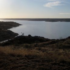
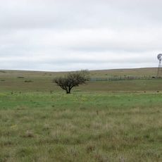
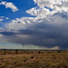
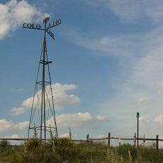
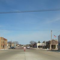
Sherman County spans the northern Texas Panhandle, a region of flat grassland where Stratford serves as the administrative center. The landscape here consists mainly of open prairie used for farming and ranching operations.

The Texas Legislature created this county in 1889 as settlement and economic activity expanded across the Texas Panhandle. Its establishment brought organized local government to an area previously developed mainly for open-range cattle operations.

This county's identity is rooted in agriculture, which continues to shape how people live and work here. Farming and ranching traditions remain central to the community's sense of place and daily rhythms.

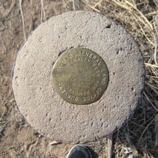
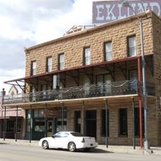
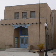
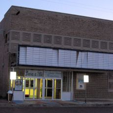
The courthouse in Stratford is where you can handle administrative matters related to property and taxes. Official records and assessments for the entire county are maintained there for public access.

The Sherman County Appraisal District implements a specialized system for managing property evaluations while providing digital resources for tax-related assessments and documentation.

The community of curious travelers

AroundUs brings together thousands of curated places, local tips, and hidden gems, enriched daily by 60,000 contributors worldwide.

Start exploring
Location
Inception
1889
Capital city
Stratford
Shares border with
Dallam County, Hansford County, Moore County, Hutchinson County, Hartley County, Texas County, Cimarron County
GPS coordinates
36.28000,-101.89000
Latest update
December 10, 2025 15:53
Around this place
Lake Meredith
United States of America

Lake Meredith

69.9 km
Rita Blanca National Grassland
United States of America

Rita Blanca National Grassland

65.9 km
Wonderland Park
United States of America

Wonderland Park

115.8 km
Black Mesa State Park
United States of America

Black Mesa State Park

108.6 km
Picture Canyon
United States of America

Picture Canyon

111.7 km
Texhomex
United States of America

Texhomex

102.6 km
8 Mile Corner
United States of America

8 Mile Corner

80.5 km
Texas Tornado
United States of America

Texas Tornado

115.5 km
Cimarron County Courthouse
United States of America

Cimarron County Courthouse

74.9 km
Eklund Hotel
United States of America

Eklund Hotel

117.6 km
Point of Rocks
United States of America

Point of Rocks

91.8 km
Carson County Square House Museum
United States of America

Carson County Square House Museum

113.7 km
Clayton Public Library
United States of America

Clayton Public Library

117.5 km
Franklin Hall
United States of America

Franklin Hall

41.7 km
Gate, Fence and Hollow Tree Shelter Designed by Dionicio Rodriguez
United States of America

Gate, Fence and Hollow Tree Shelter Designed by Dionicio Rodriguez

117.1 km
Stonington First Methodist-Episcopal Church
United States of America

Stonington First Methodist-Episcopal Church

116 km
Texas County Courthouse
United States of America

Texas County Courthouse

57.8 km
Clayton Public Schools Historic District
United States of America

Clayton Public Schools Historic District

116.9 km
Morton County WPA Bridge
United States of America

Morton County WPA Bridge

115.6 km
Dallam County Courthouse
United States of America

Dallam County Courthouse

61.8 km
Hooker Woodframe Grain Elevator
United States of America

Hooker Woodframe Grain Elevator

89.2 km
Eklund Hotel Historic Site
United States of America

Eklund Hotel Historic Site

117.6 km
XIT Museum
United States of America

XIT Museum

61.9 km
Freedom Museum USA
United States of America

Freedom Museum USA

117 km
Ellis Theatre
United States of America

Ellis Theatre

98.4 km
Morley Theatre
United States of America

Morley Theatre

81.2 km
Mission Theater
United States of America

Mission Theater

61.9 km
Lyric Cinema
United States of America

Lyric Cinema

63 km
Show the full map
Administrative divisions
« Sherman County - County administration center in Texas Panhandle, US » is provided by Around Us (aroundus.com). Images and texts are derived from Wikimedia project under a Creative Commons license. You are allowed to copy, distribute, and modify copies of this page, under the conditions set by the license, as long as this note is clearly visible.

Discover hidden gems everywhere you go!

From secret cafés to breathtaking viewpoints, skip the crowded tourist spots and find places that match your style. Our app makes it easy with voice search, smart filtering, route optimization, and insider tips from travelers worldwide. Download now for the complete mobile experience.

Around Us App Screenshot

A unique approach to discovering new places

Le Figaro

All the places worth exploring

France Info

A tailor-made excursion in just a few clicks

20 Minutes

Around Us
Travel Guide & Maps
Download

Send to your phone

QR Code
1

Open the camera app on your mobile.

2

Point at the QR code with your camera. A notification will appear.

3

Tap the notification to open the link.