Chest opened
+${chestReward.xp} XP
Explorer
NOUVEAU ×${chestReward.collectible.quantity}
tapez pour fermer
Chest locked

Open chests in the app

Around Us is built for your phone — chests unlock when you walk, explore and capture nearby places.

Enable Location

We need your location to show you interesting places around you

Discover nearby places

Find interesting locations and hidden gems around you

Precise directions

Get accurate directions and distances to places

Your location is never shared with other users. It's only used when you tap the location button.

Emo

Log in to your account

Start exploring — it's free

Trusted by 72,896 travelers worldwide

Continue with Google
Continue with Apple
or

We will send you a code to connect

By continuing, you accept our Terms and Conditions and our Privacy Policy

Check your inbox

We've sent a pincode in your inbox. Please enter the code below.

Discussion Reviews 1 Photos
12.4k Popularity

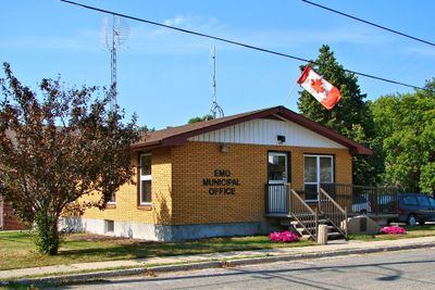
Emo, Township municipality in Rainy River District, Ontario, Canada.

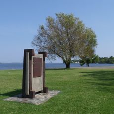
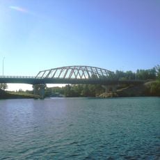
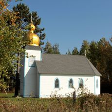
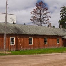
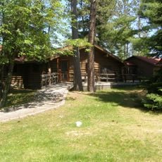
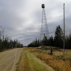
Emo is a township municipality in Ontario that stretches along the Rainy River in the southwestern corner of northern Ontario, directly north of Minnesota across the United States border. The area features riverside landscapes and open countryside typical of the region.

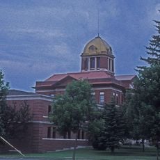
The township received its official designation on 1 July 1899, named by Alexander Luttrell after a village in Ireland near his birthplace. The name reflects the European roots of early settlers in the region.

The annual Rainy River Agricultural Fair brings together farmers and residents to display produce and celebrate rural traditions. The event reflects the importance of agriculture to the community's identity and daily rhythm.

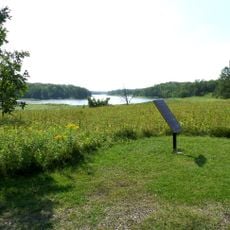
Visitors should be aware that the area is shaped by the river and offers activities such as fishing and boating. The warmer months are ideal for exploring outdoor attractions.

The Emo Walleye Classic fishing tournament takes place during the final week of May and draws competitive teams from both Canada and the United States. The event highlights the cross-border connection and the river's importance to the local economy.

The community of curious travelers

AroundUs brings together thousands of curated places, local tips, and hidden gems, enriched daily by 60,000 contributors worldwide.

Start exploring
Shares border with
Unorganized Rainy River District
Website
GPS coordinates
48.63330,-93.83330
Latest update
December 7, 2025 20:45
Around this place
Voyageurs National Park
United States of America

Voyageurs National Park

71.5 km
Big Bog State Recreation Area
United States of America

Big Bog State Recreation Area

70.1 km
Kettle Falls Hotel
United States of America

Kettle Falls Hotel

89.1 km
Grand Mound
United States of America

Grand Mound

15.9 km
Zippel Bay State Park
United States of America

Zippel Bay State Park

79.6 km
Kay-Nah-Chi-Wah-Nung
Canada

Kay-Nah-Chi-Wah-Nung

17.8 km
Fort Saint Pierre
Canada

Fort Saint Pierre

34.9 km
Kabetogama State Forest
United States of America

Kabetogama State Forest

62.5 km
Franz Jevne State Park
United States of America

Franz Jevne State Park

18 km
Kettle Falls Historic District
United States of America

Kettle Falls Historic District

89.1 km
Sioux Narrows Bridge
Canada

Sioux Narrows Bridge

89 km
Jun Fujita Cabin
United States of America

Jun Fujita Cabin

71.5 km
Sts. Peter and Paul Russian Orthodox Church
United States of America

Sts. Peter and Paul Russian Orthodox Church

95 km
Finstad's Auto Marine Shop
United States of America

Finstad's Auto Marine Shop

35.8 km
Kabetogama Ranger Station District
United States of America

Kabetogama Ranger Station District

62.9 km
Koochiching County Courthouse
United States of America

Koochiching County Courthouse

31.3 km
Orr Roadside Parking Area
United States of America

Orr Roadside Parking Area

97.9 km
Civilian Conservation Corps Camp S-52
United States of America

Civilian Conservation Corps Camp S-52

94.1 km
Gold Mine Sites
United States of America

Gold Mine Sites

49.1 km
Sioux Narrows Provincial Park
Canada

Sioux Narrows Provincial Park

89.4 km
Ash River Lookout Tower
United States of America

Ash River Lookout Tower

81.2 km
Kabetogama Lookout Tower
United States of America

Kabetogama Lookout Tower

68.2 km
Ash River Visitor Center
United States of America

Ash River Visitor Center

75.7 km
Elephant Lake Lookout Tower
United States of America

Elephant Lake Lookout Tower

94.6 km
Rainy Lake Visitor Center
United States of America

Rainy Lake Visitor Center

49.8 km
Faunce Lookout Tower
United States of America

Faunce Lookout Tower

82.6 km
Rapid River Fire Tower
United States of America

Rapid River Fire Tower

51.8 km
Kabetogama Lake Visitor Center
United States of America

Kabetogama Lake Visitor Center

62.8 km
Show the full map
Reviews
Share your experience

No review yet

Discussions
Start a discussion...

No discussion yet

« Emo - Township municipality in Rainy River District, Ontario, Canada » is provided by Around Us (aroundus.com). Images and texts are derived from Wikimedia project under a Creative Commons license. You are allowed to copy, distribute, and modify copies of this page, under the conditions set by the license, as long as this note is clearly visible.

Discover hidden gems everywhere you go!

From secret cafés to breathtaking viewpoints, skip the crowded tourist spots and find places that match your style. Our app makes it easy with voice search, smart filtering, route optimization, and insider tips from travelers worldwide. Download now for the complete mobile experience.

Around Us App Screenshot

A unique approach to discovering new places

Le Figaro

All the places worth exploring

France Info

A tailor-made excursion in just a few clicks

20 Minutes

Around Us
Travel Guide & Maps
Download

Send to your phone

QR Code
1

Open the camera app on your mobile.

2

Point at the QR code with your camera. A notification will appear.

3

Tap the notification to open the link.