Chest opened
+${chestReward.xp} XP
Explorer
NOUVEAU ×${chestReward.collectible.quantity}
tapez pour fermer
Chest locked

Open chests in the app

Around Us is built for your phone — chests unlock when you walk, explore and capture nearby places.

Enable Location

We need your location to show you interesting places around you

Discover nearby places

Find interesting locations and hidden gems around you

Precise directions

Get accurate directions and distances to places

Your location is never shared with other users. It's only used when you tap the location button.

Log in to your account

Start exploring — it's free

Trusted by 72,986 travelers worldwide

Continue with Google
Continue with Apple
or

We will send you a code to connect

By continuing, you accept our Terms and Conditions and our Privacy Policy

Check your inbox

We've sent a pincode in your inbox. Please enter the code below.

Greater Oxdrift, Ontario
Discussion Reviews Photo
1.3k Popularity

Greater Oxdrift, Ontario, Local services board in Kenora District, Ontario, Canada

Greater Oxdrift is a local services board covering eight geographic townships near Kenora, coordinating basic services across the area. The townships of Aubrey, Britton, Brownbridge, Eton, Rugby, Van Horne, Wainwright, and Zealand are connected through regional highways.

The local services board was established in 2009 to manage administration across sparsely populated regions of northern Ontario. This creation reflected efforts to address unique challenges of large, thinly settled areas.

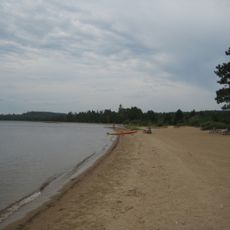
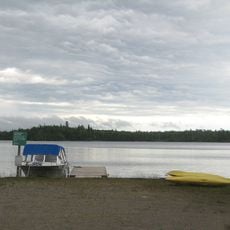
Oxdrift serves as the administrative center for the Eagle Lake First Nations band government and shapes the social life of this sparsely populated region. The community acts as a gathering place for residents spread across vast distances.

The area connects to neighboring communities through Highways 17 and 605, with Machin and Dryden nearby for additional services. Plan for long distances between locations, as the region is sparsely populated and spread across a wide territory.

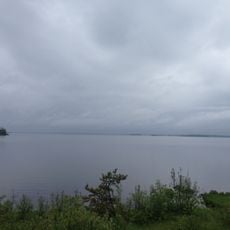
The territory sits within Kenora District, which covers a significant portion of Ontario's total land area and ranks among the province's largest administrative districts. This vast expanse makes it one of the geographically most dominant areas in the province.

The community of curious travelers

AroundUs brings together thousands of curated places, local tips, and hidden gems, enriched daily by 60,000 contributors worldwide.

Start exploring
GPS coordinates
49.83333,-93.00000
Latest update
December 14, 2025 18:13
Reviews
Share your experience

No review yet

Discussions
Start a discussion...

No discussion yet

« Greater Oxdrift, Ontario - Local services board in Kenora District, Ontario, Canada » is provided by Around Us (aroundus.com). Images and texts are derived from Wikimedia project under a Creative Commons license. You are allowed to copy, distribute, and modify copies of this page, under the conditions set by the license, as long as this note is clearly visible.

Discover hidden gems everywhere you go!

From secret cafés to breathtaking viewpoints, skip the crowded tourist spots and find places that match your style. Our app makes it easy with voice search, smart filtering, route optimization, and insider tips from travelers worldwide. Download now for the complete mobile experience.

Around Us App Screenshot

A unique approach to discovering new places

Le Figaro

All the places worth exploring

France Info

A tailor-made excursion in just a few clicks

20 Minutes

Around Us
Travel Guide & Maps
Download

Send to your phone

QR Code
1

Open the camera app on your mobile.

2

Point at the QR code with your camera. A notification will appear.

3

Tap the notification to open the link.