Enable Location

We need your location to show you interesting places around you

Discover nearby places

Find interesting locations and hidden gems around you

Precise directions

Get accurate directions and distances to places

Your location is never shared with other users. It's only used when you tap the location button.

Voyageur Hiking Trail

Log in to your account

Start exploring — it's free

Trusted by 65,430 travelers worldwide

Continue with Google
Continue with Apple
or

We will send you a code to connect

By continuing, you accept our Terms and Conditions and our Privacy Policy

Check your inbox

We've sent a pincode in your inbox. Please enter the code below.

Voyageur Hiking Trail
Discussion Reviews 1 Photos
3k Popularity

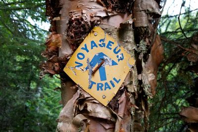
Voyageur Hiking Trail, Wilderness hiking trail in Northern Ontario, Canada

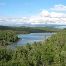
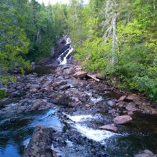
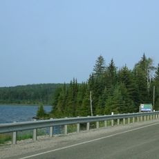
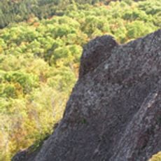
The Voyageur Hiking Trail is a long-distance hiking trail in Northern Ontario, Canada, running along the northern shores of Lake Huron and Lake Superior. The route crosses rocky outcrops of the Canadian Shield, passes through boreal forest, and is divided into named segments that together form a continuous path.

The trail began taking shape in 1973, when Harold Brain brought together a group of volunteers to build a hiking path across the Canadian Shield. Since then, the Voyageur Trail Association has maintained and gradually extended the route over the following decades.

The name refers to the French-speaking fur traders who once paddled the Great Lakes by canoe, following routes that this trail loosely traces through the same northern landscape. Walking here gives a sense of moving through territory that was once a working highway for trade.

Much of the route passes through remote forest, so it is worth downloading offline maps before heading into areas without mobile signal. Members of the Voyageur Trail Association can access the Ondago app, which helps with navigation along the trail.

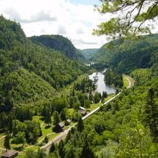
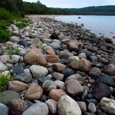
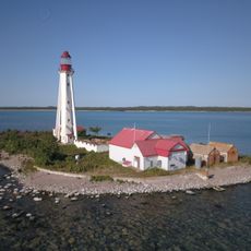
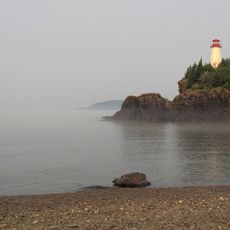
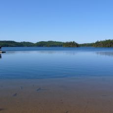
The Casque Isles segment runs directly along the rocky cliffs above Lake Superior's northern shore, making it one of the few parts of the trail where open water is visible from the path. This section is often walked as a standalone trip by hikers who do not attempt the full route.

The community of curious travelers

AroundUs brings together thousands of curated places, local tips, and hidden gems, enriched daily by 60,000 contributors worldwide.

Start exploring
Location
GPS coordinates
48.34890,-86.17680
Latest update
March 3, 2026 13:52
Reviews
Share your experience

No review yet

Discussions
Start a discussion...

No discussion yet

« Voyageur Hiking Trail - Wilderness hiking trail in Northern Ontario, Canada » is provided by Around Us (aroundus.com). Images and texts are derived from Wikimedia project under a Creative Commons license. You are allowed to copy, distribute, and modify copies of this page, under the conditions set by the license, as long as this note is clearly visible.

Discover hidden gems everywhere you go!

From secret cafés to breathtaking viewpoints, skip the crowded tourist spots and find places that match your style. Our app makes it easy with voice search, smart filtering, route optimization, and insider tips from travelers worldwide. Download now for the complete mobile experience.

Around Us App Screenshot

A unique approach to discovering new places

Le Figaro

All the places worth exploring

France Info

A tailor-made excursion in just a few clicks

20 Minutes

Around Us
Travel Guide & Maps
Download

Send to your phone

QR Code
1

Open the camera app on your mobile.

2

Point at the QR code with your camera. A notification will appear.

3

Tap the notification to open the link.