Enable Location

We need your location to show you interesting places around you

Discover nearby places

Find interesting locations and hidden gems around you

Precise directions

Get accurate directions and distances to places

Your location is never shared with other users. It's only used when you tap the location button.

Log in to your account

Start exploring — it's free

Trusted by 65,436 travelers worldwide

Continue with Google
Continue with Apple
or

We will send you a code to connect

By continuing, you accept our Terms and Conditions and our Privacy Policy

Check your inbox

We've sent a pincode in your inbox. Please enter the code below.

Hunter Island
Discussion Reviews Photo
1.7k Popularity

Hunter Island, Protected wilderness area in Ontario, Canada

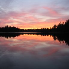
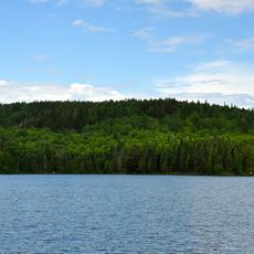
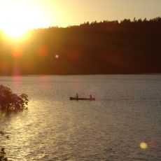
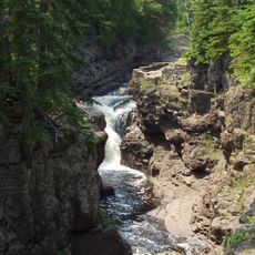
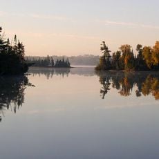
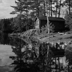
Hunter Island is a wilderness area within Quetico Provincial Park near the United States border, featuring an extensive system of interconnected waterways. The terrain consists of lakes separated by portage routes that connect the water passages.

The area came into focus during the 1890s when a boundary dispute between Canada and the United States arose over iron ore deposits. This conflict shaped the geopolitical importance of this remote location.

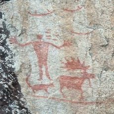
Early French fur traders called this region Iles des Chasseurs, leaving behind a legacy connected to the importance of these waterways for commerce and exchange.

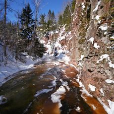
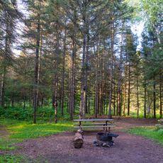
Visitors should plan for extended periods, as a canoe journey through the system takes considerable time and requires careful preparation. Conditions can be harsh, making wilderness experience essential.

Despite its name, this is not actually an island but a peninsula connected to surrounding territory by a short portage route. This geographic quirk is often overlooked yet shapes the entire layout of the paddling system.

The community of curious travelers

AroundUs brings together thousands of curated places, local tips, and hidden gems, enriched daily by 60,000 contributors worldwide.

Start exploring
Location
GPS coordinates
48.17970,-91.53530
Latest update
December 14, 2025 13:07
Around this place
Boundary Waters Canoe Area Wilderness
United States of America

Boundary Waters Canoe Area Wilderness

47.5 km
Eagle Mountain
United States of America

Eagle Mountain

79.1 km
Superior Hiking Trail
United States of America

Superior Hiking Trail

85.3 km
Lake Vermilion
United States of America

Lake Vermilion

67.2 km
Quetico Provincial Park
Canada

Quetico Provincial Park

24.1 km
Height of Land Portage
Canada

Height of Land Portage

72.4 km
Lake Vermilion-Soudan Underground Mine State Park
United States of America

Lake Vermilion-Soudan Underground Mine State Park

65.6 km
Temperance River State Park
United States of America

Temperance River State Park

85.4 km
Bear Head Lake State Park
United States of America

Bear Head Lake State Park

58.5 km
Hegman Lake Pictograph
United States of America

Hegman Lake Pictograph

30.7 km
George H. Crosby Manitou State Park
United States of America

George H. Crosby Manitou State Park

84.2 km
Finland State Forest
United States of America

Finland State Forest

74.1 km
Burntside Lodge
United States of America

Burntside Lodge

42.1 km
Listening Point
United States of America

Listening Point

47.3 km
Stuntz Bay Boathouse Historic District
United States of America

Stuntz Bay Boathouse Historic District

65.4 km
Alex Seitaniemi Housebarn
United States of America

Alex Seitaniemi Housebarn

69.2 km
United States of America

North Shore Commercial Fishing Museum

85.3 km
Hartley Building
United States of America

Hartley Building

67.3 km
State Theater
United States of America

State Theater

39.3 km
Longyear Drill Site
United States of America

Longyear Drill Site

81.7 km
Isabella Ranger Station
United States of America

Isabella Ranger Station

59.5 km
William Ingersoll Estate
United States of America

William Ingersoll Estate

72.2 km
Anna and Mikko Pyhala Farm
United States of America

Anna and Mikko Pyhala Farm

75.3 km
Erick and Kristina Nelimark Sauna
United States of America

Erick and Kristina Nelimark Sauna

75.8 km
Waino Tanttari Field Hay Barn
United States of America

Waino Tanttari Field Hay Barn

70.1 km
Dorothy Molter Museum
United States of America

Dorothy Molter Museum

38 km
Jasper Peak Fire Tower
United States of America

Jasper Peak Fire Tower

65 km
Finland Lookout Tower
United States of America

Finland Lookout Tower

83.7 km
Show the full map
Reviews
Share your experience

No review yet

Discussions
Start a discussion...

No discussion yet

« Hunter Island - Protected wilderness area in Ontario, Canada » is provided by Around Us (aroundus.com). Images and texts are derived from Wikimedia project under a Creative Commons license. You are allowed to copy, distribute, and modify copies of this page, under the conditions set by the license, as long as this note is clearly visible.

Discover hidden gems everywhere you go!

From secret cafés to breathtaking viewpoints, skip the crowded tourist spots and find places that match your style. Our app makes it easy with voice search, smart filtering, route optimization, and insider tips from travelers worldwide. Download now for the complete mobile experience.

Around Us App Screenshot

A unique approach to discovering new places

Le Figaro

All the places worth exploring

France Info

A tailor-made excursion in just a few clicks

20 Minutes

Around Us
Travel Guide & Maps
Download

Send to your phone

QR Code
1

Open the camera app on your mobile.

2

Point at the QR code with your camera. A notification will appear.

3

Tap the notification to open the link.