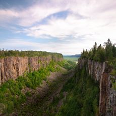
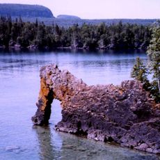
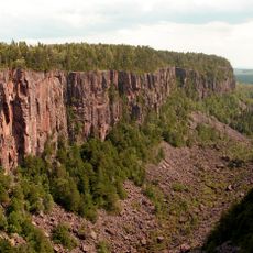
Nipigon Embayment, Geological formation in Northern Ontario, Canada
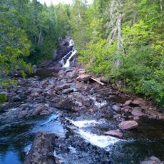
The Nipigon Embayment is a geological formation in Northern Ontario spanning a large area with varied mineral deposits scattered throughout. Silver, copper, zinc, and marble occur here, making the landscape mineralogically diverse.
Geological studies of this formation began decades ago and led to important discoveries about mineral resources in the area. These investigations shaped our understanding of Ontario's geological structures.
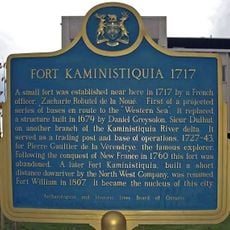
The region holds deep roots for First Nations communities who have lived here for generations and relied on its resources. This connection to the land remains central to their identity and way of life.
Geological maps and magnetic surveys provide detailed information about the mineral deposits and rock structures throughout the area. Check with local authorities about access and any restrictions before visiting, as this is an active research and exploration zone.
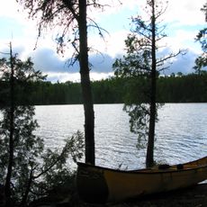
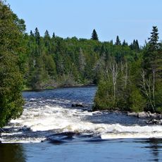
The area sits near the Nipigon River and brings together several different mineral types in relatively close geographic proximity. This concentration makes it especially interesting for geological research and mineral exploration work.
Location: Ontario
GPS coordinates: 50.07000,-88.64000
Latest update: December 14, 2025 12:21
Nipigon River Bridge
120.3 km
Gunilda
168.1 km
Terry Fox Memorial and Lookout
180.6 km
Ouimet Canyon
142.6 km
Fort William Gardens
192.7 km
Lake Superior National Marine Conservation Area
186.8 km
Wabakimi Provincial Park
92.8 km
Fort Kaministiquia
191.7 km
Finnish Labour Temple
187.3 km
Port Arthur Collegiate Institute
186.7 km
Thunder Bay Community Auditorium
188.5 km
Marina Park
186.8 km
Current River Greenway
183.9 km
Rainbow Falls Provincial Park
163.7 km
Waverley Park
186.7 km
Royal Edward Arms
192.8 km
Centennial Park
181.8 km
Thunder Bay Port Authority
189.9 km
Hillcrest Park
187.1 km
Thunder Bay Tourist Pagoda
186.8 km
Battle Island Light
166.4 km
Grain Exchange Building
192.8 km
St. Andrew's Church
186.7 km
Connaught Square
186.7 km
Saint Sylvesters Church
118.3 km
Ouimet Canyon Provincial Park
142.7 km
425 Donald Street East
192.9 km
Kopka River Provincial Park
62.3 kmVisited this place? Tap the stars to rate it and share your experience / photos with the community! Try now! You can cancel it anytime.
Discover hidden gems everywhere you go!
From secret cafés to breathtaking viewpoints, skip the crowded tourist spots and find places that match your style. Our app makes it easy with voice search, smart filtering, route optimization, and insider tips from travelers worldwide. Download now for the complete mobile experience.
A unique approach to discovering new places❞
— Le Figaro
All the places worth exploring❞
— France Info
A tailor-made excursion in just a few clicks❞
— 20 Minutes