Sud-Bandama, Administrative region in Ivory Coast.
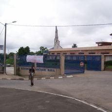
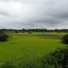
Sud-Bandama is an administrative region in Ivory Coast shaped by river systems and farming land. Three departments - Divo, Guitry, and Lakota - form the core of this territory dedicated to agriculture and rural activity.
The region was formed in 1997 as an administrative division of Ivory Coast. A restructuring in 2011 reshaped the territorial organization of the area.
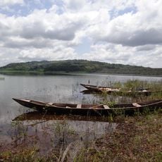
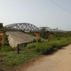
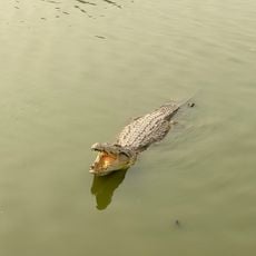
The Bandama River shapes daily life through fishing and farming practices that connect different communities across the land. Local people have built traditions around water use for both food production and exchange of goods.
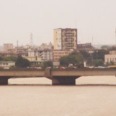
The area is mainly rural with basic infrastructure and is best visited during the dry season when roads are most passable. Getting around relies on local transport options adapted to the terrain.
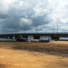
The Kossou Dam powers the region and supports large-scale farming through irrigation projects. This structure has also created fishing opportunities that shape local economic activity.
Location: Ivory Coast
Inception: 1997
Capital city: Divo
Elevation above the sea: 205 m
Shares border with: Bas-Sassandra Region, Fromager, Lagunes region
GPS coordinates: 5.66667,-5.50000
Latest update: December 14, 2025 13:02
Basilica of Our Lady of Peace of Yamoussoukro
129.4 km
Felix Houphouet Boigny Stadium
168.4 kmAlassane Ouattara Stadium
159.3 km
Laurent Pokou Stadium
156.9 km
Palacio presidencial de Abiyán
168.2 km
Banco National Park
163.3 km
St. Paul's Cathedral
168.1 km
Abidjan zoo
168.7 km
Charles Konan Banny Stadium
132.4 km
Houphouët-Boigny Bridge
168.8 km
Marché de Treichville
169.5 km
Fort de Dabou
129.4 kmSanctuaire marial d'Abidjan
165.5 km
Museum of Civilizations in Ivory Coast
167.7 km
Second Abidjan Bridge
169.6 km
Lake Kossou
165.4 km
Immeuble CAISTAB
168.6 km
Assagny National Park
85.8 km
La Pyramide
168.8 km
National Library of Ivory Coast
167.6 km
Pont Philippe-Yacé
146.5 km
Tour Postel 2001
168.6 km
Yamoussoukro Cathedral
131.2 km
Pont ferroviaire de Dimbokro
139.2 km
Hôtel du District
168.4 km
Lac aux Caïmans
131.3 km
Le Rocher des Amours
164.3 km
Parc archéologique d'Ahouakro
87.2 kmVisited this place? Tap the stars to rate it and share your experience / photos with the community! Try now! You can cancel it anytime.
Discover hidden gems everywhere you go!
From secret cafés to breathtaking viewpoints, skip the crowded tourist spots and find places that match your style. Our app makes it easy with voice search, smart filtering, route optimization, and insider tips from travelers worldwide. Download now for the complete mobile experience.
A unique approach to discovering new places❞
— Le Figaro
All the places worth exploring❞
— France Info
A tailor-made excursion in just a few clicks❞
— 20 Minutes