Banco National Park, National park in Attécoubé district of Abidjan, Côte d'Ivoire.
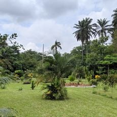
Banco National Park lies in central Abidjan at the junction of Abobo, Yopougon, Adjamé and Attécoubé, within a square roughly 7.8 km on each side. Its 3,473.55 hectares hold a 600-hectare primary forest with mahogany and avodire trees, crossed by the Gbangbo river. Hiking trails and 80 km of bike paths run through it.
The area began as a forest station in 1926 and became a national park in 1953. It gained additional protected status when designated as a Permanent Forest Estate in 1966.
The name Banco derives from the Ebrié word "Gbancô", meaning "source of refreshing water", also the meaning of the Gbangbo river crossing the forest. The park lies on the former customary land of the Atié villages of Andokoi and the Ebrié villages of Anonkoua-Kouté and Agba. Visitors today use its hiking trails and 80 km of bike paths.
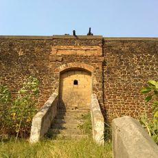
The park lies at the junction of the communes of Abobo, Yopougon, Adjamé and Attécoubé, with a boundary line of 25.58 km. Hiking trails and 80 km of bike paths have been laid out for walkers and cyclists. A brick wall 2.5 m high, begun in 2022, is meant to encircle the park in two stages of 4,400 m and 4,500 m.
The forest's water table feeds 29 boreholes and supplies 40% of the drinking water distributed in Abidjan, while capturing 90,000 tonnes of carbon dioxide a year. The Gbangbo river, whose Ebrié name means "refreshing water source", runs through the middle of the park.
The community of curious travelers
AroundUs brings together thousands of curated places, local tips, and hidden gems, enriched daily by 94,378 contributors worldwide.