Enable Location

We need your location to show you interesting places around you

Discover nearby places

Find interesting locations and hidden gems around you

Precise directions

Get accurate directions and distances to places

Your location is never shared with other users. It's only used when you tap the location button.

Mont Chaberton

Log in to your account

Start exploring — it's free

Trusted by 61,950 travelers worldwide

Continue with Google
Continue with Apple
or

We will send you a code to connect

By continuing, you accept our Terms and Conditions and our Privacy Policy

Check your inbox

We've sent a pincode in your inbox. Please enter the code below.

Mont Chaberton

Mont Chaberton, Mountain summit in Hautes-Alpes, France.

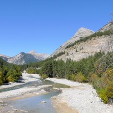
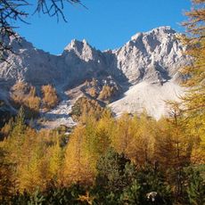
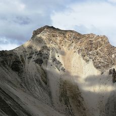
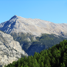
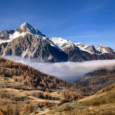
Mont Chaberton is a mountain in the French Alps rising to 3,131 meters with a distinctive pyramidal shape and flat summit. The peak sits in the Massif des Cerces region, offering hikers access to high Alpine terrain with panoramic views across the mountain range.

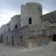
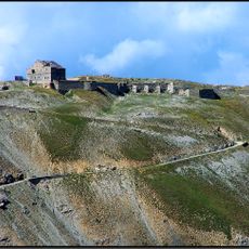
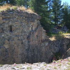
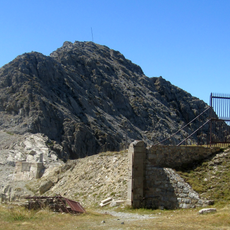
Italian forces built an artillery battery with eight masonry towers on the summit between 1898 and 1910 to defend their Alpine border. The territory changed hands to France in 1947 when the border between the two nations was redrawn.

The mountain changed nationality from Italian to French territory in 1947, marking a significant shift in the border between these two Alpine nations.

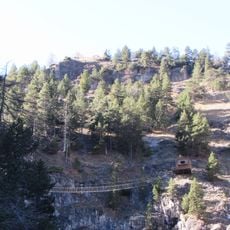
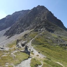
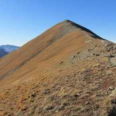
The mountain can be reached from Montgenèvre via a trail classified T1, suitable for experienced walkers with proper Alpine equipment. Visitors should prepare for the physical demands of high altitude hiking and expect changing weather conditions at the summit.

The summit earned the nickname 'battleship of the clouds' from its eight artillery towers. French forces partially destroyed most of these structures during World War II, leaving ruins visible today on the peak.

The community of curious travelers

AroundUs brings together thousands of curated places, local tips, and hidden gems, enriched daily by 60,000 contributors worldwide.

Start exploring
Location
Elevation above the sea
3,136 m
GPS coordinates
44.96454,6.75142
Latest update
December 7, 2025 10:04
« Mont Chaberton - Mountain summit in Hautes-Alpes, France » is provided by Around Us (aroundus.com). Images and texts are derived from Wikimedia project under a Creative Commons license. You are allowed to copy, distribute, and modify copies of this page, under the conditions set by the license, as long as this note is clearly visible.

Discover hidden gems everywhere you go!

From secret cafés to breathtaking viewpoints, skip the crowded tourist spots and find places that match your style. Our app makes it easy with voice search, smart filtering, route optimization, and insider tips from travelers worldwide. Download now for the complete mobile experience.

Around Us App Screenshot

A unique approach to discovering new places

Le Figaro

All the places worth exploring

France Info

A tailor-made excursion in just a few clicks

20 Minutes

Around Us
Travel Guide & Maps
Download

Send to your phone

QR Code
1

Open the camera app on your mobile.

2

Point at the QR code with your camera. A notification will appear.

3

Tap the notification to open the link.