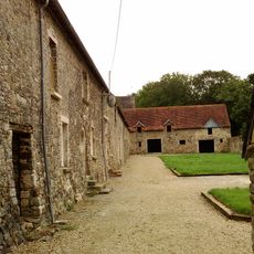
Parc naturel régional des marais du Cotentin et du Bessin, Regional natural park in Normandy, France
The Parc naturel régional des marais du Cotentin et du Bessin covers 146,650 hectares south of the Cotentin peninsula, of which 30,000 are wetland. Its marshes lie in the valleys of the Aure, Ay, Douve, Taute and Vire and along the east coast, where shallow water alternates with grazed grassland, hedged bocage and low wooded banks. The park administration sits in Saint-Côme-du-Mont.
The park was created by ministerial decree on 14 May 1991, with 117 communes joining (97 in Manche, 20 in Calvados), covering 1,195 km² including 250 km² of wetlands. Its first charter was renewed on 13 March 1998 for ten years, expanding to 145 communes and 1,400 km². A second charter followed on 17 February 2010, covering 150 communes over 1,466.5 km², and a third charter is being renewed for 2025–2040.
The park's name comes from the Cotentin peninsula and the Bessin region around Bayeux, whose boundary follows the river Elle. Winter floods whiten the marshes, a seasonal rhythm that shapes local farming. The Maison du Parc at Saint-Côme-du-Mont, near the Marais des Ponts d'Ouve, serves as the park's administrative base.
The park administration and its information point are in Saint-Côme-du-Mont, where the Maison du Parc gives access to the 120-hectare marais des Ponts d'Ouve. Boat trips through the marshes start from Carentan, on the Douve and the Taute. Winter floods whiten the low ground, so check water levels before setting out on footpaths.
The park's name comes from the winter floods that "whiten" the marshes: the water sheets reflect the sky and give the wetland its pale look. This seasonal flooding is the reason the area was classified by ministerial decree on 14 May 1991.
The community of curious travelers
AroundUs brings together thousands of curated places, local tips, and hidden gems, enriched daily by 94,314 contributors worldwide.