Enable Location

We need your location to show you interesting places around you

Discover nearby places

Find interesting locations and hidden gems around you

Precise directions

Get accurate directions and distances to places

Your location is never shared with other users. It's only used when you tap the location button.

Aiguille du Tacul

Log in to your account

Start exploring — it's free

Trusted by 63,005 travelers worldwide

Continue with Google
Continue with Apple
or

We will send you a code to connect

By continuing, you accept our Terms and Conditions and our Privacy Policy

Check your inbox

We've sent a pincode in your inbox. Please enter the code below.

Aiguille du Tacul
Discussion Reviews 1 Photos
1.1k Popularity

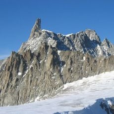
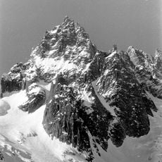
Aiguille du Tacul, Alpine summit in Mont Blanc massif, France

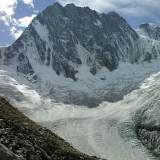
Aiguille du Tacul is an alpine summit in the Mont Blanc massif that rises to approximately 2,400 meters and features steep, exposed terrain throughout. The route includes snowfields and ice sections with technically demanding passages that require experience and proper equipment.

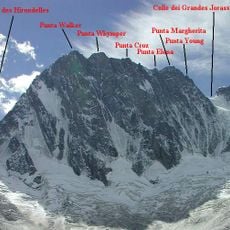
The first ascent of this summit took place in 1901 and established a climbing route that mountaineers have used ever since. That early exploration set the foundation for the modern routes that climbers follow today.

Local and international climbers use this mountain as a training ground to refine their skills before attempting more challenging peaks in the region. Many see it as an important stepping stone in their mountaineering progression.

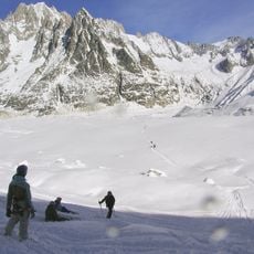
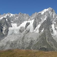
This summit is easily reached from the Aiguille du Midi cable car station, but climbers should expect snow, ice, and exposed rock throughout. Starting early is important to safely navigate between crevasses and return before weather conditions deteriorate.

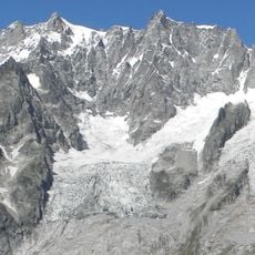
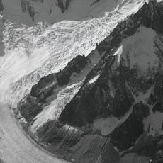
The northern face contains glacial features such as crevasses and seracs that require precise navigation during early morning ascents. Many climbers deliberately time their routes to spot and avoid these hazards when light conditions are best.

The community of curious travelers

AroundUs brings together thousands of curated places, local tips, and hidden gems, enriched daily by 60,000 contributors worldwide.

Start exploring
Location
Elevation above the sea
3,438 m
GPS coordinates
45.88435,6.96078
Latest update
December 14, 2025 18:41
Reviews
Share your experience

No review yet

Discussions
Start a discussion...

No discussion yet

« Aiguille du Tacul - Alpine summit in Mont Blanc massif, France » is provided by Around Us (aroundus.com). Images and texts are derived from Wikimedia project under a Creative Commons license. You are allowed to copy, distribute, and modify copies of this page, under the conditions set by the license, as long as this note is clearly visible.

Discover hidden gems everywhere you go!

From secret cafés to breathtaking viewpoints, skip the crowded tourist spots and find places that match your style. Our app makes it easy with voice search, smart filtering, route optimization, and insider tips from travelers worldwide. Download now for the complete mobile experience.

Around Us App Screenshot

A unique approach to discovering new places

Le Figaro

All the places worth exploring

France Info

A tailor-made excursion in just a few clicks

20 Minutes

Around Us
Travel Guide & Maps
Download

Send to your phone

QR Code
1

Open the camera app on your mobile.

2

Point at the QR code with your camera. A notification will appear.

3

Tap the notification to open the link.