Enable Location

We need your location to show you interesting places around you

Discover nearby places

Find interesting locations and hidden gems around you

Precise directions

Get accurate directions and distances to places

Your location is never shared with other users. It's only used when you tap the location button.

Aiguille de l'Éboulement

Log in to your account

Start exploring — it's free

Trusted by 61,457 travelers worldwide

Continue with Google
Continue with Apple
or

We will send you a code to connect

By continuing, you accept our Terms and Conditions and our Privacy Policy

Check your inbox

We've sent a pincode in your inbox. Please enter the code below.

Aiguille de l'Éboulement

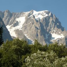
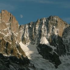
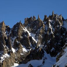
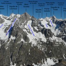
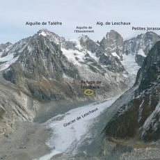
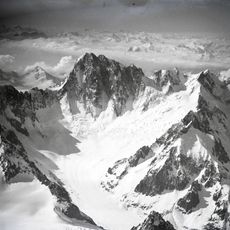
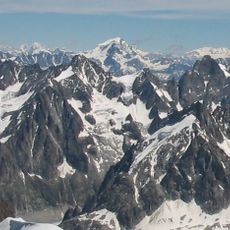
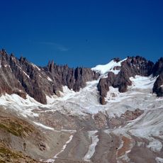
Aiguille de l'Éboulement, Mountain peak in Chamonix-Mont-Blanc, France

Description

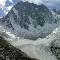
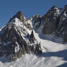
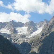
The Aiguille de l'Éboulement is a mountain peak straddling the French-Italian border with steep rock walls and intricate geological structures. The summit sits at high altitude and is surrounded by demanding terrain that requires specialized mountaineering skills to traverse.

History

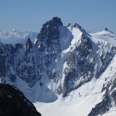
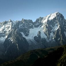
Early mountaineers explored and recorded this peak during the 1800s, creating climbing routes that became reference paths for later generations. The established approach lines have remained largely unchanged as the preferred methods for reaching the summit.

Culture

The peak reflects the mountain climbing heritage of the Chamonix Valley, where residents have long viewed such summits as defining features of their homeland. Visitors can observe the climbing marks and equipment caches left over decades on the rock faces.

Practical

Climbing this peak demands advanced mountaineering skills and complete technical equipment, with weather conditions playing a major role in feasibility. Consulting with local mountain guides or joining an organized climbing expedition is strongly recommended before attempting the ascent.

Did you know?

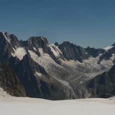
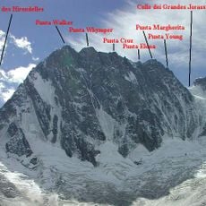
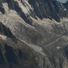
The peak marks a watershed boundary where water on either side flows toward different seas, with one side draining to the Mediterranean and the other to the Adriatic. This hydrological dividing line is significant in the broader alpine water systems of the region.

Location
Elevation above the sea
3,599 m
Part of
France–Italy border, ligne de partage des eaux entre mer Adriatique et mer Méditerranée
GPS coordinates
45.89317,7.00301
Latest update
December 14, 2025 20:21

AroundUs brings together thousands of curated places, local tips, and hidden gems, enriched daily by 60,000 contributors worldwide. Discover all places nearby (Chamonix-Mont-Blanc).

« Aiguille de l'Éboulement - Mountain peak in Chamonix-Mont-Blanc, France » is provided by Around Us (aroundus.com). Images and texts are derived from Wikimedia project under a Creative Commons license. You are allowed to copy, distribute, and modify copies of this page, under the conditions set by the license, as long as this note is clearly visible.

Discover hidden gems everywhere you go!

From secret cafés to breathtaking viewpoints, skip the crowded tourist spots and find places that match your style. Our app makes it easy with voice search, smart filtering, route optimization, and insider tips from travelers worldwide. Download now for the complete mobile experience.

Around Us App Screenshot

A unique approach to discovering new places

Le Figaro

All the places worth exploring

France Info

A tailor-made excursion in just a few clicks

20 Minutes

Around Us
Travel Guide & Maps
Download

Send to your phone

QR Code
1

Open the camera app on your mobile.

2

Point at the QR code with your camera. A notification will appear.

3

Tap the notification to open the link.