Réserve naturelle géologique du Luberon
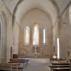
Réserve naturelle géologique du Luberon, National nature reserve in Provence-Alpes-Côte d'Azur, France
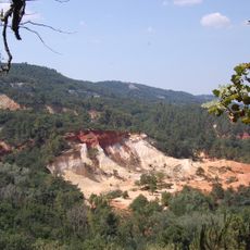
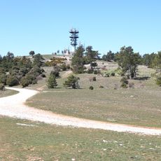
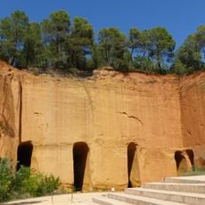
The Luberon Geological Nature Reserve is a protected area comprising 28 distinct sites spread across two administrative departments. This network includes quarries, cliff faces, and individual natural zones where rock layers from different geological periods remain exposed to view.
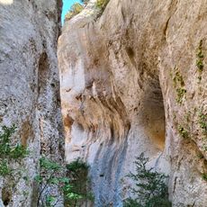
The French government designated this area as a national protected zone in 1987 to safeguard important fossil deposits and rock formations. This protection acknowledged that the exposed layers here record millions of years of geological activity and contain evidence of ancient life forms.
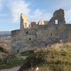
Local communities and visitors regard this place as a window into the distant past, where one can understand the landscape through visible rock layers and formations. Regular visits to these sites allow people to observe how fossils and geological features are arranged naturally across the terrain.
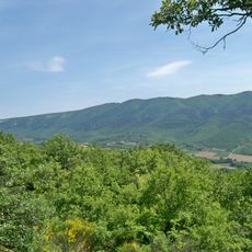
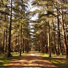
Wear sturdy shoes with good grip since most paths traverse uneven terrain and some surfaces can be slippery. Spring and autumn offer the most pleasant conditions for visiting, with comfortable temperatures and clear views of the rock formations.
Limestone surfaces here preserve fossilized footprints left by rhinoceroses, hyenas, and birds from millions of years ago that visitors can observe with careful attention. These preserved tracks offer a direct connection to creatures that walked across this land in the distant past.
Location: Aubenas-les-Alpes
Location: Bonnieux
Location: Cabrières-d'Aigues
Location: Caseneuve
Location: Céreste-en-Luberon
Location: Cheval-Blanc
Location: Cucuron
Location: Montfuron
Location: Montjustin
Location: Murs
Location: Oppedette
Location: Reillanne
Location: Revest-des-Brousses
Location: Saignon
Location: Saint-Maime
Location: Saint-Martin-de-Castillon
Location: Saint-Saturnin-lès-Apt
Location: Vachères
Location: Viens
Location: Villeneuve
Inception: 1987
Part of: Luberon Regional Nature Park
GPS coordinates: 43.83750,5.59167
Latest update: December 14, 2025 20:31
Colorado of Rustrel
11.4 km
Sénanque Abbey
34 km
Château de Lacoste
25.7 km
Ocres de Roussillon
24.6 km
Luberon Regional Nature Park
16.2 km
Pont Julien
23.1 kmChâteau d'Autet
10.9 km
Haute-Provence Observatory
14.3 km
Apt Cathedral
16.2 km
Mourre Nègre
10.3 km
Château de Sauvan
16.4 km
Musée didactique de Gordes
32.5 km
Regalon gorge
35.7 kmLa Louve
23 km
Abbey of Valsaintes
13.4 km
Mines de Bruoux
21.2 km
Prieuré de Carluc
4.3 km
Abbaye de Saint-Hilaire
27.7 km
Maison « Le Paraïs »
16 km
Château de Murs
30.8 km
La forêt des cèdres du petit Luberon
26 km
Fort de Buoux
17.2 km
Jardins de Salagon
17.3 km
Tour du Mont d'Or
16.3 kmApta Julia
16.2 km
Prieuré Notre-Dame de Salagon
17.3 km
Marché d'Apt
16.4 km
Église Saint-Sauveur de Manosque
15.4 kmVisited this place? Tap the stars to rate it and share your experience / photos with the community! Try now! You can cancel it anytime.
Discover hidden gems everywhere you go!
From secret cafés to breathtaking viewpoints, skip the crowded tourist spots and find places that match your style. Our app makes it easy with voice search, smart filtering, route optimization, and insider tips from travelers worldwide. Download now for the complete mobile experience.
A unique approach to discovering new places❞
— Le Figaro
All the places worth exploring❞
— France Info
A tailor-made excursion in just a few clicks❞
— 20 Minutes