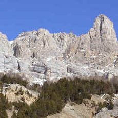
Rocher de la Grande Tempête, Mountain peak in Cerces Massif, France.
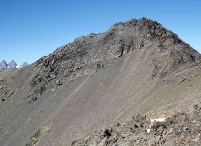
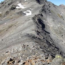
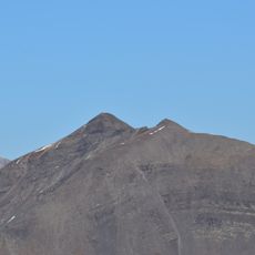
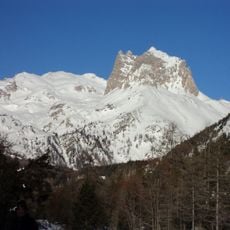
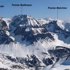
Rocher de la Grande Tempête is a mountain peak in the Cerces Massif with an elevation of 3,002 meters (9,850 feet) and forms part of a ridge system connecting to Roche du Chardonnet and Pic du Lac Blanc. The massif is surrounded by several lakes and lies between two valleys in the Alps.
The mountain formed the border between France and Italy until 1947, when the Treaty of Paris transferred the entire peak to French territory. This border shift changed the political status of the entire mountain group.
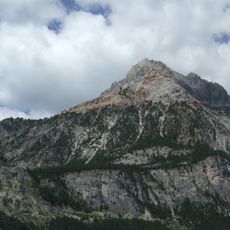
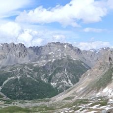
The summit serves as a central point for hikers exploring the eight lakes circuit, connecting the Clarée and Étroite valleys. Visitors use it as an anchor point to link different walking routes across the region.
The ascent is accessible by two main routes: from Refuge des Drayères or via the more challenging approach through Vallée Étroite. Both paths require mountaineering experience and should be planned during stable weather.
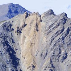
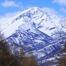
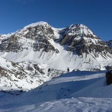
Mountain skiers starting from Laval chalets experience varied landscapes, from mountain pastures to mineral terrain, before reaching the summit. This diversity over a short distance makes the route visually interesting.
Location: Hautes-Alpes
Elevation above the sea: 3,002 m
GPS coordinates: 45.08020,6.55835
Latest update: December 14, 2025 20:00
Roche du Chardonnet
2.5 km
Grand Galibier
9.9 km
Rocca Bernauda
5.9 km
Ouvrage Les Rochilles
5.6 km
Pic Ombière
8.6 km
Guglia Rossa
7.8 km
Ouvrage Pas du Roc
10 km
Punta Quattro Sorelle
7.5 km
Grand Séru
3.5 km
Punta Nera
9.3 km
Église Saint-Marcellin de Névache
7.7 km
Aiguillette du Lauzet
8.8 km
Pointe Balthazar
6 km
Punta Gasparre
6.7 km
Rochers de la Grande Paré
8.8 km
Chapelle Saint-Antonin de Névache
7.7 km
Chapelle Sainte-Barbe de Névache
6.9 km
Chapelle Saint-Hippolyte de Roubion
9.3 km
Chapelle Notre-Dame-de-Bon-Secours de Lacou
7.1 km
Chapelle Saint-Antoine de Névache
7.8 km
Chapelle Sainte-Marie de Foncouverte
5.3 km
Chapelle Notre-Dame-de-Bon-Rencontre de Névache
10.1 km
Chiesa parrocchiale di Sant'Antonio Abate
10.1 km
Cappella di San Sisto
9.8 km
Cappella della Madonna del Carmine
10.1 km
Chapelle Saint-Roch de Ville Basse
7.9 km
L'Alpe du Lauzet
9 km
Pian del Colle
9.3 kmVisited this place? Tap the stars to rate it and share your experience / photos with the community! Try now! You can cancel it anytime.
Discover hidden gems everywhere you go!
From secret cafés to breathtaking viewpoints, skip the crowded tourist spots and find places that match your style. Our app makes it easy with voice search, smart filtering, route optimization, and insider tips from travelers worldwide. Download now for the complete mobile experience.
A unique approach to discovering new places❞
— Le Figaro
All the places worth exploring❞
— France Info
A tailor-made excursion in just a few clicks❞
— 20 Minutes